TopoQuest Logo
Do you find TopoQuest useful?
Help keep TopoQuest running and adding new maps/features by donating!
Bitcoin:  19c7KJd3qBynnjoSw5npx9KScwjBe4ifkT
Litecoin:  LXs6TkuXGGXo1vDsWCkWVdjQX94eUKd6ui
Home View Maps Find Maps Find Places Resources & Links


Gila Bend, Arizona Topographic Map

USGS Map Title: Gila Bend, AZ
USGS Map MRC: 32112H6
DRG (GeoTIFF) Download: o32112h6.tif


Neighboring USGS Topographic Map Quads:


  Citrus Valley East, AZ  
33112A7
 

  Cotton Center, AZ  
33112A6
 

  Cotton Center SE, AZ  
33112A5
 

  Smurr, AZ  
32112H7
 

  Gila Bend, AZ  
32112H6
 

  Bosque, AZ  
32112H5
 

  Black Gap, AZ  
32112G7
 

  South of Gila Bend, AZ  
32112G6
 

  Blue Plateau, AZ  
32112G5


Map MRC Location:

N33°
W113°
N33°
W112°
H8 H7 H6 H5 H4 H3 H2 H1
G8 G7 G6 G5 G4 G3 G2 G1
F8 F7 F6 F5 F4 F3 F2 F1
E8 E7 E6 E5 E4 E3 E2 E1
D8 D7 D6 D5 D4 D3 D2 D1
C8 C7 C6 C5 C4 C3 C2 C1
B8 B7 B6 B5 B4 B3 B2 B1
A8 A7 A6 A5 A4 A3 A2 A1
N32°
W113°
N32°
W112°

Gila Bend, AZ USGS 1:24K Topographic Map Preview:
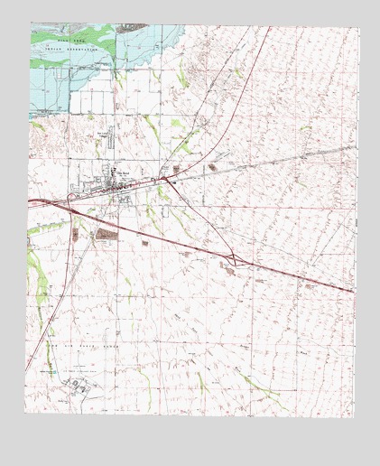
Gila Bend, AZ USGS Topographic Map
Click on map above to begin viewing in our Map Viewer.

This topographic map contains these locations and features:
Feature Name Type Latitude Longitude GNIS ID View Map
Arizona Highway Maintenance Gila Bend YardLocaleN32.9525°W112.6993°43236View Map
Augie's Quail Trail Recreational Vehicle ResortLocaleN32.9390°W112.6800°2670342View Map
Bender WashStreamN32.9203°W112.7024°1238View Map
Burleson ParkFlatN32.9556°W112.7182°2204View Map
ColedonLocaleN32.9598°W112.6340°23896View Map
Faith Assembly of GodChurchN32.9551°W112.7225°2670898View Map
First Baptist ChurchChurchN32.9495°W112.7174°2670942View Map
Gatlin SiteParkN32.9864°W112.7019°2500177View Map
Gila BendPopulated PlaceN32.9478°W112.7168°5012View Map
Gila Bend Air Force Auxiliary AirportAirportN32.8857°W112.7248°2651011View Map
Gila Bend DistrictCivilN32.9916°W112.7298°2418949View Map
Gila Bend Elementary SchoolSchoolN32.9518°W112.7182°14496View Map
Gila Bend High SchoolSchoolN32.9525°W112.7182°14497View Map
Gila Bend Municipal AirportAirportN32.9595°W112.6786°45358View Map
Gila Bend Post OfficePost OfficeN32.9481°W112.7177°44836View Map
Gila Bend Railroad StationBuildingN32.9459°W112.7146°14500View Map
Gila Bend Town HallBuildingN32.9487°W112.7202°14502View Map
Hee - A - Han ParkCemeteryN32.9500°W112.7148°5695View Map
Hunts Airport (historical)AirportN32.9495°W112.7257°42701View Map
Kiser Elementary SchoolSchoolN32.9446°W112.7311°2517551View Map
Maricopa County Library District Gila Bend BranchBuildingN32.9494°W112.7193°2669427View Map
Maricopa Sheriff's Office Gila Bend SubstationBuildingN32.9474°W112.7149°2751674View Map
Pioneer CemeteryCemeteryN32.9300°W112.7188°9519View Map
Rest Area One-hundred Twenty-nine MPLocaleN32.8917°W112.7474°43322View Map
San Lucy VillagePopulated PlaceN32.9639°W112.7179°10841View Map
Sand Tank WashStreamN32.9875°W112.7179°10901View Map
Sil Murk (historical)Populated PlaceN32.9834°W112.7285°25091View Map
Sonoran DesertPlainN32.9167°W112.6674°42810View Map
Stout CemeteryCemeteryN32.9122°W112.7415°11881View Map
The Church of Jesus Christ of Latter Day SaintsChurchN32.9507°W112.7185°2671872View Map
Town of Gila BendCivilN32.9662°W112.7155°2412681View Map
Unity ParkFlatN32.9434°W112.7177°13052View Map

Note: Coordinates in the location and feature list above are referenced to NAD83 datum.


Copyright (C) 2008-2024 Ryan Niemi / Sunset Dynamics ... All Rights Reserved