TopoQuest Logo
Do you find TopoQuest useful?
Help keep TopoQuest running and adding new maps/features by donating!
Bitcoin:  19c7KJd3qBynnjoSw5npx9KScwjBe4ifkT
Litecoin:  LXs6TkuXGGXo1vDsWCkWVdjQX94eUKd6ui
Home View Maps Find Maps Find Places Resources & Links


Giant Forest, California Topographic Map

USGS Map Title: Giant Forest, CA
USGS Map MRC: 36118E7
DRG (GeoTIFF) Download: o36118e7.tif


Neighboring USGS Topographic Map Quads:


  General Grant Grove, CA  
36118F8
 

  Muir Grove, CA  
36118F7
 

  Mount Silliman, CA  
36118F6
 

  Shadequarter Mountain, CA  
36118E8
 

  Giant Forest, CA  
36118E7
 

  Lodgepole, CA  
36118E6
 

  Kaweah, CA  
36118D8
 

  Case Mountain, CA  
36118D7
 

  Silver City, CA  
36118D6


Map MRC Location:

N37°
W119°
N37°
W118°
H8 H7 H6 H5 H4 H3 H2 H1
G8 G7 G6 G5 G4 G3 G2 G1
F8 F7 F6 F5 F4 F3 F2 F1
E8 E7 E6 E5 E4 E3 E2 E1
D8 D7 D6 D5 D4 D3 D2 D1
C8 C7 C6 C5 C4 C3 C2 C1
B8 B7 B6 B5 B4 B3 B2 B1
A8 A7 A6 A5 A4 A3 A2 A1
N36°
W119°
N36°
W118°

Giant Forest, CA USGS 1:24K Topographic Map Preview:
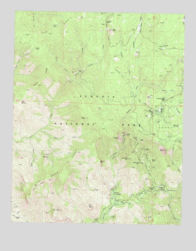
Giant Forest, CA USGS Topographic Map
Click on map above to begin viewing in our Map Viewer.

This topographic map contains these locations and features:
Feature Name Type Latitude Longitude GNIS ID View Map
Admiration PointCapeN36.5508°W118.7976°256123View Map
Amphitheater PointCapeN36.5372°W118.7823°256231View Map
Ash PeaksSummitN36.5251°W118.8487°256345View Map
Ash Peaks RidgeRidgeN36.5623°W118.8226°252295View Map
Bear HillSummitN36.5613°W118.7700°1658015View Map
Beetle RockPillarN36.5641°W118.7765°1667518View Map
Big Fern SpringsSpringN36.5383°W118.7738°1667520View Map
Bobcat PointCapeN36.5477°W118.7620°257315View Map
Buckeye FlatFlatN36.5227°W118.7643°220032View Map
Buckeye Flat Recreation SiteLocaleN36.5211°W118.7626°275629View Map
Cactus PointSummitN36.5101°W118.8191°257811View Map
Cascade CreekStreamN36.6152°W118.8093°258031View Map
Cave CreekStreamN36.5838°W118.8345°258092View Map
Cedar CreekStreamN36.5544°W118.8559°258113View Map
Circle MeadowFlatN36.5652°W118.7534°258380View Map
Colony Mill Ranger StationLocaleN36.5533°W118.8120°258603View Map
Colony PeakSummitN36.5623°W118.8226°258605View Map
Crescent CreekStreamN36.5363°W118.7582°258909View Map
Deep CanyonValleyN36.5169°W118.8019°259176View Map
Deer RidgeRidgeN36.5494°W118.7800°259246View Map
Elk CreekStreamN36.5133°W118.8023°259844View Map
Frys PointSummitN36.5077°W118.8432°260439View Map
General Sherman TreeLocaleN36.5808°W118.7509°260517View Map
GeneralsLocaleN36.6052°W118.8498°275633View Map
Giant ForestForestN36.5624°W118.7515°266746View Map
Granite SpringSpringN36.5445°W118.7781°1667525View Map
Halstead CreekStreamN36.5819°W118.7837°261031View Map
Halstead MeadowFlatN36.6186°W118.7834°261032View Map
Hidden SpringSpringN36.6030°W118.8603°261307View Map
Hospital RockPillarN36.5213°W118.7712°1667528View Map
Hospital Rock Picnic AreaLocaleN36.5205°W118.7724°275628View Map
Hospital Rock Ranger StationLocaleN36.5208°W118.7726°261551View Map
Huckleberry MeadowFlatN36.5583°W118.7534°261589View Map
Kaweah CampLocaleN36.5658°W118.7745°262082View Map
Little BaldySummitN36.6143°W118.8045°262510View Map
Little Baldy SaddleGapN36.6194°W118.8095°262517View Map
Little Deer CreekStreamN36.5749°W118.7857°262580View Map
Maple CreekStreamN36.5497°W118.8634°263169View Map
Marble FallsFallsN36.5530°W118.7922°263192View Map
Marble Fork Kaweah RiverStreamN36.5138°W118.8023°263193View Map
Middle Fork Kaweah RiverStreamN36.5138°W118.8023°263531View Map
Moro RockSummitN36.5442°W118.7649°263837View Map
Panorama PointCapeN36.5366°W118.8118°264465View Map
Paradise CreekStreamN36.5197°W118.7620°272872View Map
Pine RidgeRidgeN36.6224°W118.8273°264775View Map
PinewoodPopulated PlaceN36.5738°W118.7659°1659398View Map
PotwishaPopulated PlaceN36.5174°W118.7998°1659431View Map
Potwisha CampgroundLocaleN36.5174°W118.8004°1835596View Map
Potwisha Recreation SiteLocaleN36.5161°W118.7998°275631View Map
Red FirPopulated PlaceN36.6055°W118.7662°1667532View Map
Round MeadowFlatN36.5677°W118.7693°265601View Map
Shepherd SaddleGapN36.5030°W118.8693°1667536View Map
Sherman CreekStreamN36.5819°W118.7693°266106View Map
Skagway GroveWoodsN36.6166°W118.8487°266230View Map
Slide SpringSpringN36.5498°W118.7823°1667537View Map
Sunset RockSummitN36.5757°W118.7746°267977View Map
Suwanee CreekStreamN36.5784°W118.7785°267995View Map
Suwanee GroveWoodsN36.5891°W118.7982°267996View Map
Switchback PeakSummitN36.5388°W118.7908°268038View Map
Tunnel LogLocaleN36.5524°W118.7612°1667541View Map
Tunnel RockPillarN36.5022°W118.8123°1667542View Map
Wall SpringSpringN36.5534°W118.7734°1667543View Map
Wolverton CreekStreamN36.5978°W118.7533°269278View Map
Woodlake-Three Rivers DivisionCivilN36.5180°W118.8289°1935384View Map
Yucca MountainSummitN36.5716°W118.8701°269384View Map
Yucca RidgeRidgeN36.5891°W118.8487°269385View Map

Note: Coordinates in the location and feature list above are referenced to NAD83 datum.


Copyright (C) 2008-2024 Ryan Niemi / Sunset Dynamics ... All Rights Reserved