TopoQuest Logo
Do you find TopoQuest useful?
Help keep TopoQuest running and adding new maps/features by donating!
Bitcoin:  19c7KJd3qBynnjoSw5npx9KScwjBe4ifkT
Litecoin:  LXs6TkuXGGXo1vDsWCkWVdjQX94eUKd6ui
Home View Maps Find Maps Find Places Resources & Links


Gettysburg, Ohio Topographic Map

USGS Map Title: Gettysburg, OH
USGS Map MRC: 40084A4
DRG (GeoTIFF) Download: o40084a4.tif


Neighboring USGS Topographic Map Quads:


  Dawn, OH  
40084B5
 

  Versailles, OH  
40084B4
 

  Piqua West, OH  
40084B3
 

  Greenville East, OH  
40084A5
 

  Gettysburg, OH  
40084A4
 

  Pleasant Hill, OH  
40084A3
 

  Arcanum, OH  
39084H5
 

  Laura, OH  
39084H4
 

  West Milton, OH  
39084H3


Map MRC Location:

N41°
W85°
N41°
W84°
H8 H7 H6 H5 H4 H3 H2 H1
G8 G7 G6 G5 G4 G3 G2 G1
F8 F7 F6 F5 F4 F3 F2 F1
E8 E7 E6 E5 E4 E3 E2 E1
D8 D7 D6 D5 D4 D3 D2 D1
C8 C7 C6 C5 C4 C3 C2 C1
B8 B7 B6 B5 B4 B3 B2 B1
A8 A7 A6 A5 A4 A3 A2 A1
N40°
W85°
N40°
W84°

Gettysburg, OH USGS 1:24K Topographic Map Preview:
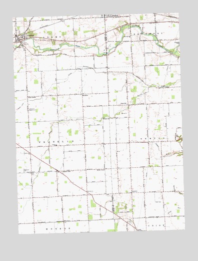
Gettysburg, OH USGS Topographic Map
Click on map above to begin viewing in our Map Viewer.

This topographic map contains these locations and features:
Feature Name Type Latitude Longitude GNIS ID View Map
Adams StripAirportN40.0596°W84.3791°2442563View Map
Allfox School (historical)SchoolN40.0881°W84.4061°1053953View Map
Bradford CemeteryCemeteryN40.1098°W84.4283°1038249View Map
Bradford QuarryMineN40.1075°W84.4269°2723117View Map
Buckeye School (historical)SchoolN40.0492°W84.4147°1053958View Map
Canyon School (historical)SchoolN40.0509°W84.3802°1053959View Map
Circle HillPopulated PlaceN40.0728°W84.4144°1039124View Map
Cool FarmsLocaleN40.0242°W84.4681°2710789View Map
Cromer CemeteryCemeteryN40.1078°W84.4949°1806158View Map
Deeter CemeteryCemeteryN40.1200°W84.3963°1039656View Map
Famous School (historical)SchoolN40.0948°W84.4294°1053968View Map
First Baptist ChurchChurchN40.1237°W84.4322°1066540View Map
Franklin-Monroe Elementary SchoolSchoolN40.0509°W84.4694°1081325View Map
German ChurchChurchN40.0364°W84.4452°1040836View Map
GettysburgPopulated PlaceN40.1114°W84.4952°1048778View Map
Gettysburg Elementary SchoolSchoolN40.1134°W84.4930°1055513View Map
Gettysburg Post OfficePost OfficeN40.1112°W84.4958°1967969View Map
Gettysburg Rural Fire DepartmentBuildingN40.1154°W84.4927°2550040View Map
Greenville Creek CemeteryCemeteryN40.1134°W84.4119°1084335View Map
Greenville Creek United Church of ChristChurchN40.1128°W84.4111°1070763View Map
Greenville Falls State Nature PreserveParkN40.1042°W84.3777°1963126View Map
Heller School (historical)SchoolN40.0212°W84.4880°1055519View Map
Kemps Field of Dreams AirportAirportN40.1032°W84.4006°2442547View Map
Little Painter CreekStreamN40.0826°W84.4011°1065754View Map
Miami Valley Organic FarmsLocaleN40.0419°W84.3989°2723319View Map
Milken FarmsLocaleN40.1136°W84.3761°2723055View Map
Miller GrovePopulated PlaceN40.0067°W84.4641°1062899View Map
Minnich School (historical)SchoolN40.0506°W84.4897°1055569View Map
Mole Hill School (historical)SchoolN40.0362°W84.3905°1053997View Map
Muddy CornersLocaleN40.0362°W84.4333°1048350View Map
Neff School (historical)SchoolN40.0645°W84.4675°1055535View Map
Newcomers CemeteryCemeteryN40.0364°W84.4933°1043855View Map
Painter CreekPopulated PlaceN40.0356°W84.4694°1066130View Map
Painter Creek Church of the BrethrenChurchN40.0464°W84.4900°1057908View Map
Painter Creek Post Office (historical)Post OfficeN40.0362°W84.4694°1968191View Map
PattytownPopulated PlaceN40.0220°W84.4136°1044329View Map
Pleasant View Missionary ChurchChurchN40.0714°W84.4894°1057930View Map
Red RiverPopulated PlaceN40.0801°W84.4486°1044900View Map
Red River Post Office (historical)Post OfficeN40.0806°W84.4486°1968196View Map
Township of FranklinCivilN40.0503°W84.4686°1086013View Map
Union CornersPopulated PlaceN40.0792°W84.4902°1049257View Map
Village of GettysburgCivilN40.1156°W84.4964°2398957View Map
Weaver Swine FarmLocaleN40.0214°W84.4031°2710793View Map
West Grove ChurchChurchN40.0237°W84.4475°1047762View Map

Note: Coordinates in the location and feature list above are referenced to NAD83 datum.


Copyright (C) 2008-2024 Ryan Niemi / Sunset Dynamics ... All Rights Reserved