TopoQuest Logo
Do you find TopoQuest useful?
Help keep TopoQuest running and adding new maps/features by donating!
Bitcoin:  19c7KJd3qBynnjoSw5npx9KScwjBe4ifkT
Litecoin:  LXs6TkuXGGXo1vDsWCkWVdjQX94eUKd6ui
Home View Maps Find Maps Find Places Resources & Links


Gerald, Missouri Topographic Map

USGS Map Title: Gerald, MO
USGS Map MRC: 38091D3
DRG (GeoTIFF) Download: o38091d3.tif


Neighboring USGS Topographic Map Quads:


  Swiss, MO  
38091E4
 

  Dissen, MO  
38091E3
 

  New Haven, MO  
38091E2
 

  Rosebud, MO  
38091D4
 

  Gerald, MO  
38091D3
 

  Leslie, MO  
38091D2
 

  Owensville East, MO  
38091C4
 

  Strain, MO  
38091C3
 

  Spring Bluff, MO  
38091C2


Map MRC Location:

N39°
W92°
N39°
W91°
H8 H7 H6 H5 H4 H3 H2 H1
G8 G7 G6 G5 G4 G3 G2 G1
F8 F7 F6 F5 F4 F3 F2 F1
E8 E7 E6 E5 E4 E3 E2 E1
D8 D7 D6 D5 D4 D3 D2 D1
C8 C7 C6 C5 C4 C3 C2 C1
B8 B7 B6 B5 B4 B3 B2 B1
A8 A7 A6 A5 A4 A3 A2 A1
N38°
W92°
N38°
W91°

Gerald, MO USGS 1:24K Topographic Map Preview:
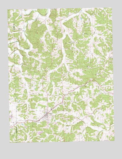
Gerald, MO USGS Topographic Map
Click on map above to begin viewing in our Map Viewer.

This topographic map contains these locations and features:
Feature Name Type Latitude Longitude GNIS ID View Map
Antioch ChurchChurchN38.3750°W91.2593°713331View Map
Bald HillSummitN38.4759°W91.2846°713586View Map
Barren ForkStreamN38.4953°W91.3377°731527View Map
Bates CemeteryCemeteryN38.4287°W91.2943°735499View Map
BeemontPopulated PlaceN38.4806°W91.3593°713882View Map
Beemont SchoolSchoolN38.4825°W91.3402°747967View Map
Big BranchStreamN38.4626°W91.3499°714134View Map
Big BranchStreamN38.4802°W91.3560°714141View Map
Boeuf CemeteryCemeteryN38.3945°W91.3451°714478View Map
Buffalo Ridge SchoolSchoolN38.4862°W91.2827°747969View Map
City of GeraldCivilN38.3992°W91.3305°2394884View Map
Forboro Lake DamDamN38.3817°W91.3402°765091View Map
GeraldPopulated PlaceN38.3998°W91.3307°755549View Map
Gerald - Rosebud Fire Protection District Station 1BuildingN38.4000°W91.3314°2621384View Map
Gerald - Rosebud Fire Protection District Station 2BuildingN38.3963°W91.3359°2620942View Map
Gerald Police DepartmentBuildingN38.4023°W91.3287°2752510View Map
Gerald Post OfficePost OfficeN38.3996°W91.3314°2783053View Map
Gerald SchoolSchoolN38.3953°W91.3396°730591View Map
Good Hope SchoolSchoolN38.3987°W91.2815°747971View Map
Gregory CemeteryCemeteryN38.4037°W91.2718°718859View Map
Harry Panhorst LakeReservoirN38.4917°W91.2902°763634View Map
Jaegers ShopPopulated PlaceN38.4612°W91.2993°730590View Map
Kamper Lake DamDamN38.4950°W91.3602°765089View Map
Middle ForkStreamN38.4962°W91.2877°722272View Map
Number 364 DamDamN38.4134°W91.3618°764359View Map
Opossum CreekStreamN38.3887°W91.2813°731628View Map
Panhorst Lake DamDamN38.4917°W91.2902°763633View Map
Pin Oak CreekStreamN38.4498°W91.3577°735778View Map
Pinoak SchoolSchoolN38.4398°W91.3432°747968View Map
Port HudsonPopulated PlaceN38.4539°W91.2540°741167View Map
Rocky Ridge SchoolSchoolN38.4437°W91.2874°747970View Map
Saint Paul CemeteryCemeteryN38.4106°W91.3107°725865View Map
Schnitzer Lake DamDamN38.4700°W91.3352°765090View Map
Skinner CreekStreamN38.3873°W91.2554°726512View Map

Note: Coordinates in the location and feature list above are referenced to NAD83 datum.


Copyright (C) 2008-2024 Ryan Niemi / Sunset Dynamics ... All Rights Reserved