TopoQuest Logo
Do you find TopoQuest useful?
Help keep TopoQuest running and adding new maps/features by donating!
Bitcoin:  19c7KJd3qBynnjoSw5npx9KScwjBe4ifkT
Litecoin:  LXs6TkuXGGXo1vDsWCkWVdjQX94eUKd6ui
Home View Maps Find Maps Find Places Resources & Links


Gentry, Missouri Topographic Map

USGS Map Title: Gentry, MO
USGS Map MRC: 40094C4
DRG (GeoTIFF) Download: o40094c4.tif


Neighboring USGS Topographic Map Quads:


  Parnell East, MO  
40094D5
 

  Grant City, MO  
40094D4
 

  Allendale, MO  
40094D3
 

  Alanthus Grove, MO  
40094C5
 

  Gentry, MO  
40094C4
 

  Albany North, MO  
40094C3
 

  Stanberry, MO  
40094B5
 

  Darlington, MO  
40094B4
 

  Albany South, MO  
40094B3


Map MRC Location:

N41°
W95°
N41°
W94°
H8 H7 H6 H5 H4 H3 H2 H1
G8 G7 G6 G5 G4 G3 G2 G1
F8 F7 F6 F5 F4 F3 F2 F1
E8 E7 E6 E5 E4 E3 E2 E1
D8 D7 D6 D5 D4 D3 D2 D1
C8 C7 C6 C5 C4 C3 C2 C1
B8 B7 B6 B5 B4 B3 B2 B1
A8 A7 A6 A5 A4 A3 A2 A1
N40°
W95°
N40°
W94°

Gentry, MO USGS 1:24K Topographic Map Preview:
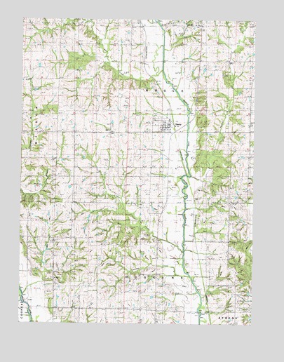
Gentry, MO USGS Topographic Map
Click on map above to begin viewing in our Map Viewer.

This topographic map contains these locations and features:
Feature Name Type Latitude Longitude GNIS ID View Map
Bear CreekStreamN40.3544°W94.4247°713810View Map
Burnett School (historical)SchoolN40.3658°W94.4725°715080View Map
Canaday CreekStreamN40.2642°W94.4044°715330View Map
Canaday School (historical)SchoolN40.2764°W94.3872°730066View Map
Center Grove SchoolSchoolN40.2847°W94.4952°715640View Map
David School (historical)SchoolN40.2694°W94.4269°716691View Map
Dure Lake DamDamN40.3317°W94.4519°762575View Map
Foster Lake DamDamN40.2950°W94.4569°762576View Map
GentryPopulated PlaceN40.3317°W94.4202°718382View Map
Gentry Post OfficePost OfficeN40.3320°W94.4209°2783096View Map
Gillespie Lake DamDamN40.2533°W94.3752°762578View Map
Green Ridge ChurchChurchN40.3280°W94.4525°718807View Map
Hall School (historical)SchoolN40.2564°W94.4772°719010View Map
Hugginsville School (historical)SchoolN40.2780°W94.4563°719967View Map
Knox ChurchChurchN40.3728°W94.4047°720678View Map
Linn CreekStreamN40.2803°W94.4119°721128View Map
New Friendship CemeteryCemeteryN40.3326°W94.3767°2702169View Map
New Friendship ChurchChurchN40.3328°W94.3763°723201View Map
Normal School (historical)SchoolN40.2955°W94.4250°723417View Map
Peddler CreekStreamN40.3108°W94.4105°724172View Map
Redmond HillSummitN40.2955°W94.4533°725178View Map
Shockley SchoolSchoolN40.3225°W94.3766°726399View Map
Smith Lake DamDamN40.2600°W94.4269°762577View Map
Snider CemeteryCemeteryN40.3578°W94.4350°726664View Map
Township of BogleCivilN40.3440°W94.4104°766665View Map
Township of HugginsCivilN40.2653°W94.4375°766668View Map
Union School (historical)SchoolN40.3653°W94.4050°728041View Map
Village of GentryCivilN40.3326°W94.4233°2398951View Map
Voyage (historical)Populated PlaceN40.2783°W94.4458°740187View Map
Waterman SchoolSchoolN40.3230°W94.4711°728409View Map

Note: Coordinates in the location and feature list above are referenced to NAD83 datum.


Copyright (C) 2008-2024 Ryan Niemi / Sunset Dynamics ... All Rights Reserved