TopoQuest Logo
Do you find TopoQuest useful?
Help keep TopoQuest running and adding new maps/features by donating!
Bitcoin:  19c7KJd3qBynnjoSw5npx9KScwjBe4ifkT
Litecoin:  LXs6TkuXGGXo1vDsWCkWVdjQX94eUKd6ui
Home View Maps Find Maps Find Places Resources & Links


Gearhart, Oregon Topographic Map

USGS Map Title: Gearhart, OR
USGS Map MRC: 46123A8
DRG (GeoTIFF) Download: o46123a8.tif


Neighboring USGS Topographic Map Quads:


  Clatsop Spit, OR  
46124B1
 

  Warrenton, OR  
46123B8
 

  Astoria, OR  
46123B7


  Gearhart, OR  
46123A8
 

  Olney, OR  
46123A7


  Tillamook Head, OR  
45123H8
 

  Necanicum Junction, OR  
45123H7


Map MRC Location:

N47°
W124°
N47°
W123°
H8 H7 H6 H5 H4 H3 H2 H1
G8 G7 G6 G5 G4 G3 G2 G1
F8 F7 F6 F5 F4 F3 F2 F1
E8 E7 E6 E5 E4 E3 E2 E1
D8 D7 D6 D5 D4 D3 D2 D1
C8 C7 C6 C5 C4 C3 C2 C1
B8 B7 B6 B5 B4 B3 B2 B1
A8 A7 A6 A5 A4 A3 A2 A1
N46°
W124°
N46°
W123°

Gearhart, OR USGS 1:24K Topographic Map Preview:
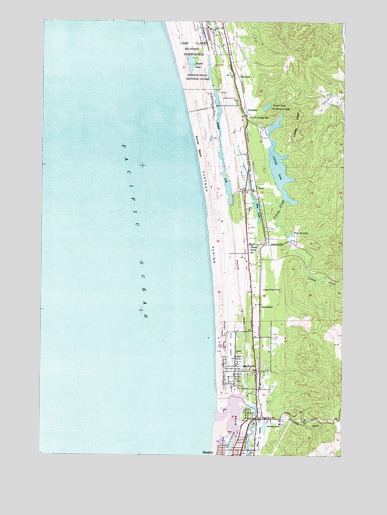
Gearhart, OR USGS Topographic Map
Click on map above to begin viewing in our Map Viewer.

This topographic map contains these locations and features:
Feature Name Type Latitude Longitude GNIS ID View Map
Abercrombie CreekStreamN46.1012°W123.8804°1129901View Map
Allendale (historical)LocaleN46.0859°W123.9151°1129848View Map
Astoria Country ClubLocaleN46.1024°W123.9215°1163673View Map
Bayview Transit Mix (historical)LocaleN46.0359°W123.9107°1167955View Map
Butterfield (historical)LocaleN46.0434°W123.9115°1136111View Map
Camp Clatsop Post Office (historical)Post OfficeN46.1234°W123.9318°1164245View Map
Camp CullabyParkN46.0946°W123.9021°2058187View Map
Camp RileaLocaleN46.1151°W123.9401°1157397View Map
Camp Rilea Sewage Treatment PlantLocaleN46.1168°W123.9292°2660700View Map
CarnahanPopulated PlaceN46.1004°W123.9171°1118617View Map
Carnahan County ParkParkN46.0973°W123.9040°2058188View Map
Carnahan County Park Boat RampLocaleN46.0956°W123.9056°2668504View Map
City of GearhartCivilN46.0289°W123.9173°2410578View Map
Clatsop PlainsFlatN46.0679°W123.9307°1118983View Map
Clatsop Plains CemeteryCemeteryN46.1214°W123.9279°1129899View Map
Clatsop Plains School (historical)SchoolN46.0603°W123.9139°1118984View Map
Clatsop Post Office (historical)Post OfficeN46.0790°W123.9138°1164274View Map
Clatsop RidgeRidgeN46.0951°W123.8940°1118985View Map
Cullaby CreekStreamN46.0629°W123.8990°1119616View Map
Cullaby LakeLakeN46.0836°W123.9032°1119617View Map
Cullaby Lake County ParkParkN46.0834°W123.9099°1638179View Map
Cullaby Lake County Park Boat RampLocaleN46.0857°W123.9075°2668495View Map
Cullaby SloughStreamN46.0734°W123.9001°1119618View Map
Del Rey Beach State ParkParkN46.0443°W123.9249°1851877View Map
Dellmoor StationLocaleN46.0609°W123.9082°1637840View Map
First Church Of Christ ScientistChurchN46.0294°W123.9119°2508085View Map
GearhartPopulated PlaceN46.0243°W123.9113°1121084View Map
Gearhart City HallBuildingN46.0245°W123.9189°2661357View Map
Gearhart City Police DepartmentBuildingN46.0244°W123.9189°2737797View Map
Gearhart Elementary SchoolSchoolN46.0250°W123.9141°1161912View Map
Gearhart Golf CourseLocaleN46.0315°W123.9213°1163712View Map
Gearhart Municipal CourtBuildingN46.0245°W123.9189°2661213View Map
Gearhart Post OfficePost OfficeN46.0243°W123.9210°1165300View Map
Gearhart Publlic WorksBuildingN46.0245°W123.9189°2661204View Map
Gearhart Volunteer Fire DepartmentBuildingN46.0244°W123.9194°2576522View Map
Gearheart Ocean State ParkParkN46.0248°W123.9263°1851885View Map
Glenwood (historical)LocaleN46.1096°W123.9215°1637847View Map
McGuire (historical)LocaleN46.0540°W123.9104°1167954View Map
Mill CreekStreamN46.0096°W123.9082°1129903View Map
Neacoxie CreekStreamN46.0179°W123.9154°1124608View Map
Neawanna CreekStreamN46.0148°W123.9201°1124618View Map
Neawanna Station (historical)LocaleN46.0104°W123.9062°1637855View Map
Necanicum RiverStreamN46.0115°W123.9274°1124623View Map
North Fork Abercrombie CreekStreamN46.1012°W123.8804°1129900View Map
Ocean Home FarmLocaleN46.0473°W123.9049°1124933View Map
Pacific Grange HallBuildingN46.0978°W123.9166°1125112View Map
Seaside High SchoolSchoolN46.0067°W123.9167°1161911View Map
Seaside Municipal AirportAirportN46.0161°W123.9077°1131711View Map
Seaside Sewage Treatment PlantLocaleN46.0063°W123.9239°2660823View Map
Shoreline Sanitary District Sewage Treatment PlantLocaleN46.0976°W123.9155°2660715View Map
Skookum CreekStreamN46.0332°W123.9096°1129902View Map
Slusher LakeLakeN46.1127°W123.9398°1127095View Map
Stanley LakeLakeN46.0080°W123.9081°1127530View Map
Sunset BeachBeachN46.0887°W123.9357°1127744View Map
Sunset BeachPopulated PlaceN46.1012°W123.9304°1129849View Map
Sunset Beach State ParkParkN46.0989°W123.9386°2058195View Map
Sunset LakeLakeN46.0865°W123.9276°1127750View Map
Sunset Lake Public ParkParkN46.1001°W123.9296°2058196View Map
Sunset Lake Public Park Boat RampLocaleN46.1009°W123.9293°2668190View Map
Surf PinesPopulated PlaceN46.0582°W123.9235°1129904View Map
Taylor LakeLakeN46.1003°W123.9082°1127906View Map
Thompson CreekStreamN46.0126°W123.9110°1128029View Map
Triangle LakeLakeN46.0635°W123.8972°1128223View Map
West (historical)LocaleN46.0765°W123.9138°1128805View Map
West LakeLocaleN46.0762°W123.9138°1129905View Map
West LakeLakeN46.0709°W123.9119°1128881View Map

Note: Coordinates in the location and feature list above are referenced to NAD83 datum.


Copyright (C) 2008-2024 Ryan Niemi / Sunset Dynamics ... All Rights Reserved