TopoQuest Logo
Do you find TopoQuest useful?
Help keep TopoQuest running and adding new maps/features by donating!
Bitcoin:  19c7KJd3qBynnjoSw5npx9KScwjBe4ifkT
Litecoin:  LXs6TkuXGGXo1vDsWCkWVdjQX94eUKd6ui
Home View Maps Find Maps Find Places Resources & Links


Garrett Grove, Arkansas Topographic Map

USGS Map Title: Garrett Grove, AR
USGS Map MRC: 34091G1
DRG (GeoTIFF) Download: o34091g1.tif


Neighboring USGS Topographic Map Quads:


  Brinkley, AR  
34091H2
 

  Wheatley, AR  
34091H1
 

  Palestine, AR  
34090H8
 

  Keevil, AR  
34091G2
 

  Garrett Grove, AR  
34091G1
 

  Moro, AR  
34090G8
 

  Park Grove, AR  
34091F2
 

  Monroe, AR  
34091F1
 

  Aubrey, AR  
34090F8


Map MRC Location:

N35°
W92°
N35°
W91°
H8 H7 H6 H5 H4 H3 H2 H1
G8 G7 G6 G5 G4 G3 G2 G1
F8 F7 F6 F5 F4 F3 F2 F1
E8 E7 E6 E5 E4 E3 E2 E1
D8 D7 D6 D5 D4 D3 D2 D1
C8 C7 C6 C5 C4 C3 C2 C1
B8 B7 B6 B5 B4 B3 B2 B1
A8 A7 A6 A5 A4 A3 A2 A1
N34°
W92°
N34°
W91°

Garrett Grove, AR USGS 1:24K Topographic Map Preview:
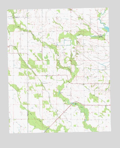
Garrett Grove, AR USGS Topographic Map
Click on map above to begin viewing in our Map Viewer.

This topographic map contains these locations and features:
Feature Name Type Latitude Longitude GNIS ID View Map
Bemis PlantationLocaleN34.7876°W91.0490°46378View Map
Big Piney CreekStreamN34.7509°W91.0565°46588View Map
Flat Fork CreekStreamN34.8076°W91.0443°83150View Map
Garrett CemeteryCemeteryN34.8470°W91.0109°49349View Map
Garrett GrovePopulated PlaceN34.8007°W91.0829°57029View Map
HopperPopulated PlaceN34.8526°W91.0518°57943View Map
Little Piney CreekStreamN34.7512°W91.0565°51309View Map
Little Prairie (historical)Populated PlaceN34.8184°W91.0143°59554View Map
Long Cane CemeteryCemeteryN34.7981°W91.0321°51417View Map
Moro TempleChurchN34.7698°W91.0576°52211View Map
Mount Canaan ChurchChurchN34.8512°W91.0832°52268View Map
Mount Jerdan Church (historical)ChurchN34.8337°W91.0323°59553View Map
Pleasant Valley CemeteryCemeteryN34.8677°W91.1189°53606View Map
Pleasant Valley ChurchChurchN34.8376°W91.1226°53614View Map
Prospect CemeteryCemeteryN34.8048°W91.0282°53814View Map
Saint Paul CemeteryCemeteryN34.7640°W91.0623°54436View Map
Saint Paul ChurchChurchN34.7684°W91.0662°54447View Map
Taylor CemeteryCemeteryN34.8545°W91.0223°55464View Map
Township of FleenerCivilN34.8659°W91.0217°66807View Map
Township of HamptonCivilN34.7773°W91.0221°66808View Map
Walnut LakeLakeN34.7795°W91.0470°75205View Map
Whistling LakeLakeN34.7902°W91.0630°75213View Map

Note: Coordinates in the location and feature list above are referenced to NAD83 datum.


Copyright (C) 2008-2024 Ryan Niemi / Sunset Dynamics ... All Rights Reserved