TopoQuest Logo
Do you find TopoQuest useful?
Help keep TopoQuest running and adding new maps/features by donating!
Bitcoin:  19c7KJd3qBynnjoSw5npx9KScwjBe4ifkT
Litecoin:  LXs6TkuXGGXo1vDsWCkWVdjQX94eUKd6ui
Home View Maps Find Maps Find Places Resources & Links


Garden Point, Montana Topographic Map

USGS Map Title: Garden Point, MT
USGS Map MRC: 46114G4
DRG (GeoTIFF) Download: o46114g4.tif


Neighboring USGS Topographic Map Quads:


  Deer Peak, MT  
46114H5
 

  Petty Mountain, MT  
46114H4
 

  Diamond Point, MT  
46114H3
 

  Lupine Creek, MT  
46114G5
 

  Garden Point, MT  
46114G4
 

  Camp Creek, MT  
46114G3
 

  Lolo Hot Springs, MT  
46114F5
 

  West Fork Butte, MT  
46114F4
 

  Dick Creek, MT  
46114F3


Map MRC Location:

N47°
W115°
N47°
W114°
H8 H7 H6 H5 H4 H3 H2 H1
G8 G7 G6 G5 G4 G3 G2 G1
F8 F7 F6 F5 F4 F3 F2 F1
E8 E7 E6 E5 E4 E3 E2 E1
D8 D7 D6 D5 D4 D3 D2 D1
C8 C7 C6 C5 C4 C3 C2 C1
B8 B7 B6 B5 B4 B3 B2 B1
A8 A7 A6 A5 A4 A3 A2 A1
N46°
W115°
N46°
W114°

Garden Point, MT USGS 1:24K Topographic Map Preview:
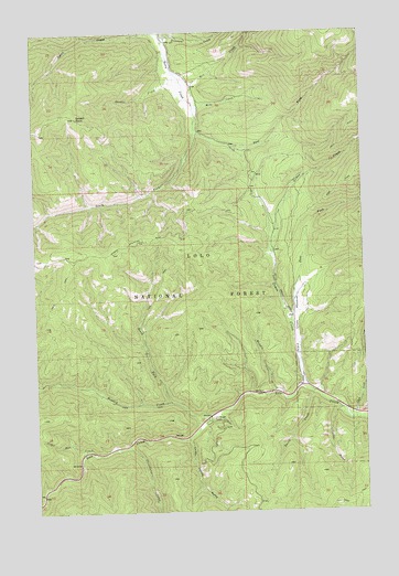
Garden Point, MT USGS Topographic Map
Click on map above to begin viewing in our Map Viewer.

This topographic map contains these locations and features:
Feature Name Type Latitude Longitude GNIS ID View Map
Bill CreekStreamN46.8613°W114.4423°779910View Map
Cedar Run CreekStreamN46.7663°W114.4796°781120View Map
Chief Joseph GulchValleyN46.7688°W114.4426°781219View Map
Clark CreekStreamN46.7741°W114.3801°781314View Map
Cloudburst CreekStreamN46.7677°W114.4660°781408View Map
Cooley GulchValleyN46.7749°W114.3837°781616View Map
Davis CreekStreamN46.7810°W114.3954°782103View Map
East Fork Grave CreekStreamN46.7996°W114.4037°782851View Map
East Fork Petty CreekStreamN46.8496°W114.4382°782888View Map
Garden CreekStreamN46.8644°W114.4457°783823View Map
Garden PointCliffN46.8530°W114.4835°783828View Map
Grave CreekStreamN46.7819°W114.3965°784219View Map
Grave Creek MeadowFlatN46.7999°W114.4015°784221View Map
Howard CreekStreamN46.7755°W114.4326°785104View Map
Hungry CreekStreamN46.7805°W114.4073°785157View Map
Lewis and Clark CampgroundLocaleN46.7749°W114.3837°794300View Map
Lolo Ranger StationLocaleN46.7744°W114.4343°786468View Map
Mike CreekStreamN46.8555°W114.4382°787334View Map
Moulton Reservoir Number TwoStreamN46.8744°W114.4498°789193View Map
North Fork Howard CreekStreamN46.7788°W114.4496°788187View Map
South Fork Petty CreekStreamN46.8499°W114.4379°791025View Map

Note: Coordinates in the location and feature list above are referenced to NAD83 datum.


Copyright (C) 2008-2024 Ryan Niemi / Sunset Dynamics ... All Rights Reserved