TopoQuest Logo
Do you find TopoQuest useful?
Help keep TopoQuest running and adding new maps/features by donating!
Bitcoin:  19c7KJd3qBynnjoSw5npx9KScwjBe4ifkT
Litecoin:  LXs6TkuXGGXo1vDsWCkWVdjQX94eUKd6ui
Home View Maps Find Maps Find Places Resources & Links


Garden Plain, Kansas Topographic Map

USGS Map Title: Garden Plain, KS
USGS Map MRC: 37097F6
DRG (GeoTIFF) Download: o37097f6.tif


Neighboring USGS Topographic Map Quads:


  Haven SE, KS  
37097G7
 

  Mount Hope, KS  
37097G6
 

  Colwich, KS  
37097G5
 

  Cheney, KS  
37097F7
 

  Garden Plain, KS  
37097F6
 

  Goddard, KS  
37097F5
 

  Cheney SE, KS  
37097E7
 

  Lake Afton, KS  
37097E6
 

  Clearwater, KS  
37097E5


Map MRC Location:

N38°
W98°
N38°
W97°
H8 H7 H6 H5 H4 H3 H2 H1
G8 G7 G6 G5 G4 G3 G2 G1
F8 F7 F6 F5 F4 F3 F2 F1
E8 E7 E6 E5 E4 E3 E2 E1
D8 D7 D6 D5 D4 D3 D2 D1
C8 C7 C6 C5 C4 C3 C2 C1
B8 B7 B6 B5 B4 B3 B2 B1
A8 A7 A6 A5 A4 A3 A2 A1
N37°
W98°
N37°
W97°

Garden Plain, KS USGS 1:24K Topographic Map Preview:
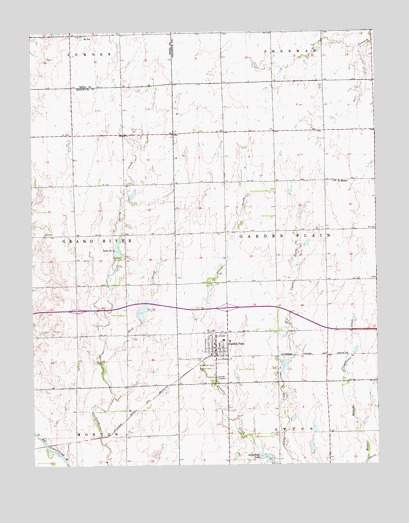
Garden Plain, KS USGS Topographic Map
Click on map above to begin viewing in our Map Viewer.

This topographic map contains these locations and features:
Feature Name Type Latitude Longitude GNIS ID View Map
Birch (historical)LocaleN37.7186°W97.7462°482576View Map
Calvary CemeteryCemeteryN37.6528°W97.6849°473992View Map
City of Garden PlainCivilN37.6629°W97.6793°2394853View Map
Garden PlainPopulated PlaceN37.6583°W97.6837°473990View Map
Garden Plain Community ChurchChurchN37.6552°W97.6795°2510014View Map
Garden Plain Community LibraryBuildingN37.6574°W97.6845°2509711View Map
Garden Plain Elementary SchoolSchoolN37.6606°W97.6786°480995View Map
Garden Plain High SchoolSchoolN37.6610°W97.6811°480994View Map
Garden Plain Police DepartmentBuildingN37.6581°W97.6843°2504056View Map
Garden Plain Post OfficePost OfficeN37.6572°W97.6837°2509622View Map
Garden Plain Wastewater Treatment PlantLocaleN37.6499°W97.6837°2511215View Map
Lake Forty-eightReservoirN37.6862°W97.7194°473995View Map
Mulkey CemeteryCemeteryN37.7069°W97.6870°2673389View Map
Saint Anthony CemeteryCemeteryN37.6540°W97.6846°473991View Map
Saint Anthonys of Padua Catholic ChurchChurchN37.6589°W97.6846°2510076View Map
Saint JoePopulated PlaceN37.7489°W97.7320°473994View Map
Saint Joseph Catholic SchoolSchoolN37.7485°W97.7323°2720279View Map
Saint MarysPopulated PlaceN37.7067°W97.6400°473993View Map
Saint Marys CemeteryCemeteryN37.7065°W97.6428°2673394View Map
Saint Paul Lutheran CemeteryCemeteryN37.6631°W97.7428°2673390View Map
Sand CreekStreamN37.6545°W97.7259°473988View Map
Sedgwick County Fire District 1 Station 39BuildingN37.6263°W97.6426°2695502View Map
Sunnebuhl LakeReservoirN37.6269°W97.6653°473987View Map
Township of Garden PlainCivilN37.6922°W97.6438°473996View Map
Wetta Egg FarmLocaleN37.7339°W97.6456°2726909View Map
Yoder AirparkAirportN37.6597°W97.6295°2675727View Map

Note: Coordinates in the location and feature list above are referenced to NAD83 datum.


Copyright (C) 2008-2024 Ryan Niemi / Sunset Dynamics ... All Rights Reserved