TopoQuest Logo
Do you find TopoQuest useful?
Help keep TopoQuest running and adding new maps/features by donating!
Bitcoin:  19c7KJd3qBynnjoSw5npx9KScwjBe4ifkT
Litecoin:  LXs6TkuXGGXo1vDsWCkWVdjQX94eUKd6ui
Home View Maps Find Maps Find Places Resources & Links


Galt, California Topographic Map

USGS Map Title: Galt, CA
USGS Map MRC: 38121C3
DRG (GeoTIFF) Download: o38121c3.tif


Neighboring USGS Topographic Map Quads:


  Florin, CA  
38121D4
 

  Elk Grove, CA  
38121D3
 

  Sloughhouse, CA  
38121D2
 

  Bruceville, CA  
38121C4
 

  Galt, CA  
38121C3
 

  Clay, CA  
38121C2
 

  Thornton, CA  
38121B4
 

  Lodi North, CA  
38121B3
 

  Lockeford, CA  
38121B2


Map MRC Location:

N39°
W122°
N39°
W121°
H8 H7 H6 H5 H4 H3 H2 H1
G8 G7 G6 G5 G4 G3 G2 G1
F8 F7 F6 F5 F4 F3 F2 F1
E8 E7 E6 E5 E4 E3 E2 E1
D8 D7 D6 D5 D4 D3 D2 D1
C8 C7 C6 C5 C4 C3 C2 C1
B8 B7 B6 B5 B4 B3 B2 B1
A8 A7 A6 A5 A4 A3 A2 A1
N38°
W122°
N38°
W121°

Galt, CA USGS 1:24K Topographic Map Preview:
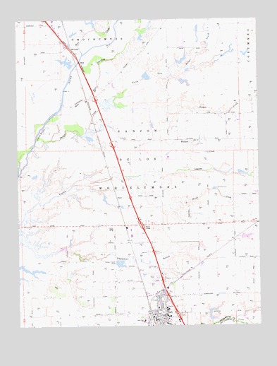
Galt, CA USGS Topographic Map
Click on map above to begin viewing in our Map Viewer.

This topographic map contains these locations and features:
Feature Name Type Latitude Longitude GNIS ID View Map
Arno (historical)Populated PlaceN38.3332°W121.3366°1666252View Map
Arno School (historical)SchoolN38.3255°W121.3136°1666253View Map
Badger CreekStreamN38.3232°W121.3675°218512View Map
Canyon Creek ParkParkN38.2719°W121.2972°1827026View Map
Chabolla ParkParkN38.2505°W121.2980°1827027View Map
City of GaltCivilN38.2671°W121.3034°2410563View Map
Cosumnes Community Services District Fire Department Station 45BuildingN38.2531°W121.3040°2061341View Map
Cosumnes Community Services District Fire Department Station 46BuildingN38.2797°W121.2892°2061502View Map
Cosumnes Community Services District Fire Department William Perry Schulze Fire Training FacilityBuildingN38.3718°W121.3559°2624589View Map
Cosumnes River OverflowStreamN38.3369°W121.3547°221614View Map
Deadman GulchValleyN38.2791°W121.3658°222119View Map
Deer CreekStreamN38.3605°W121.3416°222177View Map
Elk Grove Fire Prevention BureauBuildingN38.3719°W121.3560°2623763View Map
Emerald Lakes Golf CourseLocaleN38.3710°W121.3522°1827033View Map
Emerald Vista ParkParkN38.2755°W121.3033°1827034View Map
Estrellita High SchoolSchoolN38.2566°W121.2952°1827035View Map
Fairsite Elementary SchoolSchoolN38.2507°W121.2991°223347View Map
Flying R Airport (historical)AirportN38.2827°W121.2555°1653475View Map
GaltPopulated PlaceN38.2546°W121.2999°277522View Map
Galt Adventist Christian SchoolSchoolN38.2571°W121.3038°2061339View Map
Galt City HallBuildingN38.2527°W121.2958°2061340View Map
Galt High SchoolSchoolN38.2565°W121.2986°1827038View Map
Galt Neighborhood LibraryBuildingN38.2510°W121.2974°1827037View Map
Galt Plaza Shopping CenterLocaleN38.2541°W121.2955°1827039View Map
Galt Police DepartmentBuildingN38.2639°W121.3055°2755669View Map
Galt Police StationBuildingN38.2638°W121.3055°2061342View Map
Galt Post OfficePost OfficeN38.2661°W121.3025°1827040View Map
Harvey ParkParkN38.2513°W121.3077°1827042View Map
HicksvillePopulated PlaceN38.3271°W121.3233°1666291View Map
Hicksville CemeteryCemeteryN38.3263°W121.3190°225238View Map
Lake Canyon ParkParkN38.2874°W121.2927°1827046View Map
Marengo Ranch Elementary SchoolSchoolN38.2835°W121.2911°2061379View Map
McCaffrey Middle SchoolSchoolN38.2846°W121.2869°2061383View Map
McConnelLocaleN38.3624°W121.3469°1656153View Map
Mustang AirportAirportN38.3348°W121.3105°1653476View Map
NeedPopulated PlaceN38.3021°W121.3247°1656187View Map
North Fork Badger CreekStreamN38.3432°W121.3252°229639View Map
Oak ParkParkN38.2588°W121.3055°1827049View Map
Rae House MuseumBuildingN38.2569°W121.3052°2061415View Map
Richard A McGee Correctional Training CenterSchoolN38.2891°W121.3280°2061422View Map
River Oaks Elementary SchoolSchoolN38.2752°W121.2955°1827056View Map
Sacramento Metro Fire Station Number 45BuildingN38.2532°W121.3041°2061501View Map
Saint Lukes Episcopal ChurchChurchN38.2527°W121.3077°1827057View Map
Sanjon De Los MoquelumnesCivilN38.3144°W121.3155°232533View Map
Skunk CreekStreamN38.3096°W121.3155°233206View Map
Smud ParkParkN38.2546°W121.3016°1827059View Map
Stop and Shop Shopping CenterLocaleN38.2555°W121.3016°1827060View Map
Twin CitiesPopulated PlaceN38.2910°W121.3111°236685View Map
Valley Christian School of GaltSchoolN38.2541°W121.3044°2061552View Map
Valley Oaks Elementary SchoolSchoolN38.2519°W121.3108°236975View Map
Van Warmerdam DairyLocaleN38.3186°W121.2975°2708026View Map
Vernon E Greer Middle SchoolSchoolN38.2538°W121.3219°1827062View Map
Willow CreekStreamN38.3202°W121.3224°237878View Map

Note: Coordinates in the location and feature list above are referenced to NAD83 datum.


Copyright (C) 2008-2024 Ryan Niemi / Sunset Dynamics ... All Rights Reserved