TopoQuest Logo
Do you find TopoQuest useful?
Help keep TopoQuest running and adding new maps/features by donating!
Bitcoin:  19c7KJd3qBynnjoSw5npx9KScwjBe4ifkT
Litecoin:  LXs6TkuXGGXo1vDsWCkWVdjQX94eUKd6ui
Home View Maps Find Maps Find Places Resources & Links


Gage, Montana Topographic Map

USGS Map Title: Gage, MT
USGS Map MRC: 46108D4
DRG (GeoTIFF) Download: o46108d4.tif


Neighboring USGS Topographic Map Quads:


  Lake Mason SE, MT  
46108E5
 

  Big Wall West, MT  
46108E4
 

  Big Wall East, MT  
46108E3
 

  Roundup, MT  
46108D5
 

  Gage, MT  
46108D4
 

  Gage NE, MT  
46108D3
 

  Harper Coulee, MT  
46108C5
 

  Signal Mountain, MT  
46108C4
 

  Dunn Mountain North, MT  
46108C3


Map MRC Location:

N47°
W109°
N47°
W108°
H8 H7 H6 H5 H4 H3 H2 H1
G8 G7 G6 G5 G4 G3 G2 G1
F8 F7 F6 F5 F4 F3 F2 F1
E8 E7 E6 E5 E4 E3 E2 E1
D8 D7 D6 D5 D4 D3 D2 D1
C8 C7 C6 C5 C4 C3 C2 C1
B8 B7 B6 B5 B4 B3 B2 B1
A8 A7 A6 A5 A4 A3 A2 A1
N46°
W109°
N46°
W108°

Gage, MT USGS 1:24K Topographic Map Preview:
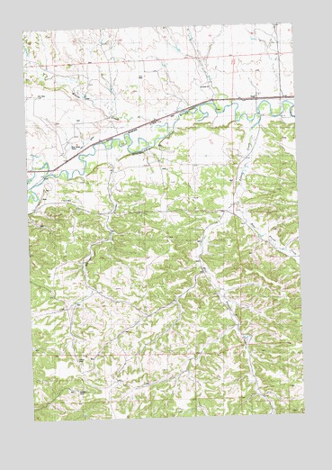
Gage, MT USGS Topographic Map
Click on map above to begin viewing in our Map Viewer.

This topographic map contains these locations and features:
Feature Name Type Latitude Longitude GNIS ID View Map
07N26E02ADCB01 WellWellN46.3900°W108.4312°815970View Map
07N26E03DADA01 WellWellN46.3858°W108.4474°815937View Map
07N26E03DBDA01 WellWellN46.3858°W108.4507°815938View Map
07N26E04AABC01 WellWellN46.3944°W108.4710°815998View Map
07N26E04CDBA01 WellWellN46.3841°W108.4818°815926View Map
07N27E06CBBB01 WellWellN46.3877°W108.4015°815958View Map
07N27E06CCB_01 WellWellN46.3869°W108.4001°815944View Map
07N27E06DCBC01 WellWellN46.3816°W108.3929°815902View Map
07N27E06DDDD01 WellWellN46.3800°W108.3832°815894View Map
08N26E10BBBB01 WellWellN46.4691°W108.4654°816399View Map
08N26E25BACC01 WellWellN46.4208°W108.4190°816165View Map
08N26E25BBDA01 WellWellN46.4247°W108.4207°816189View Map
08N26E25CA__01 SpringSpringN46.4072°W108.4151°816076View Map
08N26E25DB__01 WellWellN46.4161°W108.4118°816138View Map
08N26E26DBAD01 WellWellN46.4158°W108.4287°816128View Map
08N26E26DCC_01 SpringSpringN46.4127°W108.4351°816111View Map
08N26E27BA__01 WellWellN46.4327°W108.4562°816246View Map
08N26E28CD__01 WellWellN46.4122°W108.4801°816105View Map
08N26E28CDCA01 WellWellN46.4116°W108.4810°816102View Map
08N26E28DB__01 SpringSpringN46.4158°W108.4735°816129View Map
08N26E32AAAA01 WellWellN46.4097°W108.4868°816088View Map
08N26E34AC__01 SpringSpringN46.4030°W108.4540°816060View Map
08N26E34ADA_01 SpringSpringN46.4072°W108.4479°816077View Map
08N26E34ADB_01 WellWellN46.4077°W108.4471°816078View Map
08N26E34CAA_01 WellWellN46.4030°W108.4587°816061View Map
08N26E34DDC_01 WellWellN46.3961°W108.4526°816014View Map
08N26E35BBA_01 SpringSpringN46.4094°W108.4432°816085View Map
08N27E29BCA_01 SpringSpringN46.4211°W108.3860°816167View Map
08N27E31CCBD01 WellWellN46.4000°W108.4032°816047View Map
08N27E32CDB_01 SpringSpringN46.4019°W108.3798°816056View Map
Barrigan CouleeValleyN46.4561°W108.4599°768528View Map
Blue Streak DownsLocaleN46.4630°W108.4812°769049View Map
Davisten (historical)LocaleN46.4505°W108.4924°1723107View Map
East Parrot CreekStreamN46.4430°W108.4021°771096View Map
GagePopulated PlaceN46.4766°W108.3932°771672View Map
Gage (historical)LocaleN46.4766°W108.3932°1723094View Map
Gage Post Office (historical)Post OfficeN46.4766°W108.3932°1723095View Map
Jeffries MineMineN46.3939°W108.4799°772807View Map
Musselshell CountyCivilN46.4966°W108.3981°1719593View Map
N-F DitchCanalN46.4641°W108.4712°774540View Map
Number 4 MineMineN46.4455°W108.4849°774653View Map
Parrot CreekStreamN46.4714°W108.3923°775094View Map
West Parrot CreekStreamN46.4430°W108.4021°778302View Map
Western MineMineN46.3841°W108.4799°778321View Map
Willow CreekStreamN46.4661°W108.4340°793360View Map

Note: Coordinates in the location and feature list above are referenced to NAD83 datum.


Copyright (C) 2008-2024 Ryan Niemi / Sunset Dynamics ... All Rights Reserved