TopoQuest Logo
Do you find TopoQuest useful?
Help keep TopoQuest running and adding new maps/features by donating!
Bitcoin:  19c7KJd3qBynnjoSw5npx9KScwjBe4ifkT
Litecoin:  LXs6TkuXGGXo1vDsWCkWVdjQX94eUKd6ui
Home View Maps Find Maps Find Places Resources & Links


Friendship, New York Topographic Map

USGS Map Title: Friendship, NY
USGS Map MRC: 42078B2
DRG (GeoTIFF) Download: o42078b2.tif


Neighboring USGS Topographic Map Quads:


  Rawson, NY  
42078C3
 

  Black Creek, NY  
42078C2
 

  Angelica, NY  
42078C1
 

  Cuba, NY  
42078B3
 

  Friendship, NY  
42078B2
 

  Belmont, NY  
42078B1
 

  Portville, NY  
42078A3
 

  Bolivar, NY  
42078A2
 

  Allentown, NY  
42078A1


Map MRC Location:

N43°
W79°
N43°
W78°
H8 H7 H6 H5 H4 H3 H2 H1
G8 G7 G6 G5 G4 G3 G2 G1
F8 F7 F6 F5 F4 F3 F2 F1
E8 E7 E6 E5 E4 E3 E2 E1
D8 D7 D6 D5 D4 D3 D2 D1
C8 C7 C6 C5 C4 C3 C2 C1
B8 B7 B6 B5 B4 B3 B2 B1
A8 A7 A6 A5 A4 A3 A2 A1
N42°
W79°
N42°
W78°

Friendship, NY USGS 1:24K Topographic Map Preview:
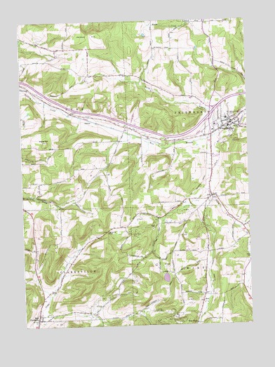
Friendship, NY USGS Topographic Map
Click on map above to begin viewing in our Map Viewer.

This topographic map contains these locations and features:
Feature Name Type Latitude Longitude GNIS ID View Map
Beebe HillSummitN42.2009°W78.2364°943496View Map
Clarksville Ambulance ServiceBuildingN42.1293°W78.2404°2719186View Map
Clarksville CemeteryCemeteryN42.1267°W78.2438°2544242View Map
Clarksville NotchGapN42.1637°W78.2039°946795View Map
Dew AirparkAirportN42.2372°W78.2115°977976View Map
First United Methodist ChurchChurchN42.2085°W78.1318°2616022View Map
FriendshipPopulated PlaceN42.2065°W78.1375°950738View Map
Friendship Ambulance SquadBuildingN42.2077°W78.1338°2719188View Map
Friendship Bible Baptist ChurchChurchN42.2073°W78.1360°2616048View Map
Friendship Census Designated PlaceCensusN42.2056°W78.1418°2389819View Map
Friendship Central SchoolSchoolN42.2062°W78.1357°2669024View Map
Friendship Church of GodChurchN42.2056°W78.1398°2616049View Map
Friendship Fire DepartmentBuildingN42.2084°W78.1339°2701266View Map
Friendship Free LibraryBuildingN42.2069°W78.1354°2617279View Map
Friendship Post OfficePost OfficeN42.2077°W78.1332°2617930View Map
Jackson HillSummitN42.2434°W78.2167°953886View Map
Moulton School (historical)SchoolN42.1786°W78.2431°2371526View Map
NilePopulated PlaceN42.1781°W78.1456°958586View Map
Nile CemeteryCemeteryN42.1789°W78.1461°2057587View Map
Nile Community ChurchChurchN42.1777°W78.1428°2616142View Map
North Branch Van Campen CreekStreamN42.2051°W78.1356°958728View Map
Pink School (historical)SchoolN42.1519°W78.1253°2371530View Map
Rocking R FarmLocaleN42.2000°W78.1972°2703661View Map
Sacred Heart CemeteryCemeteryN42.2109°W78.1343°963179View Map
Sawyer Trailer CourtPopulated PlaceN42.1938°W78.1439°2618284View Map
School Number 3 (historical)SchoolN42.1467°W78.1669°2371534View Map
School Number 4 (historical)SchoolN42.1283°W78.2092°2371535View Map
School Number 4 (historical)SchoolN42.2283°W78.2064°2371537View Map
School Number 5 (historical)SchoolN42.2386°W78.1689°2371539View Map
Smalley School (historical)SchoolN42.1697°W78.1778°2371544View Map
South Branch Van Campen CreekStreamN42.2031°W78.1397°965708View Map
SummitLocaleN42.2101°W78.2161°966767View Map
Town of ClarksvilleCivilN42.1300°W78.2498°978833View Map
Town of CubaCivilN42.2169°W78.2495°978880View Map
Town of FriendshipCivilN42.2169°W78.1328°978978View Map
Town of WirtCivilN42.1299°W78.1325°979651View Map
United Church of FriendshipChurchN42.2090°W78.1321°2617122View Map
Val Dale FarmsLocaleN42.1708°W78.1383°2703653View Map
West Branch Van Campen CreekStreamN42.2026°W78.1397°969142View Map
West ClarksvillePopulated PlaceN42.1281°W78.2431°969180View Map
West Clarksville Post OfficePost OfficeN42.1278°W78.2428°2618181View Map
West NotchPopulated PlaceN42.1256°W78.1553°973246View Map
Wheeler CemeteryCemeteryN42.1369°W78.1458°2544243View Map
WirtPopulated PlaceN42.1351°W78.1511°973279View Map
Wirt Center School (historical)SchoolN42.1397°W78.1492°2371546View Map

Note: Coordinates in the location and feature list above are referenced to NAD83 datum.


Copyright (C) 2008-2024 Ryan Niemi / Sunset Dynamics ... All Rights Reserved