TopoQuest Logo
Do you find TopoQuest useful?
Help keep TopoQuest running and adding new maps/features by donating!
Bitcoin:  19c7KJd3qBynnjoSw5npx9KScwjBe4ifkT
Litecoin:  LXs6TkuXGGXo1vDsWCkWVdjQX94eUKd6ui
Home View Maps Find Maps Find Places Resources & Links


Franklinton, Kentucky Topographic Map

USGS Map Title: Franklinton, KY
USGS Map MRC: 38085D1
DRG (GeoTIFF) Download: o38085d1.tif


Neighboring USGS Topographic Map Quads:


  Campbellsburg, KY  
38085E2
 

  Worthville, KY  
38085E1
 

  New Liberty, KY  
38084E8
 

  New Castle, KY  
38085D2
 

  Franklinton, KY  
38085D1
 

  Gratz, KY  
38084D8
 

  Eminence, KY  
38085C2
 

  North Pleasureville, KY  
38085C1
 

  Polsgrove, KY  
38084C8


Map MRC Location:

N39°
W86°
N39°
W85°
H8 H7 H6 H5 H4 H3 H2 H1
G8 G7 G6 G5 G4 G3 G2 G1
F8 F7 F6 F5 F4 F3 F2 F1
E8 E7 E6 E5 E4 E3 E2 E1
D8 D7 D6 D5 D4 D3 D2 D1
C8 C7 C6 C5 C4 C3 C2 C1
B8 B7 B6 B5 B4 B3 B2 B1
A8 A7 A6 A5 A4 A3 A2 A1
N38°
W86°
N38°
W85°

Franklinton, KY USGS 1:24K Topographic Map Preview:
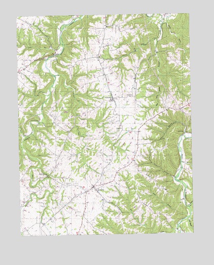
Franklinton, KY USGS Topographic Map
Click on map above to begin viewing in our Map Viewer.

This topographic map contains these locations and features:
Feature Name Type Latitude Longitude GNIS ID View Map
Adams School (historical)SchoolN38.4446°W85.0079°2568565View Map
Bantas ForkStreamN38.3751°W85.0244°486321View Map
Berea Christian ChurchChurchN38.4351°W85.0494°486901View Map
Berea School (historical)SchoolN38.4347°W85.0495°2568568View Map
BethlehemPopulated PlaceN38.4006°W85.0694°487004View Map
Bethlehem Missionary Baptist Church (historical)ChurchN38.4006°W85.0692°2568569View Map
Bethlehem School (historical)SchoolN38.4002°W85.0697°2568570View Map
Blackwell Post Office (historical)Post OfficeN38.3823°W85.0084°2568572View Map
Boling BranchStreamN38.4945°W85.0186°487641View Map
Boss Spring (historical)SpringN38.4283°W85.0278°2568573View Map
Boyd BranchStreamN38.3856°W85.0019°487763View Map
Carroll Post Office (historical)Post OfficeN38.4327°W85.0043°2568580View Map
Collins School (historical)SchoolN38.4952°W85.0897°2568583View Map
Cureton School (historical)SchoolN38.4234°W85.0936°2568585View Map
DelvillePopulated PlaceN38.4776°W85.0975°507841View Map
Ditto School (historical)SchoolN38.3853°W85.0810°2568587View Map
Drennon FallsFallsN38.4389°W85.1103°2568588View Map
Eastern Grade School (historical)SchoolN38.4252°W85.0392°2568594View Map
Fivemile CreekStreamN38.4662°W85.0972°492157View Map
Flag RunStreamN38.4812°W85.0944°492163View Map
Fool HollowValleyN38.4068°W85.0136°492298View Map
FranklintonPopulated PlaceN38.4526°W85.0555°492460View Map
Gilgal School (historical)SchoolN38.4395°W85.0997°2568599View Map
Greens ForkStreamN38.4862°W85.0225°493338View Map
Greens Fork School (historical)SchoolN38.4870°W85.0234°2568601View Map
Happy RidgeRidgeN38.3934°W85.0369°493710View Map
Henry CountyCivilN38.4485°W85.1189°516898View Map
Holy Water BranchStreamN38.4648°W85.0197°494461View Map
James RidgeRidgeN38.4040°W85.0261°495162View Map
Jenkins CemeteryCemeteryN38.4844°W85.1111°2728874View Map
Joes BranchStreamN38.4306°W85.0050°495306View Map
Little Sixmile CreekStreamN38.3842°W85.0027°496863View Map
Longs BranchStreamN38.4153°W85.0080°497153View Map
McElwain CreekStreamN38.4255°W85.1221°2568626View Map
Mount Zion (historical)LocaleN38.4057°W85.0686°2568633View Map
Old Bethel Church (historical)ChurchN38.4909°W85.0438°2568636View Map
Periwinkle School (historical)SchoolN38.4936°W85.0528°2568640View Map
Pleasureville DivisionCivilN38.4064°W85.0110°1937207View Map
Point PleasantPopulated PlaceN38.4088°W85.1052°2568643View Map
Point Pleasant CemeteryCemeteryN38.4034°W85.0897°500992View Map
Point Pleasant Christian ChurchChurchN38.4090°W85.1044°500994View Map
Pringle Branch Salt RiverStreamN38.3946°W85.0467°2568645View Map
Rush CreekStreamN38.4426°W85.0813°502483View Map
Salem School (historical)SchoolN38.4072°W85.0129°2568648View Map
Salt RiverStreamN38.3820°W85.0088°502831View Map
Saltwater (historical)Populated PlaceN38.3808°W85.0382°2568649View Map
School Number Thirty-Five (historical)SchoolN38.3799°W85.0120°2568657View Map
School Number Twenty-Six (historical)SchoolN38.4269°W85.0561°2568662View Map
Sewell CemeteryCemeteryN38.4173°W85.0574°503191View Map
Sewell School (historical)SchoolN38.3917°W85.0372°2568663View Map
Sixmile (historical)Populated PlaceN38.3939°W85.0062°2568665View Map
SlabtownPopulated PlaceN38.4328°W85.0052°509073View Map
Town CreekStreamN38.4309°W85.1191°505393View Map
Willhite CemeteryCemeteryN38.3844°W85.0556°2729127View Map
Willis School (historical)SchoolN38.3815°W85.1082°2568679View Map
Woodcocks BranchStreamN38.3901°W85.0027°507090View Map

Note: Coordinates in the location and feature list above are referenced to NAD83 datum.


Copyright (C) 2008-2024 Ryan Niemi / Sunset Dynamics ... All Rights Reserved