TopoQuest Logo
Do you find TopoQuest useful?
Help keep TopoQuest running and adding new maps/features by donating!
Bitcoin:  19c7KJd3qBynnjoSw5npx9KScwjBe4ifkT
Litecoin:  LXs6TkuXGGXo1vDsWCkWVdjQX94eUKd6ui
Home View Maps Find Maps Find Places Resources & Links


Fourmile Lake, Florida Topographic Map

USGS Map Title: Fourmile Lake, FL
USGS Map MRC: 29082F7
DRG (GeoTIFF) Download: o29082f7.tif


Neighboring USGS Topographic Map Quads:


  Hatchbend, FL  
29082G8
 

  Bell, FL  
29082G7
 

  High Springs SW, FL  
29082G6
 

  Wannee, FL  
29082F8
 

  Fourmile Lake, FL  
29082F7
 

  Waters Lake, FL  
29082F6
 

  Fanning Springs, FL  
29082E8
 

  Trenton, FL  
29082E7
 

  Newberry SW, FL  
29082E6


Map MRC Location:

N30°
W83°
N30°
W82°
H8 H7 H6 H5 H4 H3 H2 H1
G8 G7 G6 G5 G4 G3 G2 G1
F8 F7 F6 F5 F4 F3 F2 F1
E8 E7 E6 E5 E4 E3 E2 E1
D8 D7 D6 D5 D4 D3 D2 D1
C8 C7 C6 C5 C4 C3 C2 C1
B8 B7 B6 B5 B4 B3 B2 B1
A8 A7 A6 A5 A4 A3 A2 A1
N29°
W83°
N29°
W82°

Fourmile Lake, FL USGS 1:24K Topographic Map Preview:
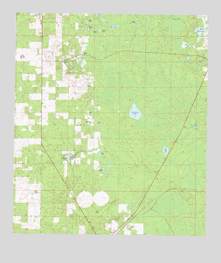
Fourmile Lake, FL USGS Topographic Map
Click on map above to begin viewing in our Map Viewer.

This topographic map contains these locations and features:
Feature Name Type Latitude Longitude GNIS ID View Map
Bird PondLakeN29.7227°W82.7531°278831View Map
Black LakeLakeN29.7430°W82.8110°278911View Map
Bonnet PondLakeN29.7416°W82.8278°279225View Map
Bright LakeLakeN29.7456°W82.7984°279394View Map
Buttonwood PondLakeN29.6888°W82.8240°279754View Map
Cannon PondLakeN29.7410°W82.8203°279987View Map
Flying Harness Farms AirportAirportN29.7188°W82.8428°309262View Map
Fourmile LakeLakeN29.6946°W82.7966°282748View Map
Gator PondLakeN29.7270°W82.8311°282988View Map
Gilchrist CountyCivilN29.7258°W82.8004°303633View Map
Gilchrist County Emergency Medical Services Medic 2BuildingN29.6312°W82.8246°2661873View Map
Gilchrist County Lookout TowerTowerN29.6316°W82.8243°300171View Map
Goose PondLakeN29.6619°W82.8164°283198View Map
Grass PondLakeN29.7479°W82.7690°283303View Map
Jennings LakeLakeN29.6690°W82.8396°284756View Map
Jennings Lake ChurchChurchN29.6686°W82.8429°284757View Map
Joppa CemeteryCemeteryN29.6288°W82.8412°284927View Map
Joppa LakeLakeN29.6382°W82.8220°284929View Map
Lee LakeLakeN29.6875°W82.7572°285429View Map
Mill PondLakeN29.7452°W82.8288°286892View Map
Morgan PondLakeN29.6887°W82.8213°287132View Map
MutualPopulated PlaceN29.7430°W82.8332°300170View Map
Negro PondLakeN29.7409°W82.8234°287577View Map
Pleasant Hill ChurchChurchN29.7233°W82.8426°289062View Map
Sapp LakeLakeN29.6707°W82.8190°290671View Map
Saw Whet Farms AirportAirportN29.6909°W82.8729°309260View Map
Threemile LakeLakeN29.6734°W82.7763°292256View Map
Trenton CemeteryCemeteryN29.6305°W82.8018°292421View Map
Trenton DivisionCivilN29.6733°W82.7738°1935956View Map
TylerPopulated PlaceN29.6511°W82.7640°295681View Map
Waccasassa FlatsSwampN29.7408°W82.7818°300160View Map
Wash PondLakeN29.6942°W82.8271°292902View Map
Watson Flight StripAirportN29.6653°W82.8261°309935View Map
Weeks LakeLakeN29.7330°W82.7635°292989View Map
Weeks WaterholeLakeN29.7414°W82.7554°292992View Map
Yard PondLakeN29.7089°W82.8283°293567View Map

Note: Coordinates in the location and feature list above are referenced to NAD83 datum.


Copyright (C) 2008-2024 Ryan Niemi / Sunset Dynamics ... All Rights Reserved