TopoQuest Logo
Do you find TopoQuest useful?
Help keep TopoQuest running and adding new maps/features by donating!
Bitcoin:  19c7KJd3qBynnjoSw5npx9KScwjBe4ifkT
Litecoin:  LXs6TkuXGGXo1vDsWCkWVdjQX94eUKd6ui
Home View Maps Find Maps Find Places Resources & Links


Fort Wilkins, Michigan Topographic Map

USGS Map Title: Fort Wilkins, MI
USGS Map MRC: 47087D7
DRG (GeoTIFF) Download: o47087d7.tif


Neighboring USGS Topographic Map Quads:


  Lake Medora, MI  
47087D8
 

  Fort Wilkins, MI  
47087D7
 

  Manitou Island, MI  
47087D5
 

  Point Isabelle, MI  
47087C8


Map MRC Location:

N48°
W88°
N48°
W87°
H8 H7 H6 H5 H4 H3 H2 H1
G8 G7 G6 G5 G4 G3 G2 G1
F8 F7 F6 F5 F4 F3 F2 F1
E8 E7 E6 E5 E4 E3 E2 E1
D8 D7 D6 D5 D4 D3 D2 D1
C8 C7 C6 C5 C4 C3 C2 C1
B8 B7 B6 B5 B4 B3 B2 B1
A8 A7 A6 A5 A4 A3 A2 A1
N47°
W88°
N47°
W87°

Fort Wilkins, MI USGS 1:24K Topographic Map Preview:
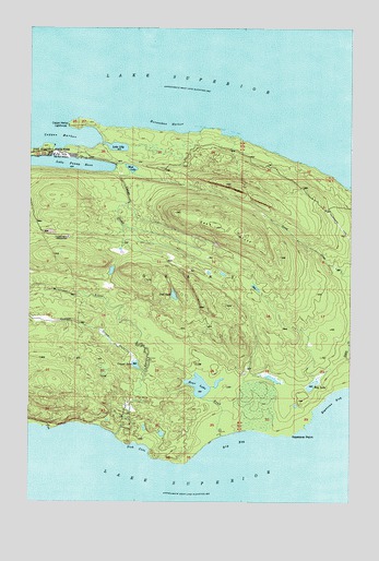
Fort Wilkins, MI USGS Topographic Map
Click on map above to begin viewing in our Map Viewer.

This topographic map contains these locations and features:
Feature Name Type Latitude Longitude GNIS ID View Map
Bay LakeLakeN47.4057°W87.7647°620784View Map
Big BayBayN47.3905°W87.7946°621287View Map
Copper CreekStreamN47.4094°W87.8307°623805View Map
Copper HarborBayN47.4713°W87.8715°623808View Map
Copper Harbor LighthouseLocaleN47.4743°W87.8604°623810View Map
Copper Harbor Rear Range LighthouseLocaleN47.4689°W87.8667°2112198View Map
Copper LakeLakeN47.4110°W87.8335°623811View Map
East BluffRidgeN47.4460°W87.7939°625119View Map
Fish CoveBayN47.3891°W87.8315°626026View Map
Fort Wilkins Historical Marker (historical)ParkN47.4706°W87.8667°2112185View Map
Fort Wilkins State ParkParkN47.4671°W87.8698°626297View Map
Fort Wilkins State Park CemeteryCemeteryN47.4662°W87.8590°2112224View Map
Hoar CreekStreamN47.3921°W87.8001°628358View Map
Hoar LakeLakeN47.4055°W87.8087°628359View Map
Horseshoe HarborBayN47.4741°W87.8221°628603View Map
Keystone PointCapeN47.3930°W87.7723°629648View Map
Lake Fanny HooeLakeN47.4640°W87.8631°625823View Map
Lily LakeLakeN47.4685°W87.8412°630401View Map
Lost LakeLakeN47.4294°W87.8188°631109View Map
Lower FallsFallsN47.3939°W87.8394°2112194View Map
Montreal RiverStreamN47.3924°W87.8415°632608View Map
Mud LakeLakeN47.4628°W87.8357°633051View Map
Old Fort WilkinsLocaleN47.4663°W87.8648°633995View Map
Upper FallsFallsN47.4006°W87.8358°2112196View Map
Vulcan CreekStreamN47.4624°W87.8371°1615637View Map

Note: Coordinates in the location and feature list above are referenced to NAD83 datum.


Copyright (C) 2008-2024 Ryan Niemi / Sunset Dynamics ... All Rights Reserved