TopoQuest Logo
Do you find TopoQuest useful?
Help keep TopoQuest running and adding new maps/features by donating!
Bitcoin:  19c7KJd3qBynnjoSw5npx9KScwjBe4ifkT
Litecoin:  LXs6TkuXGGXo1vDsWCkWVdjQX94eUKd6ui
Home View Maps Find Maps Find Places Resources & Links


Fort Necessity, Pennsylvania Topographic Map

USGS Map Title: Fort Necessity, PA
USGS Map MRC: 39079G5
DRG (GeoTIFF) Download: o39079g5.tif


Neighboring USGS Topographic Map Quads:


  Uniontown, PA  
39079H6
 

  South Connellsville, PA  
39079H5
 

  Mill Run, PA  
39079H4
 

  Brownfield, PA  
39079G6
 

  Fort Necessity, PA  
39079G5
 

  Ohiopyle, PA  
39079G4
 

  Bruceton Mills, WV  
39079F6
 

  Brandonville, WV  
39079F5
 

  Friendsville, MD  
39079F4


Map MRC Location:

N40°
W80°
N40°
W79°
H8 H7 H6 H5 H4 H3 H2 H1
G8 G7 G6 G5 G4 G3 G2 G1
F8 F7 F6 F5 F4 F3 F2 F1
E8 E7 E6 E5 E4 E3 E2 E1
D8 D7 D6 D5 D4 D3 D2 D1
C8 C7 C6 C5 C4 C3 C2 C1
B8 B7 B6 B5 B4 B3 B2 B1
A8 A7 A6 A5 A4 A3 A2 A1
N39°
W80°
N39°
W79°

Fort Necessity, PA USGS 1:24K Topographic Map Preview:
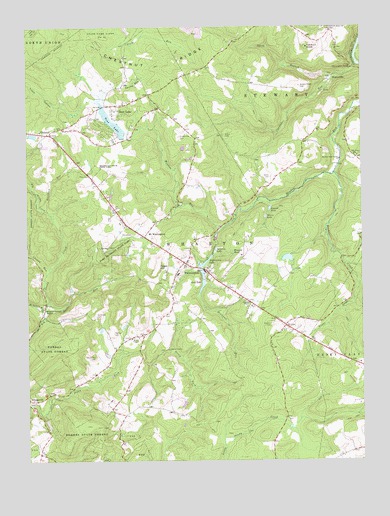
Fort Necessity, PA USGS Topographic Map
Click on map above to begin viewing in our Map Viewer.

This topographic map contains these locations and features:
Feature Name Type Latitude Longitude GNIS ID View Map
Alanconnie LakeReservoirN39.8072°W79.5584°1168110View Map
Beaver CreekStreamN39.8329°W79.5098°1168997View Map
Bethel ChapelChurchN39.7851°W79.5856°1169365View Map
Bluegill PondReservoirN39.7979°W79.5425°1169902View Map
Braddock Grave State ParkParkN39.8337°W79.5995°1170123View Map
Braddock RunStreamN39.8223°W79.6167°1170125View Map
Bryner School (historical)SchoolN39.8584°W79.5414°1205669View Map
Camp RiamoLocaleN39.7823°W79.5720°1171071View Map
Chalk Hill Post OfficePost OfficeN39.8447°W79.6181°2779845View Map
ChalkhillPopulated PlaceN39.8442°W79.6167°1171531View Map
Chalkhill Census Designated PlaceCensusN39.8461°W79.6142°2631254View Map
Chaney RunStreamN39.8026°W79.6187°1171559View Map
Cucumber FallsFallsN39.8629°W79.5031°1192320View Map
Cucumber RunStreamN39.8640°W79.5011°1172810View Map
Deadman RunStreamN39.8173°W79.5514°1173028View Map
Deer LakePopulated PlaceN39.8501°W79.5892°1173088View Map
Deer LakeReservoirN39.8477°W79.5928°1173090View Map
Deer Lake Census Designated PlaceCensusN39.8481°W79.5906°2631258View Map
Deer Lake DamDamN39.8430°W79.5894°1194377View Map
FarmingtonPopulated PlaceN39.8073°W79.5656°1174626View Map
Farmington Census Designated PlaceCensusN39.8100°W79.5623°2631265View Map
Farmington Post OfficePost OfficeN39.8075°W79.5653°2779833View Map
Farmington Volunteer Fire Department Station 15BuildingN39.8062°W79.5677°2645000View Map
Fayette Emergency Medical Services WhartonBuildingN39.8063°W79.5676°2719600View Map
Fayette SpringsPopulated PlaceN39.8395°W79.6231°1212650View Map
Fort Necessity National BattlefieldParkN39.8131°W79.5903°1193713View Map
Fort Necessity State ParkParkN39.8137°W79.5892°1175016View Map
Great Gorge TrailTrailN39.8684°W79.5025°1192544View Map
Great Meadow RunStreamN39.8234°W79.5678°1956251View Map
Hager Airstrip (historical)AirportN39.7770°W79.5859°1193736View Map
Hager HillSummitN39.8059°W79.5759°1176358View Map
Heritage LakeReservoirN39.7581°W79.5515°1194351View Map
Heritage Reservation DamDamN39.7534°W79.5514°1194350View Map
Kentuck KnobSummitN39.8695°W79.5198°1178387View Map
Kentuck Union ChurchChurchN39.8745°W79.5106°1178388View Map
Lake George DamDamN39.8084°W79.5564°1194362View Map
McIntire RunStreamN39.7923°W79.6184°1180728View Map
Meadow Run Valley ChurchChurchN39.8367°W79.5075°1180835View Map
Middle Ridge CemeteryCemeteryN39.8579°W79.5223°1181047View Map
Morris Family CemeteryCemeteryN39.8324°W79.5337°1188318View Map
Mount WashingtonPopulated PlaceN39.8145°W79.5800°1213396View Map
Nemacolin AirportAirportN39.8057°W79.5494°1193746View Map
Noahs GladeStreamN39.8009°W79.5006°1209315View Map
North Branch Cucumber RunStreamN39.8609°W79.5098°1182535View Map
Oak Grove SchoolSchoolN39.8379°W79.5012°1182752View Map
Oak LakeReservoirN39.8019°W79.5594°1182782View Map
Oak Lake DamDamN39.8050°W79.5598°1194360View Map
Peters LakeReservoirN39.8203°W79.5355°1183628View Map
Russell LakeReservoirN39.8227°W79.5341°1185654View Map
Sansom CemeteryCemeteryN39.7894°W79.5334°1186973View Map
Sansom ChapelChurchN39.7959°W79.5414°1186974View Map
Schaffer School (historical)SchoolN39.7934°W79.5381°1205668View Map
Scotts RunStreamN39.7959°W79.6170°1187174View Map
Smiley RunStreamN39.8579°W79.5920°1187852View Map
Smith School (historical)SchoolN39.8556°W79.5789°1205670View Map
Spaw SchoolSchoolN39.7645°W79.5928°1205671View Map
Spear CemeteryCemeteryN39.8440°W79.5507°1188156View Map
StonervillePopulated PlaceN39.8601°W79.5114°1204746View Map
Stony ForkStreamN39.7662°W79.6242°1209341View Map
Sunset View CemeteryCemeteryN39.8435°W79.5678°1189096View Map
Surprise LakeLakeN39.8106°W79.5545°1189105View Map
Thomas CemeteryCemeteryN39.7870°W79.5920°1189475View Map
Township of WhartonCivilN39.7862°W79.6080°1216450View Map
Trout HollowValleyN39.8522°W79.6118°1193552View Map
Van Sickle CemeteryCemeteryN39.7801°W79.5997°1190341View Map
Wharton Elementary SchoolSchoolN39.8040°W79.5681°1211488View Map
Wharton Furnace ChapelChurchN39.7937°W79.6184°1191203View Map
Workman CemeteryCemeteryN39.7915°W79.5989°1191790View Map

Note: Coordinates in the location and feature list above are referenced to NAD83 datum.


Copyright (C) 2008-2024 Ryan Niemi / Sunset Dynamics ... All Rights Reserved