TopoQuest Logo
Do you find TopoQuest useful?
Help keep TopoQuest running and adding new maps/features by donating!
Bitcoin:  19c7KJd3qBynnjoSw5npx9KScwjBe4ifkT
Litecoin:  LXs6TkuXGGXo1vDsWCkWVdjQX94eUKd6ui
Home View Maps Find Maps Find Places Resources & Links


Forkville, Mississippi Topographic Map

USGS Map Title: Forkville, MS
USGS Map MRC: 32089D6
DRG (GeoTIFF) Download: o32089d6.tif


Neighboring USGS Topographic Map Quads:


  Sharon SE, MS  
32089E7
 

  Ludlow, MS  
32089E6
 

  Lena, MS  
32089E5
 

  Leesburg, MS  
32089D7
 

  Forkville, MS  
32089D6
 

  Hillsboro, MS  
32089D5
 

  Pelahatchie, MS  
32089C7
 

  Morton, MS  
32089C6
 

  Pulaski, MS  
32089C5


Map MRC Location:

N33°
W90°
N33°
W89°
H8 H7 H6 H5 H4 H3 H2 H1
G8 G7 G6 G5 G4 G3 G2 G1
F8 F7 F6 F5 F4 F3 F2 F1
E8 E7 E6 E5 E4 E3 E2 E1
D8 D7 D6 D5 D4 D3 D2 D1
C8 C7 C6 C5 C4 C3 C2 C1
B8 B7 B6 B5 B4 B3 B2 B1
A8 A7 A6 A5 A4 A3 A2 A1
N32°
W90°
N32°
W89°

Forkville, MS USGS 1:24K Topographic Map Preview:
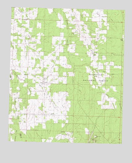
Forkville, MS USGS Topographic Map
Click on map above to begin viewing in our Map Viewer.

This topographic map contains these locations and features:
Feature Name Type Latitude Longitude GNIS ID View Map
Armstrong SchoolSchoolN32.4385°W89.6570°692414View Map
Armstrong SchoolSchoolN32.4374°W89.6529°711524View Map
Bald PrairieLakeN32.4411°W89.7212°692446View Map
Balucta (historical)LocaleN32.4740°W89.6259°707285View Map
BeachPopulated PlaceN32.4965°W89.6551°692483View Map
Bethlehem ChurchChurchN32.4565°W89.6579°704943View Map
Big BranchStreamN32.4629°W89.6892°695201View Map
BranchPopulated PlaceN32.4304°W89.7115°704945View Map
Branch ChurchChurchN32.4824°W89.7392°692688View Map
Branch SchoolSchoolN32.4407°W89.7145°692689View Map
Buck BranchStreamN32.4174°W89.6334°692741View Map
Byrns (historical)LocaleN32.4849°W89.6765°704946View Map
Cherry CreekStreamN32.4451°W89.6817°692881View Map
ForkvillePopulated PlaceN32.4607°W89.6609°711463View Map
Groveton ChurchChurchN32.4304°W89.7104°704972View Map
Groveton ChurchChurchN32.4385°W89.7137°693379View Map
Hodge Hill CemeteryCemeteryN32.3779°W89.6557°693492View Map
Howard Walker Pond DamDamN32.4985°W89.6567°695460View Map
Latham CemeteryCemeteryN32.4779°W89.6817°693690View Map
Liberty CemeteryCemeteryN32.4301°W89.7120°693715View Map
Line PrairieFlatN32.4168°W89.7009°693731View Map
Line Prairie ChurchChurchN32.4010°W89.7034°704985View Map
Line Prairie SchoolSchoolN32.4013°W89.7042°693732View Map
Macedonia ChurchChurchN32.4376°W89.6542°705646View Map
Morton Memorial CemeteryCemeteryN32.3815°W89.6542°704989View Map
New Liberty ChurchChurchN32.4335°W89.7112°704992View Map
Peagler StoreLocaleN32.4732°W89.7292°694329View Map
Pilgrim Rest ChurchChurchN32.4351°W89.7292°694372View Map
Pleasant Gift ChurchChurchN32.4890°W89.7326°694418View Map
Pleasant Grove ChurchChurchN32.3854°W89.6884°694796View Map
Sugar BogueStreamN32.4440°W89.6590°694902View Map
Supervisor District 4CivilN32.4933°W89.6699°712058View Map
Truelight SchoolSchoolN32.4526°W89.7154°695010View Map

Note: Coordinates in the location and feature list above are referenced to NAD83 datum.


Copyright (C) 2008-2024 Ryan Niemi / Sunset Dynamics ... All Rights Reserved