TopoQuest Logo
Do you find TopoQuest useful?
Help keep TopoQuest running and adding new maps/features by donating!
Bitcoin:  19c7KJd3qBynnjoSw5npx9KScwjBe4ifkT
Litecoin:  LXs6TkuXGGXo1vDsWCkWVdjQX94eUKd6ui
Home View Maps Find Maps Find Places Resources & Links


Flat Mountain, Oregon Topographic Map

USGS Map Title: Flat Mountain, OR
USGS Map MRC: 44123D4
DRG (GeoTIFF) Download: o44123d4.tif


Neighboring USGS Topographic Map Quads:


  Marys Peak, OR  
44123E5
 

  Wren, OR  
44123E4
 

  Corvallis, OR  
44123E3
 

  Alsea, OR  
44123D5
 

  Flat Mountain, OR  
44123D4
 

  Greenberry, OR  
44123D3
 

  Prairie Peak, OR  
44123C5
 

  Glenbrook, OR  
44123C4
 

  Monroe, OR  
44123C3


Map MRC Location:

N45°
W124°
N45°
W123°
H8 H7 H6 H5 H4 H3 H2 H1
G8 G7 G6 G5 G4 G3 G2 G1
F8 F7 F6 F5 F4 F3 F2 F1
E8 E7 E6 E5 E4 E3 E2 E1
D8 D7 D6 D5 D4 D3 D2 D1
C8 C7 C6 C5 C4 C3 C2 C1
B8 B7 B6 B5 B4 B3 B2 B1
A8 A7 A6 A5 A4 A3 A2 A1
N44°
W124°
N44°
W123°

Flat Mountain, OR USGS 1:24K Topographic Map Preview:
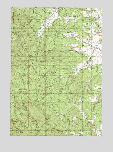
Flat Mountain, OR USGS Topographic Map
Click on map above to begin viewing in our Map Viewer.

This topographic map contains these locations and features:
Feature Name Type Latitude Longitude GNIS ID View Map
Beaver Creek Seed OrchardLocaleN44.4415°W123.4045°1167198View Map
Benton CountyCivilN44.4918°W123.4292°1155126View Map
Buck PeakSummitN44.3787°W123.4884°1138809View Map
Bunker HillSummitN44.3937°W123.4159°1135513View Map
Cedar CreekStreamN44.4735°W123.4637°1639297View Map
Cheyenne CreekStreamN44.4465°W123.4409°1135508View Map
Decker RidgeRidgeN44.4762°W123.4207°1135510View Map
Dinner CreekStreamN44.4698°W123.4893°1141041View Map
Duffy CreekStreamN44.4387°W123.4082°1639310View Map
Emerich CemeteryCemeteryN44.4949°W123.3915°1116547View Map
Ervin CreekStreamN44.4846°W123.4259°1153528View Map
Flat MountainSummitN44.4198°W123.4829°1142238View Map
Franklin RidgeRidgeN44.4957°W123.4859°1135509View Map
Gleason CreekStreamN44.4304°W123.4234°1155387View Map
Hells CanyonValleyN44.4018°W123.3884°1135511View Map
Henderson CreekStreamN44.4526°W123.3929°1138733View Map
Hyde CreekStreamN44.4846°W123.4507°1143553View Map
Kiser CreekStreamN44.4687°W123.4962°1144642View Map
Mercer CreekStreamN44.4621°W123.3865°1153531View Map
Moss CreekStreamN44.4901°W123.4359°1153532View Map
Powell CemeteryCemeteryN44.4747°W123.3953°1153530View Map
Powell CreekStreamN44.4598°W123.3815°1147962View Map
Rickard CreekStreamN44.3810°W123.4351°1148426View Map
Ridenour CreekStreamN44.3793°W123.3829°1135512View Map
Schreiber Lodge Boy Scout CampLocaleN44.4679°W123.4870°1638021View Map
South CreekStreamN44.4304°W123.4234°1155367View Map
Spencer CreekStreamN44.4804°W123.4540°1153529View Map
Wells CreekStreamN44.4754°W123.4584°1152011View Map
Westwood CreekStreamN44.4971°W123.4401°1152161View Map

Note: Coordinates in the location and feature list above are referenced to NAD83 datum.


Copyright (C) 2008-2024 Ryan Niemi / Sunset Dynamics ... All Rights Reserved