TopoQuest Logo
Do you find TopoQuest useful?
Help keep TopoQuest running and adding new maps/features by donating!
Bitcoin:  19c7KJd3qBynnjoSw5npx9KScwjBe4ifkT
Litecoin:  LXs6TkuXGGXo1vDsWCkWVdjQX94eUKd6ui
Home View Maps Find Maps Find Places Resources & Links


Firth, Nebraska Topographic Map

USGS Map Title: Firth, NE
USGS Map MRC: 40096E5
DRG (GeoTIFF) Download: o40096e5.tif


Neighboring USGS Topographic Map Quads:


  Roca, NE  
40096F6
 

  Bennet, NE  
40096F5
 

  Palmyra, NE  
40096F4
 

  Cortland, NE  
40096E6
 

  Firth, NE  
40096E5
 

  Douglas, NE  
40096E4
 

  Pickrell, NE  
40096D6
 

  Adams, NE  
40096D5
 

  Sterling, NE  
40096D4


Map MRC Location:

N41°
W97°
N41°
W96°
H8 H7 H6 H5 H4 H3 H2 H1
G8 G7 G6 G5 G4 G3 G2 G1
F8 F7 F6 F5 F4 F3 F2 F1
E8 E7 E6 E5 E4 E3 E2 E1
D8 D7 D6 D5 D4 D3 D2 D1
C8 C7 C6 C5 C4 C3 C2 C1
B8 B7 B6 B5 B4 B3 B2 B1
A8 A7 A6 A5 A4 A3 A2 A1
N40°
W97°
N40°
W96°

Firth, NE USGS 1:24K Topographic Map Preview:
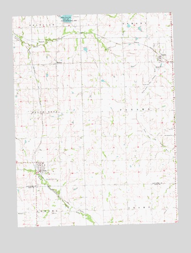
Firth, NE USGS Topographic Map
Click on map above to begin viewing in our Map Viewer.

This topographic map contains these locations and features:
Feature Name Type Latitude Longitude GNIS ID View Map
Big Nemaha Dam 11-ADamN40.5341°W96.6007°1767816View Map
Big Nemaha Dam L-4DamN40.5476°W96.5872°1767814View Map
Big Nemaha Reservoir 11-AReservoirN40.5337°W96.5981°1767817View Map
Big Nemaha Reservoir 6-4ReservoirN40.5495°W96.5867°1767815View Map
FirthPopulated PlaceN40.5325°W96.6061°829302View Map
FirthLocaleN40.5319°W96.6081°1898462View Map
Firth CemeteryCemeteryN40.5250°W96.6089°829303View Map
Firth Community ChurchChurchN40.5325°W96.6061°1899240View Map
Firth Cooperative Company ElevatorLocaleN40.5325°W96.6061°1899242View Map
Firth Post OfficePost OfficeN40.5329°W96.6066°1899239View Map
Firth Rural Fire District Firth StationBuildingN40.5328°W96.6058°2553337View Map
Firth Rural Fire District Panama StationBuildingN40.5973°W96.5108°2553322View Map
Hedgefield ReservoirReservoirN40.6040°W96.5688°1767783View Map
Hedgefield State Wildlife Management AreaParkN40.6042°W96.5683°1899099View Map
HollandPopulated PlaceN40.5964°W96.5917°830052View Map
Holland CemeteryCemeteryN40.5958°W96.6000°830053View Map
Holland Post OfficePost OfficeN40.5964°W96.5917°1898428View Map
Lakeview Rest HomeBuildingN40.5325°W96.6061°1899238View Map
Liesveld Airport (historical)AirportN40.5927°W96.5883°837602View Map
N F Big Nemaha Dam 23-BDamN40.5750°W96.5285°1769780View Map
N F Big Nemaha Dam 23-CDamN40.5717°W96.5354°1769778View Map
N F Big Nemaha Dam 23-DDamN40.5624°W96.5432°1769776View Map
N F Big Nemaha Reservoir 23-BReservoirN40.5768°W96.5265°1769781View Map
N F Big Nemaha Reservoir 23-CReservoirN40.5729°W96.5362°1769779View Map
N F Big Nemaha Reservoir 23-DReservoirN40.5620°W96.5458°1769777View Map
PanamaPopulated PlaceN40.5978°W96.5108°831963View Map
Panama (historical)LocaleN40.5989°W96.5108°1898454View Map
Panama CemeteryCemeteryN40.5822°W96.5258°831964View Map
Panama Election PrecinctCivilN40.5669°W96.5181°1929132View Map
Panama Post OfficePost OfficeN40.5980°W96.5109°1898455View Map
Pella (historical)Populated PlaceN40.5522°W96.5017°1898521View Map
Pella CemeteryCemeteryN40.5555°W96.5017°832032View Map
Pella Post Office (historical)Post OfficeN40.5522°W96.5017°1898520View Map
Pella Reformed ChurchChurchN40.5519°W96.5028°832033View Map
Reformed Church of FirthChurchN40.5325°W96.6061°1899241View Map
Rusty Crankshaft AirportAirportN40.6038°W96.6209°2770543View Map
Saint Johns ChurchChurchN40.5083°W96.6245°832915View Map
Salt Creek Dam 10-4DamN40.5850°W96.5570°1767756View Map
Salt Creek Dam 10-ADamN40.6050°W96.5703°1767782View Map
Salt Creek Dam 11-ADamN40.5900°W96.6003°1767744View Map
Salt Creek Dam 38-3DamN40.6167°W96.5270°1767766View Map
Salt Creek Dam 38-ADamN40.6167°W96.5353°1767776View Map
Salt Creek Reservoir 10-4ReservoirN40.5854°W96.5561°1767757View Map
Salt Creek Reservoir 11-AReservoirN40.5895°W96.5993°1767745View Map
Salt Creek Reservoir 38-3ReservoirN40.6156°W96.5263°1767767View Map
Salt Creek Reservoir 38-AReservoirN40.6180°W96.5342°1767777View Map
Township of PanamaCivilN40.5667°W96.5031°1898483View Map
Upper Big Nemaha Dam L-17DamN40.5367°W96.5664°1769084View Map
Upper Big Nemaha Dam L-5DamN40.5386°W96.5655°1769016View Map
Upper Big Nemaha Reservoir L-17ReservoirN40.5366°W96.5672°1769085View Map
Upper Big Nemaha Reservoir L-5ReservoirN40.5392°W96.5656°1769017View Map
Upper Salt Creek Dam 11-4DamN40.5783°W96.6236°1768370View Map
Upper Salt Creek Reservoir 11-4ReservoirN40.5775°W96.6239°1768371View Map
Van Pelt DamDamN40.5800°W96.5636°1767790View Map
Van Pelt ReservoirReservoirN40.5800°W96.5655°1767791View Map
Village of FirthCivilN40.5349°W96.6051°2398879View Map
Village of PanamaCivilN40.5998°W96.5112°2399618View Map
Wagon Train Dam-Site 8 DamDamN40.6200°W96.5836°1768776View Map
Windy Hill Pig FarmLocaleN40.6008°W96.5364°2585740View Map

Note: Coordinates in the location and feature list above are referenced to NAD83 datum.


Copyright (C) 2008-2024 Ryan Niemi / Sunset Dynamics ... All Rights Reserved