TopoQuest Logo
Do you find TopoQuest useful?
Help keep TopoQuest running and adding new maps/features by donating!
Bitcoin:  19c7KJd3qBynnjoSw5npx9KScwjBe4ifkT
Litecoin:  LXs6TkuXGGXo1vDsWCkWVdjQX94eUKd6ui
Home View Maps Find Maps Find Places Resources & Links


Faulkton West, South Dakota Topographic Map

USGS Map Title: Faulkton West, SD
USGS Map MRC: 45099A2
DRG (GeoTIFF) Download: o45099a2.tif


Neighboring USGS Topographic Map Quads:


  Clark Lake, SD  
45099B3
 

  Norbeck, SD  
45099B2
 

  Wecota, SD  
45099B1
 

  Burkmere, SD  
45099A3
 

  Faulkton West, SD  
45099A2
 

  Faulkton East, SD  
45099A1
 

  Rezac Lake NE, SD  
44099H3
 

  Orient NW, SD  
44099H2
 

  Orient, SD  
44099H1


Map MRC Location:

N46°
W100°
N46°
W99°
H8 H7 H6 H5 H4 H3 H2 H1
G8 G7 G6 G5 G4 G3 G2 G1
F8 F7 F6 F5 F4 F3 F2 F1
E8 E7 E6 E5 E4 E3 E2 E1
D8 D7 D6 D5 D4 D3 D2 D1
C8 C7 C6 C5 C4 C3 C2 C1
B8 B7 B6 B5 B4 B3 B2 B1
A8 A7 A6 A5 A4 A3 A2 A1
N45°
W100°
N45°
W99°

Faulkton West, SD USGS 1:24K Topographic Map Preview:
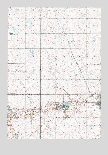
Faulkton West, SD USGS Topographic Map
Click on map above to begin viewing in our Map Viewer.

This topographic map contains these locations and features:
Feature Name Type Latitude Longitude GNIS ID View Map
Baldwin SchoolSchoolN45.1000°W99.2479°1253754View Map
City of FaulktonCivilN45.0342°W99.1267°1267390View Map
Faulk CountyCivilN45.0710°W99.1453°1265760View Map
Faulk County CourthouseBuildingN45.0338°W99.1263°2712644View Map
Faulk County JailBuildingN45.0339°W99.1268°2755658View Map
Faulk County LibraryBuildingN45.0340°W99.1250°2723474View Map
Faulk County SheriffBuildingN45.0339°W99.1263°2755551View Map
Faulkton Area Medical CenterHospitalN45.0305°W99.1326°2610946View Map
Faulkton DamDamN45.0329°W99.1677°1260253View Map
Faulkton Elementary SchoolSchoolN45.0343°W99.1299°2728710View Map
Faulkton High SchoolSchoolN45.0343°W99.1299°2728711View Map
Faulkton Junior High SchoolSchoolN45.0343°W99.1299°2728712View Map
Lake FaulktonReservoirN45.0305°W99.1772°1255023View Map
Lake Fualkton State Game RefugeParkN45.0316°W99.1754°1256018View Map
Tamworth SchoolSchoolN45.0272°W99.1337°1258500View Map
Township of FaulktonCivilN45.0205°W99.1343°1268355View Map
Township of PulaskiCivilN45.1080°W99.1343°1268356View Map
Township of TamworthCivilN45.0275°W99.1452°1268354View Map
Unorganized Territory of PulaskiCivilN45.1147°W99.1447°1267540View Map
Vogeler DrawValleyN45.0208°W99.2496°1258766View Map
Walgamuth SchoolSchoolN45.0430°W99.2465°1265410View Map

Note: Coordinates in the location and feature list above are referenced to NAD83 datum.


Copyright (C) 2008-2024 Ryan Niemi / Sunset Dynamics ... All Rights Reserved