TopoQuest Logo
Do you find TopoQuest useful?
Help keep TopoQuest running and adding new maps/features by donating!
Bitcoin:  19c7KJd3qBynnjoSw5npx9KScwjBe4ifkT
Litecoin:  LXs6TkuXGGXo1vDsWCkWVdjQX94eUKd6ui
Home View Maps Find Maps Find Places Resources & Links


Everson Creek, Montana Topographic Map

USGS Map Title: Everson Creek, MT
USGS Map MRC: 44113H3
DRG (GeoTIFF) Download: o44113h3.tif


Neighboring USGS Topographic Map Quads:


  Kitty Creek, MT  
45113A4
 

  Coyote Creek, MT  
45113A3
 

  Bachelor Mountain, MT  
45113A2
 

  Lemhi Pass, MT  
44113H4
 

  Everson Creek, MT  
44113H3
 

  Jeff Davis Peak, MT  
44113H2
 

  Goat Mountain, ID  
44113G4
 

  Bannock Pass, MT  
44113G3
 

  Deadman Pass, MT  
44113G2


Map MRC Location:

N45°
W114°
N45°
W113°
H8 H7 H6 H5 H4 H3 H2 H1
G8 G7 G6 G5 G4 G3 G2 G1
F8 F7 F6 F5 F4 F3 F2 F1
E8 E7 E6 E5 E4 E3 E2 E1
D8 D7 D6 D5 D4 D3 D2 D1
C8 C7 C6 C5 C4 C3 C2 C1
B8 B7 B6 B5 B4 B3 B2 B1
A8 A7 A6 A5 A4 A3 A2 A1
N44°
W114°
N44°
W113°

Everson Creek, MT USGS 1:24K Topographic Map Preview:
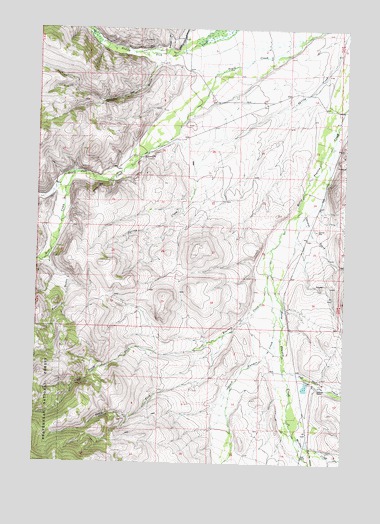
Everson Creek, MT USGS Topographic Map
Click on map above to begin viewing in our Map Viewer.

This topographic map contains these locations and features:
Feature Name Type Latitude Longitude GNIS ID View Map
10S14W03BBCB01 WellWellN44.9991°W113.3148°807269View Map
10S14W10BDAD01 WellWellN44.9813°W113.3053°807248View Map
10S14W23CDBB01 WellWellN44.9463°W113.2887°807241View Map
Bear CreekStreamN44.9583°W113.3595°779492View Map
Bear GulchValleyN44.9330°W113.3709°779537View Map
Black Canyon CreekStreamN44.9266°W113.2823°779990View Map
Bloody Dick Creek MineMineN44.9958°W113.3273°802446View Map
Brenner RanchLocaleN44.9680°W113.2556°794879View Map
Confederate DamDamN44.8966°W113.2659°798737View Map
Donovan (historical)LocaleN44.8966°W113.2578°1797332View Map
Donovan Airstrip (historical)AirportN44.9249°W113.2698°794880View Map
Donovan RanchLocaleN44.8969°W113.2606°782475View Map
Donovan Ranch Post Office (historical)Post OfficeN44.8966°W113.2578°1797232View Map
Everson CreekStreamN44.9319°W113.2806°783261View Map
Horse Prairie (historical)LocaleN44.8985°W113.2564°1797354View Map
Horse Prairie Post Office (historical)Post OfficeN44.8985°W113.2564°1797242View Map
Horse Prairie School (historical)SchoolN44.8985°W113.2564°1797353View Map
Jeff Davis CreekStreamN44.9027°W113.2756°785432View Map
Jeff Davis Gulch (historical)LocaleN44.9027°W113.2703°1797355View Map
JS Brenner RanchLocaleN44.9810°W113.3062°794878View Map
Magpie GulchValleyN44.9894°W113.3289°786780View Map
Maiden CreekStreamN44.8830°W113.2700°786784View Map
Monument (historical)LocaleN44.9902°W113.3162°1797376View Map
Monument Post Office (historical)Post OfficeN44.9902°W113.3162°1797248View Map
Monument School (historical)SchoolN44.9902°W113.3162°1797375View Map
NE Section 5 MineMineN44.9999°W113.3409°802496View Map
North Fork Everson CreekStreamN44.9121°W113.2992°788157View Map
North Fork Maiden CreekStreamN44.8788°W113.2595°788206View Map
NW Section 4 MineMineN44.9999°W113.3409°802497View Map
Shenon CreekStreamN44.9671°W113.2562°790396View Map
South Fork Everson CreekStreamN44.9121°W113.2992°790961View Map
Starlight MineMineN44.9960°W113.3342°802448View Map
Sullivan GulchValleyN44.9946°W113.3237°791651View Map
Trail Creek (historical)LocaleN44.9596°W113.3439°1797260View Map

Note: Coordinates in the location and feature list above are referenced to NAD83 datum.


Copyright (C) 2008-2024 Ryan Niemi / Sunset Dynamics ... All Rights Reserved