TopoQuest Logo
Do you find TopoQuest useful?
Help keep TopoQuest running and adding new maps/features by donating!
Bitcoin:  19c7KJd3qBynnjoSw5npx9KScwjBe4ifkT
Litecoin:  LXs6TkuXGGXo1vDsWCkWVdjQX94eUKd6ui
Home View Maps Find Maps Find Places Resources & Links


Ephrata, Washington Topographic Map

USGS Map Title: Ephrata, WA
USGS Map MRC: 47119C5
DRG (GeoTIFF) Download: o47119c5.tif


Neighboring USGS Topographic Map Quads:


  Sagebrush Flat, WA  
47119D6
 

  Little Soap Lake, WA  
47119D5
 

  Soap Lake, WA  
47119D4
 

  Ephrata SW, WA  
47119C6
 

  Ephrata, WA  
47119C5
 

  Grant Orchards, WA  
47119C4
 

  Winchester, WA  
47119B6
 

  Winchester NE, WA  
47119B5
 

  Moses Lake NW, WA  
47119B4


Map MRC Location:

N48°
W120°
N48°
W119°
H8 H7 H6 H5 H4 H3 H2 H1
G8 G7 G6 G5 G4 G3 G2 G1
F8 F7 F6 F5 F4 F3 F2 F1
E8 E7 E6 E5 E4 E3 E2 E1
D8 D7 D6 D5 D4 D3 D2 D1
C8 C7 C6 C5 C4 C3 C2 C1
B8 B7 B6 B5 B4 B3 B2 B1
A8 A7 A6 A5 A4 A3 A2 A1
N47°
W120°
N47°
W119°

Ephrata, WA USGS 1:24K Topographic Map Preview:
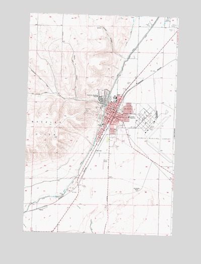
Ephrata, WA USGS Topographic Map
Click on map above to begin viewing in our Map Viewer.

This topographic map contains these locations and features:
Feature Name Type Latitude Longitude GNIS ID View Map
Beasley Springs Elementary SchoolSchoolN47.3262°W119.5495°1515047View Map
City of EphrataCivilN47.3119°W119.5343°2410450View Map
Columbia Basin HospitalHospitalN47.3145°W119.5469°1514524View Map
Columbia Basin Hospital HeliportAirportN47.3143°W119.5475°1533760View Map
Columbia Ridge Elementary SchoolSchoolN47.3173°W119.5391°1533437View Map
Davis CanyonValleyN47.3274°W119.5831°1504335View Map
Drumheller RanchLocaleN47.2754°W119.5292°1504545View Map
EphrataPopulated PlaceN47.3176°W119.5536°1512192View Map
Ephrata Army Air Field (historical)MilitaryN47.3094°W119.5167°2091968View Map
Ephrata Fire DepartmentBuildingN47.3126°W119.5540°2619446View Map
Ephrata Heights ParkParkN47.3185°W119.5389°1514446View Map
Ephrata High SchoolSchoolN47.3259°W119.5517°1514170View Map
Ephrata Middle SchoolSchoolN47.3142°W119.5499°1514171View Map
Ephrata Municipal AirportAirportN47.3115°W119.5198°1533758View Map
Ephrata Police DepartmentBuildingN47.3190°W119.5513°2722049View Map
Ephrata Post OfficePost OfficeN47.3215°W119.5496°2781633View Map
Ephrata SubstationLocaleN47.2818°W119.5545°1533113View Map
Ephrata-Soap Lake DivisionCivilN47.2625°W119.5553°1939505View Map
Grandview Elementary SchoolSchoolN47.3285°W119.5659°1533448View Map
Grant County CourthouseBuildingN47.3221°W119.5536°1514199View Map
Grant County Fire District 13BuildingN47.3079°W119.5570°2643563View Map
Grant County Fire District 5 Station 14BuildingN47.3130°W119.5276°2643534View Map
Grant County Sheriff's OfficeBuildingN47.3218°W119.5534°2722007View Map
Grant Elementary SchoolSchoolN47.3256°W119.5542°1514198View Map
Hunter CanyonValleyN47.3521°W119.5467°1505672View Map
KULE-AM (Ephrata)TowerN47.3151°W119.5659°1534250View Map
KULE-FM (Ephrata)TowerN47.3204°W119.5737°1534346View Map
LakeviewPopulated PlaceN47.3740°W119.5023°1852947View Map
Lakeview Country ClubLocaleN47.3738°W119.5100°1533153View Map
Maplewood Handicapped SchoolSchoolN47.3162°W119.5511°1514285View Map
NaylorPopulated PlaceN47.2626°W119.6137°1511534View Map
New Life Christian SchoolSchoolN47.3192°W119.5382°1515048View Map
Oasis ParkParkN47.2840°W119.5795°1514325View Map
Olson SpurLocaleN47.2971°W119.5664°1507178View Map
Parkway ParkParkN47.3110°W119.5442°1514342View Map
Parkway SchoolSchoolN47.3125°W119.5611°1533470View Map
Saint Rose of Lima Catholic SchoolSchoolN47.3099°W119.5403°1514485View Map
The Pot HoleBasinN47.2537°W119.5749°1512881View Map

Note: Coordinates in the location and feature list above are referenced to NAD83 datum.


Copyright (C) 2008-2024 Ryan Niemi / Sunset Dynamics ... All Rights Reserved