TopoQuest Logo
Do you find TopoQuest useful?
Help keep TopoQuest running and adding new maps/features by donating!
Bitcoin:  19c7KJd3qBynnjoSw5npx9KScwjBe4ifkT
Litecoin:  LXs6TkuXGGXo1vDsWCkWVdjQX94eUKd6ui
Home View Maps Find Maps Find Places Resources & Links


Enterprise, Louisiana Topographic Map

USGS Map Title: Enterprise, LA
USGS Map MRC: 31091H8
DRG (GeoTIFF) Download: o31091h8.tif


Neighboring USGS Topographic Map Quads:


  Columbia, LA  
32092A1
 

  Mason, LA  
32091A8
 

  Fort Necessity, LA  
32091A7
 

  Holum, LA  
31092H1
 

  Enterprise, LA  
31091H8
 

  Extension, LA  
31091H7
 

  Nickel, LA  
31092G1
 

  Aimwell, LA  
31091G8
 

  Harrisonburg, LA  
31091G7


Map MRC Location:

N32°
W92°
N32°
W91°
H8 H7 H6 H5 H4 H3 H2 H1
G8 G7 G6 G5 G4 G3 G2 G1
F8 F7 F6 F5 F4 F3 F2 F1
E8 E7 E6 E5 E4 E3 E2 E1
D8 D7 D6 D5 D4 D3 D2 D1
C8 C7 C6 C5 C4 C3 C2 C1
B8 B7 B6 B5 B4 B3 B2 B1
A8 A7 A6 A5 A4 A3 A2 A1
N31°
W92°
N31°
W91°

Enterprise, LA USGS 1:24K Topographic Map Preview:
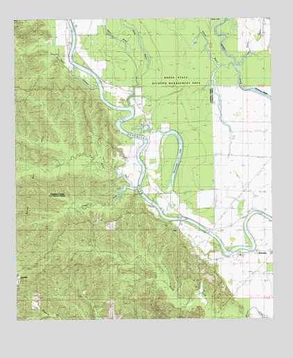
Enterprise, LA USGS Topographic Map
Click on map above to begin viewing in our Map Viewer.

This topographic map contains these locations and features:
Feature Name Type Latitude Longitude GNIS ID View Map
Bayou CalamusStreamN31.9718°W91.9593°532478View Map
Bayou DanStreamN31.9299°W91.9407°532556View Map
Bayou Dan HillsSummitN31.9346°W91.9957°542963View Map
Bayou WadeStreamN31.9638°W91.9440°541613View Map
Big Grassy BayouStreamN31.9807°W91.8921°533072View Map
Blythe CemeteryCemeteryN31.9268°W91.9415°533246View Map
Catahoula CemeteryCemeteryN31.8757°W91.9204°546006View Map
Catahoula ChurchChurchN31.8754°W91.9204°553924View Map
Cottingham LandingLocaleN31.9502°W91.9357°546294View Map
Cottonwood LandingLocaleN31.9404°W91.9404°546295View Map
DutyPopulated PlaceN31.9152°W91.9240°541088View Map
EnterprisePopulated PlaceN31.9032°W91.8832°541090View Map
Enterprise High SchoolSchoolN31.9016°W91.8910°546013View Map
Enterprise Post OfficePost OfficeN31.9024°W91.8896°1630405View Map
Enterprise Volunteer Fire DepartmentBuildingN31.9020°W91.8900°2673048View Map
Fife CemeteryCemeteryN31.9979°W91.9993°554401View Map
Grassy BayouStreamN31.9807°W91.8932°535358View Map
Horseshoe LakeLakeN31.9425°W91.9207°554774View Map
Lively CemeteryCemeteryN31.9424°W91.9460°536639View Map
Lively LakeLakeN31.9981°W91.9048°541614View Map
Lower Coles LandingLocaleN31.9982°W91.9718°546324View Map
McSween CemeteryCemeteryN31.9888°W91.9701°537020View Map
McSween LandingLocaleN31.9993°W91.9710°546327View Map
Myatt LandingLocaleN31.9690°W91.9585°546330View Map
Neathery Woodyard (historical)LocaleN31.9557°W91.9507°546331View Map
Pierce LandingLocaleN31.9613°W91.9418°546337View Map
Rocky HillSummitN31.8777°W91.9307°546049View Map
RosefieldPopulated PlaceN31.8910°W91.9987°541181View Map
Rosefield CemeteryCemeteryN31.8915°W91.9987°546050View Map
S B Harrelson Pond DamDamN31.9552°W91.9368°556833View Map
Sandy BayouLakeN31.9964°W91.9436°539149View Map
Sandy Bayou Baptist ChurchChurchN31.9679°W91.9421°555972View Map
South Fork Bayou DanStreamN31.9299°W91.9443°539493View Map
Sphinx LandingLocaleN31.9832°W91.9735°558366View Map
Upper Danville LandingLocaleN31.9296°W91.9390°546348View Map
Wyant CemeteryCemeteryN31.9621°W91.9512°540549View Map

Note: Coordinates in the location and feature list above are referenced to NAD83 datum.


Copyright (C) 2008-2024 Ryan Niemi / Sunset Dynamics ... All Rights Reserved