TopoQuest Logo
Do you find TopoQuest useful?
Help keep TopoQuest running and adding new maps/features by donating!
Bitcoin:  19c7KJd3qBynnjoSw5npx9KScwjBe4ifkT
Litecoin:  LXs6TkuXGGXo1vDsWCkWVdjQX94eUKd6ui
Home View Maps Find Maps Find Places Resources & Links


Elwood NW, Nebraska Topographic Map

USGS Map Title: Elwood NW, NE
USGS Map MRC: 40099F8
DRG (GeoTIFF) Download: o40099f8.tif


Neighboring USGS Topographic Map Quads:


  Gothenburg SE, NE  
40100G1
 

  Cozad, NE  
40099G8
 

  Lexington West, NE  
40099G7
 

  Eustis, NE  
40100F1
 

  Elwood NW, NE  
40099F8
 

  Johnson Lake, NE  
40099F7
 

  Eustis SE, NE  
40100E1
 

  Elwood SW, NE  
40099E8
 

  Elwood, NE  
40099E7


Map MRC Location:

N41°
W100°
N41°
W99°
H8 H7 H6 H5 H4 H3 H2 H1
G8 G7 G6 G5 G4 G3 G2 G1
F8 F7 F6 F5 F4 F3 F2 F1
E8 E7 E6 E5 E4 E3 E2 E1
D8 D7 D6 D5 D4 D3 D2 D1
C8 C7 C6 C5 C4 C3 C2 C1
B8 B7 B6 B5 B4 B3 B2 B1
A8 A7 A6 A5 A4 A3 A2 A1
N40°
W100°
N40°
W99°

Elwood NW, NE USGS 1:24K Topographic Map Preview:
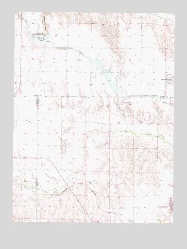
Elwood NW, NE USGS Topographic Map
Click on map above to begin viewing in our Map Viewer.

This topographic map contains these locations and features:
Feature Name Type Latitude Longitude GNIS ID View Map
Bellamy DamDamN40.6483°W99.9204°1769286View Map
Bellamy ReservoirReservoirN40.6472°W99.9197°1769287View Map
Brace Election PrecinctCivilN40.6560°W99.9251°1928747View Map
Earth Dam Canal Mile 605DamN40.7033°W99.9237°1768741View Map
Earth Dam-Canal Mile 567 DamDamN40.7400°W99.9837°1768742View Map
Earth Dam-Canal Mile 608 DamDamN40.7017°W99.9187°1768740View Map
Franta DamDamN40.6350°W99.9371°1769616View Map
Franta ReservoirReservoirN40.6350°W99.9371°1769617View Map
Gallagher Canyon State Recreation AreaParkN40.7356°W99.9793°829444View Map
Keller DamDamN40.6717°W99.9571°1768183View Map
Keller ReservoirReservoirN40.6717°W99.9577°1768184View Map
Plum Creek CanyonValleyN40.6795°W99.9113°832281View Map
Plum Creek State Recreation AreaParkN40.6972°W99.9115°1874025View Map
Schilling Dam Number 1DamN40.6833°W99.9221°1768191View Map
Schilling Dam Number 2DamN40.6850°W99.9004°1768193View Map
Schilling Reservoir Number 1ReservoirN40.6842°W99.9228°1768192View Map
Schilling Reservoir Number 2ReservoirN40.6848°W99.9010°1768194View Map
Township of BraceCivilN40.6528°W99.9171°1874062View Map

Note: Coordinates in the location and feature list above are referenced to NAD83 datum.


Copyright (C) 2008-2024 Ryan Niemi / Sunset Dynamics ... All Rights Reserved