TopoQuest Logo
Do you find TopoQuest useful?
Help keep TopoQuest running and adding new maps/features by donating!
Bitcoin:  19c7KJd3qBynnjoSw5npx9KScwjBe4ifkT
Litecoin:  LXs6TkuXGGXo1vDsWCkWVdjQX94eUKd6ui
Home View Maps Find Maps Find Places Resources & Links


Elton, Montana Topographic Map

USGS Map Title: Elton, MT
USGS Map MRC: 45110F3
DRG (GeoTIFF) Download: o45110f3.tif


Neighboring USGS Topographic Map Quads:


  Grannis, MT  
45110G4
 

  Hunters Hot Springs, MT  
45110G3
 

  Kelly Hills, MT  
45110G2
 

  Mission, MT  
45110F4
 

  Elton, MT  
45110F3
 

  Springdale, MT  
45110F2
 

  Livingston Peak, MT  
45110E4
 

  Mount Rae, MT  
45110E3
 

  McLeod Basin, MT  
45110E2


Map MRC Location:

N46°
W111°
N46°
W110°
H8 H7 H6 H5 H4 H3 H2 H1
G8 G7 G6 G5 G4 G3 G2 G1
F8 F7 F6 F5 F4 F3 F2 F1
E8 E7 E6 E5 E4 E3 E2 E1
D8 D7 D6 D5 D4 D3 D2 D1
C8 C7 C6 C5 C4 C3 C2 C1
B8 B7 B6 B5 B4 B3 B2 B1
A8 A7 A6 A5 A4 A3 A2 A1
N45°
W111°
N45°
W110°

Elton, MT USGS 1:24K Topographic Map Preview:
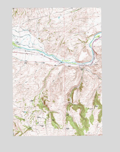
Elton, MT USGS Topographic Map
Click on map above to begin viewing in our Map Viewer.

This topographic map contains these locations and features:
Feature Name Type Latitude Longitude GNIS ID View Map
01S11E27C___01 WellWellN45.7155°W110.3599°811360View Map
Alkire HomesteadLocaleN45.6452°W110.2969°768201View Map
Big Mission DitchCanalN45.7016°W110.3708°768807View Map
Cady CouleeValleyN45.6933°W110.3016°769492View Map
Cady Post Office (historical)Post OfficeN45.6958°W110.3080°1743199View Map
Clay RanchLocaleN45.6930°W110.3149°769914View Map
Dalzeil HomesteadLocaleN45.6402°W110.3216°770433View Map
East Fork Peterson CreekStreamN45.6749°W110.2507°771062View Map
EltonPopulated PlaceN45.6958°W110.3080°771213View Map
Elton School (historical)SchoolN45.6958°W110.3080°1743238View Map
Fitzpatrick LakeLakeN45.6485°W110.3584°771406View Map
Francis RanchLocaleN45.6955°W110.3338°771602View Map
Frelick HomesteadLocaleN45.6508°W110.2627°771628View Map
Gate LakeLakeN45.6381°W110.3422°771730View Map
Greeley CreekStreamN45.6899°W110.2771°771960View Map
Interchange 350CrossingN45.7027°W110.2591°1743084View Map
John M Bozeman Historical Marker (historical)ParkN45.6944°W110.2952°1743211View Map
L M LodgeLocaleN45.6933°W110.2816°773157View Map
Larkin RanchLocaleN45.6416°W110.3599°773230View Map
Locke CreekStreamN45.6966°W110.3041°773524View Map
Locke Creek School (historical)SchoolN45.6352°W110.3330°773525View Map
Lower Windsor DitchCanalN45.7141°W110.3616°773745View Map
McAdows CanyonValleyN45.7119°W110.2655°773958View Map
Mesoydez HomesteadLocaleN45.6535°W110.2616°774115View Map
Oregon ValleyValleyN45.6513°W110.3655°774980View Map
Peterson CreekStreamN45.6522°W110.2507°775173View Map
Peterson RanchLocaleN45.6902°W110.2783°775177View Map
Swanson RanchLocaleN45.6930°W110.2980°777353View Map
Teichert HomesteadLocaleN45.6427°W110.3416°777446View Map
Tenland HomesteadLocaleN45.6330°W110.3499°777460View Map
Troutman HomesteadLocaleN45.6313°W110.3016°777783View Map
Upper Windsor DitchCanalN45.7285°W110.3719°777949View Map
Wilburn RanchLocaleN45.6966°W110.3588°778459View Map
Wilcox HomesteadLocaleN45.6583°W110.3483°778461View Map
Windsor RanchLocaleN45.7163°W110.3702°778588View Map
Woods PlacePopulated PlaceN45.6941°W110.2613°778684View Map
Work CreekStreamN45.7044°W110.3296°778697View Map

Note: Coordinates in the location and feature list above are referenced to NAD83 datum.


Copyright (C) 2008-2024 Ryan Niemi / Sunset Dynamics ... All Rights Reserved