TopoQuest Logo
Do you find TopoQuest useful?
Help keep TopoQuest running and adding new maps/features by donating!
Bitcoin:  19c7KJd3qBynnjoSw5npx9KScwjBe4ifkT
Litecoin:  LXs6TkuXGGXo1vDsWCkWVdjQX94eUKd6ui
Home View Maps Find Maps Find Places Resources & Links


Elm Creek East, Nebraska Topographic Map

USGS Map Title: Elm Creek East, NE
USGS Map MRC: 40099F3
DRG (GeoTIFF) Download: o40099f3.tif


Neighboring USGS Topographic Map Quads:


  Miller SW, NE  
40099G4
 

  Amherst, NE  
40099G3
 

  Riverdale, NE  
40099G2
 

  Elm Creek West, NE  
40099F4
 

  Elm Creek East, NE  
40099F3
 

  Alfalfa Center, NE  
40099F2
 

  Elm Creek SW, NE  
40099E4
 

  Elm Creek SE, NE  
40099E3
 

  Kearney SW, NE  
40099E2


Map MRC Location:

N41°
W100°
N41°
W99°
H8 H7 H6 H5 H4 H3 H2 H1
G8 G7 G6 G5 G4 G3 G2 G1
F8 F7 F6 F5 F4 F3 F2 F1
E8 E7 E6 E5 E4 E3 E2 E1
D8 D7 D6 D5 D4 D3 D2 D1
C8 C7 C6 C5 C4 C3 C2 C1
B8 B7 B6 B5 B4 B3 B2 B1
A8 A7 A6 A5 A4 A3 A2 A1
N40°
W100°
N40°
W99°

Elm Creek East, NE USGS 1:24K Topographic Map Preview:
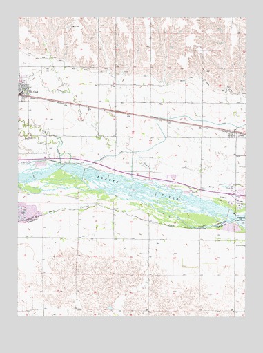
Elm Creek East, NE USGS Topographic Map
Click on map above to begin viewing in our Map Viewer.

This topographic map contains these locations and features:
Feature Name Type Latitude Longitude GNIS ID View Map
Blue Hole East LakeReservoirN40.6882°W99.3628°1875136View Map
Blue Hole State Wildlife Management AreaParkN40.6881°W99.3670°1875142View Map
Buffalo CreekStreamN40.6964°W99.3532°827749View Map
Election Precinct 25CivilN40.7273°W99.3670°2784120View Map
Elm CreekPopulated PlaceN40.7195°W99.3720°829073View Map
Elm CreekStreamN40.6883°W99.3518°829076View Map
Elm CreekLocaleN40.7195°W99.3720°1875343View Map
Elm Creek Historical MarkerParkN40.7195°W99.3720°1875345View Map
Elm Creek Post OfficePost OfficeN40.7176°W99.3730°1875346View Map
Elm Creek Public LibraryBuildingN40.7195°W99.3720°1875344View Map
Elm Creek Public SchoolsSchoolN40.7197°W99.3712°1875348View Map
Immaculate Conception Catholic ChurchChurchN40.7195°W99.3720°1875342View Map
Interchange 263CrossingN40.6761°W99.2556°1875373View Map
Kearney Diversion DamDamN40.6872°W99.3515°1769416View Map
Kearney Diversion Dam ReservoirReservoirN40.6883°W99.3504°1769417View Map
Lakeside RV ParkLocaleN40.6792°W99.2509°1875158View Map
OdessaPopulated PlaceN40.7017°W99.2568°835396View Map
OdessaLocaleN40.7022°W99.2573°1875318View Map
Odessa Census Designated PlaceCensusN40.6991°W99.2544°2587010View Map
Odessa Post OfficePost OfficeN40.7017°W99.2568°1875317View Map
Odessa Public SchoolSchoolN40.7031°W99.2562°1875319View Map
Sandy Channel State Recreation AreaParkN40.6667°W99.3712°1875143View Map
South Channel Platte RiverStreamN40.6647°W99.2607°833569View Map
Township of CottonwoodCivilN40.6492°W99.2893°837943View Map
Township of Elm Creek (historical)CivilN40.7273°W99.3670°837988View Map
Township of Odessa (historical)CivilN40.7252°W99.2537°838172View Map
Union Pacific CampgroundLocaleN40.6792°W99.2509°1875157View Map
Union Pacific State Recreation AreaParkN40.6778°W99.2515°1875156View Map

Note: Coordinates in the location and feature list above are referenced to NAD83 datum.


Copyright (C) 2008-2024 Ryan Niemi / Sunset Dynamics ... All Rights Reserved