TopoQuest Logo
Do you find TopoQuest useful?
Help keep TopoQuest running and adding new maps/features by donating!
Bitcoin:  19c7KJd3qBynnjoSw5npx9KScwjBe4ifkT
Litecoin:  LXs6TkuXGGXo1vDsWCkWVdjQX94eUKd6ui
Home View Maps Find Maps Find Places Resources & Links


Ellison Bay, Wisconsin Topographic Map

USGS Map Title: Ellison Bay, WI
USGS Map MRC: 45087C1
DRG (GeoTIFF) Download: o45087c1.tif


Neighboring USGS Topographic Map Quads:


  Washington Island NW, WI  
45086D8


  Ellison Bay, WI  
45087C1
 

  Washington Island SW, WI  
45086C8
 

  Ephraim, WI  
45087B2
 

  Sister Bay, WI  
45087B1
 

  Spider Island, WI  
45086B8


Map MRC Location:

N46°
W88°
N46°
W87°
H8 H7 H6 H5 H4 H3 H2 H1
G8 G7 G6 G5 G4 G3 G2 G1
F8 F7 F6 F5 F4 F3 F2 F1
E8 E7 E6 E5 E4 E3 E2 E1
D8 D7 D6 D5 D4 D3 D2 D1
C8 C7 C6 C5 C4 C3 C2 C1
B8 B7 B6 B5 B4 B3 B2 B1
A8 A7 A6 A5 A4 A3 A2 A1
N45°
W88°
N45°
W87°

Ellison Bay, WI USGS 1:24K Topographic Map Preview:
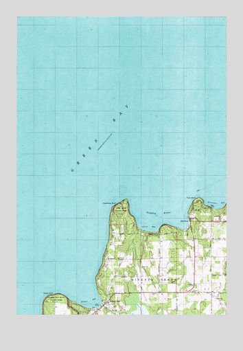
Ellison Bay, WI USGS Topographic Map
Click on map above to begin viewing in our Map Viewer.

This topographic map contains these locations and features:
Feature Name Type Latitude Longitude GNIS ID View Map
Bethel ChurchChurchN45.2594°W87.0218°1561643View Map
Cedar Grove ResortLocaleN45.2550°W87.0734°1577933View Map
Cedar Grove ResortLocaleN45.2550°W87.0734°1581397View Map
Deathdoor BluffCliffN45.2964°W87.0654°1581150View Map
Door Bluff County ParkParkN45.2942°W87.0623°1577937View Map
Ellison BayBayN45.2555°W87.0812°1564543View Map
Ellison BayPopulated PlaceN45.2547°W87.0715°1564544View Map
Ellison Bay Bluff County ParkParkN45.2555°W87.1087°1577478View Map
Ellison Bay Census Designated PlaceCensusN45.2553°W87.0729°2586484View Map
Ellison Bay Post OfficePost OfficeN45.2569°W87.0717°2711345View Map
Ellison BluffCliffN45.2589°W87.1023°1564545View Map
Ellison Bluff State Natural AreaParkN45.2550°W87.1064°2085421View Map
Garret BayBayN45.2864°W87.0465°1565426View Map
Gills RockPopulated PlaceN45.2900°W87.0218°1565532View Map
Hedgehog HarborBayN45.2928°W87.0365°1566260View Map
Sister Bay Liberty Grove Fire Department North StationBuildingN45.2584°W87.0640°2697674View Map
Table BluffCliffN45.2992°W87.0165°1575213View Map
Wisconsin BayBayN45.2969°W87.0065°1576898View Map

Note: Coordinates in the location and feature list above are referenced to NAD83 datum.


Copyright (C) 2008-2024 Ryan Niemi / Sunset Dynamics ... All Rights Reserved