TopoQuest Logo
Do you find TopoQuest useful?
Help keep TopoQuest running and adding new maps/features by donating!
Bitcoin:  19c7KJd3qBynnjoSw5npx9KScwjBe4ifkT
Litecoin:  LXs6TkuXGGXo1vDsWCkWVdjQX94eUKd6ui
Home View Maps Find Maps Find Places Resources & Links


Elliotts Creek, Virginia Topographic Map

USGS Map Title: Elliotts Creek, VA
USGS Map MRC: 37076B1
DRG (GeoTIFF) Download: o37076b1.tif


Neighboring USGS Topographic Map Quads:


  East of New Point Comfort, VA  
37076C2
 

  Cape Charles, VA  
37076C1
 

  Cheriton, VA  
37075C8
 

  East of Poquoson East, VA  
37076B2
 

  Elliotts Creek, VA  
37076B1
 

  Townsend, VA  
37075B8
 

  East of Hampton, VA  
37076A2
 

  Chesapeake Channel, VA  
37076A1
 

  Fishermans Island, VA  
37075A8


Map MRC Location:

N38°
W77°
N38°
W76°
H8 H7 H6 H5 H4 H3 H2 H1
G8 G7 G6 G5 G4 G3 G2 G1
F8 F7 F6 F5 F4 F3 F2 F1
E8 E7 E6 E5 E4 E3 E2 E1
D8 D7 D6 D5 D4 D3 D2 D1
C8 C7 C6 C5 C4 C3 C2 C1
B8 B7 B6 B5 B4 B3 B2 B1
A8 A7 A6 A5 A4 A3 A2 A1
N37°
W77°
N37°
W76°

Elliotts Creek, VA USGS 1:24K Topographic Map Preview:
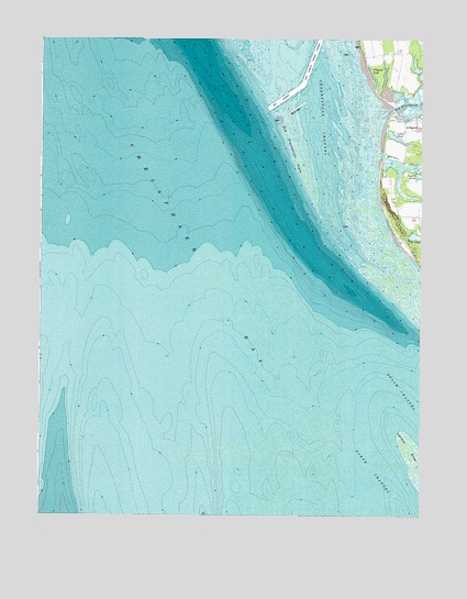
Elliotts Creek, VA USGS Topographic Map
Click on map above to begin viewing in our Map Viewer.

This topographic map contains these locations and features:
Feature Name Type Latitude Longitude GNIS ID View Map
Allegood PondReservoirN37.2402°W76.0159°1462401View Map
ArlingtonPopulated PlaceN37.2265°W76.0013°1494175View Map
Bar ChannelChannelN37.2349°W76.0447°1480210View Map
Bay RidgePopulated PlaceN37.2113°W76.0102°1739161View Map
Cherrystone ChannelChannelN37.2421°W76.0335°1464788View Map
Costin PondReservoirN37.2241°W76.0084°1465274View Map
Dixon and Parson DamDamN37.2149°W76.0019°1490464View Map
Dixon and Parson PondReservoirN37.2165°W76.0021°1490465View Map
Earth AirportAirportN37.2216°W76.0087°2675650View Map
Elliotts CreekStreamN37.2188°W76.0141°1502789View Map
Little Annemessex RiverLakeN37.2402°W76.0159°585433View Map
Old Plantation CreekStreamN37.2321°W76.0105°1471862View Map
Old Plantation FlatsFlatN37.2207°W76.0413°1471863View Map
Pond DrainStreamN37.1965°W76.0077°1472594View Map
Tomb of CustinCemeteryN37.2290°W76.0035°1475769View Map
Virginias Chesapeake ShoresPopulated PlaceN37.2279°W76.0099°1739261View Map

Note: Coordinates in the location and feature list above are referenced to NAD83 datum.


Copyright (C) 2008-2024 Ryan Niemi / Sunset Dynamics ... All Rights Reserved