TopoQuest Logo
Do you find TopoQuest useful?
Help keep TopoQuest running and adding new maps/features by donating!
Bitcoin:  19c7KJd3qBynnjoSw5npx9KScwjBe4ifkT
Litecoin:  LXs6TkuXGGXo1vDsWCkWVdjQX94eUKd6ui
Home View Maps Find Maps Find Places Resources & Links


Ellenburg Center, New York Topographic Map

USGS Map Title: Ellenburg Center, NY
USGS Map MRC: 44073G8
DRG (GeoTIFF) Download: o44073g8.tif


Neighboring USGS Topographic Map Quads:


  Chateaugay, NY  
44074H1
 

  Churubusco, NY  
44073H8
 

  Ellenburg Depot, NY  
44073H7
 

  Brainardsville, NY  
44074G1
 

  Ellenburg Center, NY  
44073G8
 

  Ellenburg Mountain, NY  
44073G7
 

  Ragged Lake, NY  
44074F1
 

  Lyon Mountain, NY  
44073F8
 

  Moffitsville, NY  
44073F7


Map MRC Location:

N45°
W74°
N45°
W73°
H8 H7 H6 H5 H4 H3 H2 H1
G8 G7 G6 G5 G4 G3 G2 G1
F8 F7 F6 F5 F4 F3 F2 F1
E8 E7 E6 E5 E4 E3 E2 E1
D8 D7 D6 D5 D4 D3 D2 D1
C8 C7 C6 C5 C4 C3 C2 C1
B8 B7 B6 B5 B4 B3 B2 B1
A8 A7 A6 A5 A4 A3 A2 A1
N44°
W74°
N44°
W73°

Ellenburg Center, NY USGS 1:24K Topographic Map Preview:
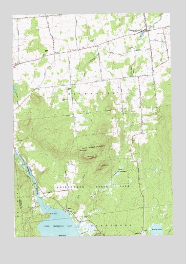
Ellenburg Center, NY USGS Topographic Map
Click on map above to begin viewing in our Map Viewer.

This topographic map contains these locations and features:
Feature Name Type Latitude Longitude GNIS ID View Map
Barrow School (historical)SchoolN44.7779°W73.9799°2463382View Map
Bell School (historical)SchoolN44.8375°W73.9292°2463378View Map
Bluff PointCapeN44.7620°W73.9729°944357View Map
Bradley PondLakeN44.7531°W73.8877°944585View Map
Chateaugay NarrowsChannelN44.7839°W73.9860°946445View Map
Cobble HillSummitN44.7898°W73.9307°946966View Map
Ellenburg CenterPopulated PlaceN44.8648°W73.8971°949505View Map
Ellenburg Center Fire DepartmentBuildingN44.8644°W73.8930°2718590View Map
Gregory School (historical)SchoolN44.8055°W73.9061°2463381View Map
Hammond School (historical)SchoolN44.8521°W73.8775°2463380View Map
HarriganPopulated PlaceN44.8525°W73.9665°972600View Map
Hazeltine HillSummitN44.8275°W73.9618°952470View Map
Hogan School (historical)SchoolN44.8643°W73.9957°2463376View Map
Hutchins CemeteryCemeteryN44.8635°W73.8804°953540View Map
MerrillPopulated PlaceN44.7648°W73.9582°957002View Map
Moffitt IslandIslandN44.7503°W73.9657°957467View Map
Ouleout CreekStreamN44.7600°W73.9465°959587View Map
Panther HillSummitN44.7950°W73.9432°959815View Map
Separator BrookStreamN44.7514°W73.9490°970595View Map
Spruce HillSummitN44.7975°W73.9499°966123View Map
StarLocaleN44.8737°W73.9729°966239View Map
Star Road CemeteryCemeteryN44.8742°W73.9659°966243View Map
Steam Mill School (historical)SchoolN44.8398°W73.9004°2463379View Map
Town of EllenburgCivilN44.8393°W73.8846°978931View Map
Weed BrookStreamN44.7631°W73.9557°969002View Map
West HillSummitN44.8542°W73.9757°969260View Map
West Hill CemeteryCemeteryN44.8544°W73.9521°969265View Map
West Hill School (historical)SchoolN44.8543°W73.9529°2463377View Map

Note: Coordinates in the location and feature list above are referenced to NAD83 datum.


Copyright (C) 2008-2024 Ryan Niemi / Sunset Dynamics ... All Rights Reserved