TopoQuest Logo
Do you find TopoQuest useful?
Help keep TopoQuest running and adding new maps/features by donating!
Bitcoin:  19c7KJd3qBynnjoSw5npx9KScwjBe4ifkT
Litecoin:  LXs6TkuXGGXo1vDsWCkWVdjQX94eUKd6ui
Home View Maps Find Maps Find Places Resources & Links


Argyle, Missouri Topographic Map

USGS Map Title: Argyle, MO
USGS Map MRC: 38092C1
DRG (GeoTIFF) Download: o38092c1.tif


Neighboring USGS Topographic Map Quads:


  Wardsville, MO  
38092D2
 

  Westphalia West, MO  
38092D1
 

  Westphalia East, MO  
38091D8
 

  Meta, MO  
38092C2
 

  Argyle, MO  
38092C1
 

  Freeburg, MO  
38091C8
 

  Van Cleve, MO  
38092B2
 

  Brinktown, MO  
38092B1
 

  Vienna, MO  
38091B8


Map MRC Location:

N39°
W93°
N39°
W92°
H8 H7 H6 H5 H4 H3 H2 H1
G8 G7 G6 G5 G4 G3 G2 G1
F8 F7 F6 F5 F4 F3 F2 F1
E8 E7 E6 E5 E4 E3 E2 E1
D8 D7 D6 D5 D4 D3 D2 D1
C8 C7 C6 C5 C4 C3 C2 C1
B8 B7 B6 B5 B4 B3 B2 B1
A8 A7 A6 A5 A4 A3 A2 A1
N38°
W93°
N38°
W92°

Argyle, MO USGS 1:24K Topographic Map Preview:
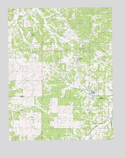
Argyle, MO USGS Topographic Map
Click on map above to begin viewing in our Map Viewer.

This topographic map contains these locations and features:
Feature Name Type Latitude Longitude GNIS ID View Map
ArgylePopulated PlaceN38.2945°W92.0238°729274View Map
Argyle LakeReservoirN38.3093°W92.0421°758405View Map
Argyle Lake DamDamN38.3084°W92.0435°763619View Map
Argyle Volunteer Fire DepartmentBuildingN38.2952°W92.0256°2621505View Map
JGF Farms DamDamN38.3517°W92.0518°765316View Map
JGF Farms LakeReservoirN38.3519°W92.0514°765317View Map
KoeltztownPopulated PlaceN38.3248°W92.0421°720683View Map
Little Maries RiverStreamN38.2700°W92.0016°721267View Map
Massman SchoolSchoolN38.3736°W92.1088°729338View Map
Saint Aloysius Catholic ChurchChurchN38.2943°W92.0231°743710View Map
Saint Aloysius CemeteryCemeteryN38.2969°W92.0223°2702592View Map
Town of ArgyleCivilN38.2954°W92.0255°2397437View Map
Township of JacksonCivilN38.3721°W92.0990°767119View Map
Tunnel Number 2TunnelN38.3137°W92.0810°755433View Map
Victory School (historical)SchoolN38.2737°W92.1196°728195View Map
Willibrand LakeReservoirN38.3634°W92.0335°763666View Map
Willibrand Lake DamDamN38.3634°W92.0335°763665View Map

Note: Coordinates in the location and feature list above are referenced to NAD83 datum.


Copyright (C) 2008-2024 Ryan Niemi / Sunset Dynamics ... All Rights Reserved