TopoQuest Logo
Do you find TopoQuest useful?
Help keep TopoQuest running and adding new maps/features by donating!
Bitcoin:  19c7KJd3qBynnjoSw5npx9KScwjBe4ifkT
Litecoin:  LXs6TkuXGGXo1vDsWCkWVdjQX94eUKd6ui
Home View Maps Find Maps Find Places Resources & Links


Elk Point, South Dakota Topographic Map

USGS Map Title: Elk Point, SD
USGS Map MRC: 42096F6
DRG (GeoTIFF) Download: o42096f6.tif


Neighboring USGS Topographic Map Quads:


  Vermillion SE, SD  
42096G7
 

  Richland, SD  
42096G6
 

  Akron, IA  
42096G5
 

  Burbank, SD  
42096F7
 

  Elk Point, SD  
42096F6
 

  Elk Point NE, IA  
42096F5
 

  Martinsburg, NE  
42096E7
 

  Ponca, NE  
42096E6
 

  Jefferson, SD  
42096E5


Map MRC Location:

N43°
W97°
N43°
W96°
H8 H7 H6 H5 H4 H3 H2 H1
G8 G7 G6 G5 G4 G3 G2 G1
F8 F7 F6 F5 F4 F3 F2 F1
E8 E7 E6 E5 E4 E3 E2 E1
D8 D7 D6 D5 D4 D3 D2 D1
C8 C7 C6 C5 C4 C3 C2 C1
B8 B7 B6 B5 B4 B3 B2 B1
A8 A7 A6 A5 A4 A3 A2 A1
N42°
W97°
N42°
W96°

Elk Point, SD USGS 1:24K Topographic Map Preview:
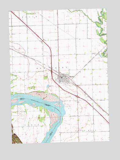
Elk Point, SD USGS Topographic Map
Click on map above to begin viewing in our Map Viewer.

This topographic map contains these locations and features:
Feature Name Type Latitude Longitude GNIS ID View Map
Brule CreekStreamN42.7372°W96.6395°1254089View Map
City of Elk PointCivilN42.6817°W96.6801°1267378View Map
Curry SchoolSchoolN42.6342°W96.6459°1254579View Map
Elk PointPopulated PlaceN42.6833°W96.6836°1254905View Map
Elk Point CemeteryCemeteryN42.6797°W96.6791°2779396View Map
Elk Point Community AmbulanceBuildingN42.6854°W96.6836°2658937View Map
Elk Point Community LibraryBuildingN42.6826°W96.6880°2723469View Map
Elk Point Fire DepartmentBuildingN42.6871°W96.6876°2580662View Map
Elk Point Police DepartmentBuildingN42.6874°W96.6841°2755513View Map
Elk Point Post OfficePost OfficeN42.6869°W96.6856°2709844View Map
Elk Point-Jefferson Elementary SchoolSchoolN42.6819°W96.6889°2728686View Map
Elk Point-Jefferson High SchoolSchoolN42.6827°W96.6882°2728687View Map
Elk Point-Jefferson Middle SchoolSchoolN42.6827°W96.6882°2728688View Map
Government SloughStreamN42.6875°W96.7253°1255306View Map
Interchange 15CrossingN42.6677°W96.6652°2725645View Map
Interchange 18CrossingN42.6910°W96.6975°2725646View Map
Kline SchoolSchoolN42.7219°W96.6884°1255954View Map
MJ Aviation II AirportAirportN42.6840°W96.6991°2444011View Map
Plainview SchoolSchoolN42.7283°W96.7473°1257080View Map
Pleasant View SchoolSchoolN42.6636°W96.6361°1257139View Map
Ryan SchoolSchoolN42.7081°W96.6450°1257530View Map
Saint Joseph CemeteryCemeteryN42.6798°W96.6810°1257634View Map
South Dakota Highway Patrol - Jefferson Port of EntryBuildingN42.6469°W96.6307°2755636View Map
Township of Elk PointCivilN42.6924°W96.6909°1269006View Map
Union County CourthouseBuildingN42.6857°W96.6829°2722906View Map
Union County Historical Society MuseumBuildingN42.6856°W96.6840°2729348View Map
Union County JailBuildingN42.6858°W96.6826°2755660View Map
Union County SheriffBuildingN42.6858°W96.6829°2755531View Map
Woodland SchoolSchoolN42.6306°W96.7470°834866View Map

Note: Coordinates in the location and feature list above are referenced to NAD83 datum.


Copyright (C) 2008-2024 Ryan Niemi / Sunset Dynamics ... All Rights Reserved