TopoQuest Logo
Do you find TopoQuest useful?
Help keep TopoQuest running and adding new maps/features by donating!
Bitcoin:  19c7KJd3qBynnjoSw5npx9KScwjBe4ifkT
Litecoin:  LXs6TkuXGGXo1vDsWCkWVdjQX94eUKd6ui
Home View Maps Find Maps Find Places Resources & Links


Elevation Mountain, Montana Topographic Map

USGS Map Title: Elevation Mountain, MT
USGS Map MRC: 46113G3
DRG (GeoTIFF) Download: o46113g3.tif


Neighboring USGS Topographic Map Quads:


  Greenough, MT  
46113H4
 

  Bata Mountain, MT  
46113H3
 

  Chamberlain Mountain, MT  
46113H2
 

  Union Peak, MT  
46113G4
 

  Elevation Mountain, MT  
46113G3
 

  Wild Horse Parks, MT  
46113G2
 

  Medicine Tree Hill, MT  
46113F4
 

  Bearmouth, MT  
46113F3
 

  Drummond, MT  
46113F2


Map MRC Location:

N47°
W114°
N47°
W113°
H8 H7 H6 H5 H4 H3 H2 H1
G8 G7 G6 G5 G4 G3 G2 G1
F8 F7 F6 F5 F4 F3 F2 F1
E8 E7 E6 E5 E4 E3 E2 E1
D8 D7 D6 D5 D4 D3 D2 D1
C8 C7 C6 C5 C4 C3 C2 C1
B8 B7 B6 B5 B4 B3 B2 B1
A8 A7 A6 A5 A4 A3 A2 A1
N46°
W114°
N46°
W113°

Elevation Mountain, MT USGS 1:24K Topographic Map Preview:
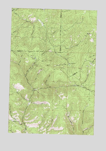
Elevation Mountain, MT USGS Topographic Map
Click on map above to begin viewing in our Map Viewer.

This topographic map contains these locations and features:
Feature Name Type Latitude Longitude GNIS ID View Map
Alcona MineMineN46.8174°W113.3309°803107View Map
Amex Number 1 MineMineN46.8244°W113.3354°803146View Map
Amex Number 5 MineMineN46.8272°W113.3504°803157View Map
Anaconda HillSummitN46.8319°W113.3490°768234View Map
Anderson HillSummitN46.8188°W113.3226°768247View Map
Austin MineMineN46.8272°W113.3334°803136View Map
BeartownPopulated PlaceN46.7933°W113.3401°768617View Map
Beartown Post Office (historical)Post OfficeN46.7933°W113.3401°1781819View Map
Berlene MineMineN46.8155°W113.3351°803142View Map
Bilk (historical)LocaleN46.8249°W113.2523°1803431View Map
Boston MineMineN46.8247°W113.2592°805026View Map
Cardinal MineMineN46.8202°W113.2698°805025View Map
Cascade MineMineN46.8244°W113.3529°803134View Map
Cave GulchValleyN46.7983°W113.3445°769684View Map
Cave Hill-Fairview MineMineN46.8135°W113.3329°803106View Map
Cayuse GulchValleyN46.7963°W113.3201°769688View Map
Dandy MineMineN46.8247°W113.3015°803213View Map
Dandy MineMineN46.8166°W113.2984°770449View Map
Day GulchValleyN46.8202°W113.2904°770493View Map
Deep CreekStreamN46.7922°W113.3409°770549View Map
Deer CreekStreamN46.8733°W113.3734°770580View Map
Elevation MountainSummitN46.8513°W113.2601°771171View Map
Fairview MineMineN46.8147°W113.3284°771292View Map
Finn GulchValleyN46.7822°W113.3442°771360View Map
First Chance GulchValleyN46.8083°W113.3523°771373View Map
Fourth of July MineMineN46.8147°W113.3392°803144View Map
Free Coin - Redcloud Mill MineMineN46.8199°W113.3465°803140View Map
Gambler CreekStreamN46.7988°W113.2712°771693View Map
GarnetPopulated PlaceN46.8252°W113.3390°771716View Map
Garnet MineMineN46.8244°W113.3459°803041View Map
Garnet Post Office (historical)Post OfficeN46.8252°W113.3390°1781812View Map
Garnet School (historical)SchoolN46.8252°W113.3390°1781874View Map
Goldleaf MineMineN46.8188°W113.2590°803100View Map
Grant and Hartford MineMineN46.8230°W113.3404°803147View Map
Harparanda MineMineN46.8102°W113.2945°803110View Map
Herzer and Green MineMineN46.8166°W113.3223°803105View Map
Homestake MineMineN46.8222°W113.3365°803208View Map
Independence MineMineN46.8083°W113.3142°803104View Map
International MineMineN46.8272°W113.3423°803156View Map
Kearns CreekStreamN46.8183°W113.3620°772948View Map
Kennedy CreekStreamN46.8513°W113.3245°772985View Map
Keno CreekStreamN46.8374°W113.3137°772992View Map
Lehson MineMineN46.8194°W113.2587°803101View Map
Lynx MineMineN46.8105°W113.3176°803103View Map
Magone and Anderson MineMineN46.8202°W113.3351°803141View Map
McGinnis CreekStreamN46.8633°W113.3551°774015View Map
McManus GulchValleyN46.8363°W113.3137°774040View Map
Mountain MineMineN46.8166°W113.2723°805024View Map
Mountain MineMineN46.8166°W113.2720°774427View Map
Mountain View MineMineN46.8230°W113.3301°803043View Map
Mountain View MineMineN46.8227°W113.3292°774431View Map
Nancy Hanks MineMineN46.8272°W113.3459°774547View Map
Nineteen ten RidgeSummitN46.8291°W113.3701°774650View Map
North Fork Elk CreekStreamN46.8735°W113.3740°774748View Map
NW Section 10 MineMineN46.8124°W113.3479°803139View Map
Pearl Fraction MineMineN46.8202°W113.2556°803099View Map
Pearl MineMineN46.8216°W113.2584°805027View Map
Pearl MineMineN46.8219°W113.2567°775123View Map
Peggy Ann MineMineN46.8308°W113.3570°803158View Map
Red Cloud MineMineN46.8183°W113.3370°803149View Map
Redrock MineMineN46.8144°W113.2606°803102View Map
Reynolds CityPopulated PlaceN46.8210°W113.2870°775734View Map
Robert Emmet MineMineN46.8180°W113.3356°803143View Map
San Jose MineMineN46.8202°W113.3351°803145View Map
SE Section 2 MineMineN46.8241°W113.3170°803137View Map
Secret GulchValleyN46.7824°W113.3459°776334View Map
Shamrock MineMineN46.8266°W113.3431°803044View Map
Sierra MineMineN46.8272°W113.3348°803135View Map
Skimmerhorn CreekStreamN46.8605°W113.3448°776611View Map
Sleepy Tom GulchValleyN46.7619°W113.3629°790652View Map
Spokane MineMineN46.8285°W113.3556°803159View Map
SpringtownPopulated PlaceN46.7997°W113.2795°777093View Map
Stone MineMineN46.8141°W113.3098°803108View Map
Stump Town (historical)Populated PlaceN46.8283°W113.3467°1781890View Map
Summit CabinLocaleN46.8152°W113.3098°777305View Map
Tenmile (historical)LocaleN46.7605°W113.3542°1781888View Map
Tenmile CreekStreamN46.7605°W113.3529°777464View Map
Tiger MineMineN46.8263°W113.3406°803133View Map
Top O Deep Post Office (historical)Post OfficeN46.8244°W113.2592°1781793View Map
Top O'DeepPopulated PlaceN46.8244°W113.2592°777713View Map
Tostman MineMineN46.8285°W113.3542°803160View Map
Walker GulchValleyN46.7541°W113.2659°778081View Map
Willie MineMineN46.8185°W113.3417°803138View Map
YrekaPopulated PlaceN46.8613°W113.3309°778755View Map
Yreka Post Office (historical)Post OfficeN46.8613°W113.3309°1781220View Map

Note: Coordinates in the location and feature list above are referenced to NAD83 datum.


Copyright (C) 2008-2024 Ryan Niemi / Sunset Dynamics ... All Rights Reserved