TopoQuest Logo
Do you find TopoQuest useful?
Help keep TopoQuest running and adding new maps/features by donating!
Bitcoin:  19c7KJd3qBynnjoSw5npx9KScwjBe4ifkT
Litecoin:  LXs6TkuXGGXo1vDsWCkWVdjQX94eUKd6ui
Home View Maps Find Maps Find Places Resources & Links


Elcho, Wisconsin Topographic Map

USGS Map Title: Elcho, WI
USGS Map MRC: 45089D2
DRG (GeoTIFF) Download: o45089d2.tif


Neighboring USGS Topographic Map Quads:


  George Lake, WI  
45089E3
 

  Monico, WI  
45089E2
 

  Nashville, WI  
45089E1
 

  Enterprise, WI  
45089D3
 

  Elcho, WI  
45089D2
 

  Post Lake, WI  
45089D1
 

  Bavaria, WI  
45089C3
 

  Kempster, WI  
45089C2
 

  Pearson, WI  
45089C1


Map MRC Location:

N46°
W90°
N46°
W89°
H8 H7 H6 H5 H4 H3 H2 H1
G8 G7 G6 G5 G4 G3 G2 G1
F8 F7 F6 F5 F4 F3 F2 F1
E8 E7 E6 E5 E4 E3 E2 E1
D8 D7 D6 D5 D4 D3 D2 D1
C8 C7 C6 C5 C4 C3 C2 C1
B8 B7 B6 B5 B4 B3 B2 B1
A8 A7 A6 A5 A4 A3 A2 A1
N45°
W90°
N45°
W89°

Elcho, WI USGS 1:24K Topographic Map Preview:
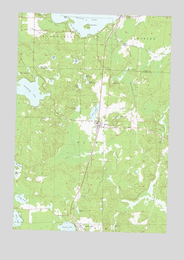
Elcho, WI USGS Topographic Map
Click on map above to begin viewing in our Map Viewer.

This topographic map contains these locations and features:
Feature Name Type Latitude Longitude GNIS ID View Map
Airhole LakeLakeN45.3927°W89.2443°1560717View Map
Antigo IslandIslandN45.4930°W89.1943°1560895View Map
Apple LakesLakeN45.4647°W89.2496°1840741View Map
Bellis SpringSpringN45.4280°W89.1298°1561544View Map
Brady LakeLakeN45.3885°W89.2196°2784066View Map
Duck LakeLakeN45.3807°W89.2474°1564156View Map
Eagle LakeLakeN45.4744°W89.2206°1564247View Map
East Apple LakeLakeN45.4647°W89.2484°1564269View Map
ElchoPopulated PlaceN45.4358°W89.1835°1564493View Map
Elcho Census Designated PlaceCensusN45.4355°W89.1853°2586483View Map
Elcho Elementary SchoolSchoolN45.4376°W89.1835°2713274View Map
Elcho High SchoolSchoolN45.4376°W89.1835°1840758View Map
Elcho Volunteer Fire and Rescue DepartmentBuildingN45.4354°W89.1817°2696734View Map
Enterprise CemeteryCemeteryN45.4897°W89.2321°1564672View Map
Enterprise LakeLakeN45.4548°W89.2388°1564674View Map
Enterprise School (historical)SchoolN45.4963°W89.2476°1843843View Map
Flood SpringSpringN45.4611°W89.1721°1565076View Map
Guths BayBayN45.4925°W89.2065°1565948View Map
Hilson LakeLakeN45.4605°W89.2221°1566477View Map
Indian PointCapeN45.4975°W89.2098°1566930View Map
Jordan LakeLakeN45.4583°W89.1985°1567288View Map
Lower First LakeLakeN45.4607°W89.1927°1568730View Map
Nelson LakeLakeN45.4410°W89.1664°1570162View Map
Oneida County Ambulance Pelican LakeBuildingN45.4995°W89.1649°2698432View Map
Otter LakeLakeN45.4436°W89.1863°1570910View Map
Pelican LakePopulated PlaceN45.4994°W89.1668°1571153View Map
Pelican Lake Fire DistrictBuildingN45.4996°W89.1649°2696758View Map
Pine LakeLakeN45.4121°W89.2475°1571505View Map
Pohaida LakeLakeN45.3864°W89.1972°1571714View Map
Pratt JunctionPopulated PlaceN45.4825°W89.1646°1577778View Map
Rasmussen SpringSpringN45.3780°W89.1676°1572085View Map
Saint Johns ChurchChurchN45.4902°W89.2373°1573117View Map
Silver LakeLakeN45.4729°W89.2021°1574144View Map
Summit LakePopulated PlaceN45.3777°W89.1948°1575061View Map
Summit Lake Census Designated PlaceCensusN45.3759°W89.2044°2586557View Map
Summit Lake Ranger StationLocaleN45.3872°W89.2015°1840817View Map
Town of ElchoCivilN45.4237°W89.1764°1583142View Map
Upper First LakeLakeN45.4638°W89.1947°1575963View Map
WZTT-FM (Rhinelander)TowerN45.3786°W89.1940°1582624View Map

Note: Coordinates in the location and feature list above are referenced to NAD83 datum.


Copyright (C) 2008-2024 Ryan Niemi / Sunset Dynamics ... All Rights Reserved