TopoQuest Logo
Do you find TopoQuest useful?
Help keep TopoQuest running and adding new maps/features by donating!
Bitcoin:  19c7KJd3qBynnjoSw5npx9KScwjBe4ifkT
Litecoin:  LXs6TkuXGGXo1vDsWCkWVdjQX94eUKd6ui
Home View Maps Find Maps Find Places Resources & Links


El Muerto Peak, Texas Topographic Map

USGS Map Title: El Muerto Peak, TX
USGS Map MRC: 30104F3
DRG (GeoTIFF) Download: o30104f3.tif


Neighboring USGS Topographic Map Quads:


  Boggy Draw, TX  
30104G4
 

  Bare Mountain, TX  
30104G3
 

  Robbers Roost Canyon, TX  
30104G2
 

  Horseshoe Butte, TX  
30104F4
 

  El Muerto Peak, TX  
30104F3
 

  Mount Livermore, TX  
30104F2
 

  Valentine East, TX  
30104E4
 

  San Antonio Pass, TX  
30104E3
 

  Paradise Mountain, TX  
30104E2


Map MRC Location:

N31°
W105°
N31°
W104°
H8 H7 H6 H5 H4 H3 H2 H1
G8 G7 G6 G5 G4 G3 G2 G1
F8 F7 F6 F5 F4 F3 F2 F1
E8 E7 E6 E5 E4 E3 E2 E1
D8 D7 D6 D5 D4 D3 D2 D1
C8 C7 C6 C5 C4 C3 C2 C1
B8 B7 B6 B5 B4 B3 B2 B1
A8 A7 A6 A5 A4 A3 A2 A1
N30°
W105°
N30°
W104°

El Muerto Peak, TX USGS 1:24K Topographic Map Preview:
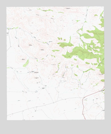
El Muerto Peak, TX USGS Topographic Map
Click on map above to begin viewing in our Map Viewer.

This topographic map contains these locations and features:
Feature Name Type Latitude Longitude GNIS ID View Map
Baldy MountainSummitN30.6924°W104.3555°1351460View Map
Bear MountainSummitN30.6751°W104.2516°1372447View Map
Brushy MountainSummitN30.7079°W104.3466°1353087View Map
Cottonwood CanyonValleyN30.6721°W104.3047°1355060View Map
Cracker Jack WindmillLocaleN30.6785°W104.3435°1355297View Map
Devils CanyonValleyN30.6704°W104.3177°1355954View Map
El Muerto PeakSummitN30.6715°W104.3385°1356870View Map
El Muerto SpringSpringN30.6777°W104.3406°1356871View Map
Garden DrawValleyN30.7265°W104.3700°1357872View Map
Geronimo WindmillsLocaleN30.7379°W104.2507°1357973View Map
H O Canyon WindmillLocaleN30.6565°W104.2546°1358558View Map
Jess WindmillLocaleN30.6354°W104.2507°1360241View Map
Lonely LeeSummitN30.6863°W104.3171°1361681View Map
Moore RanchLocaleN30.6635°W104.3260°1363113View Map
Old House WindmillLocaleN30.6599°W104.3299°1364438View Map
Phillips CanyonValleyN30.7480°W104.3519°1365143View Map
Rincon TankReservoirN30.6679°W104.3030°1366485View Map
Sheep Camp MountainSummitN30.7485°W104.2991°1368087View Map
Spring CanyonValleyN30.6944°W104.3457°1368954View Map
Spring MountainSummitN30.7029°W104.3308°1369029View Map
Yates CanyonValleyN30.7275°W104.3577°1372017View Map
Yates WindmillLocaleN30.7115°W104.3210°1372022View Map

Note: Coordinates in the location and feature list above are referenced to NAD83 datum.


Copyright (C) 2008-2024 Ryan Niemi / Sunset Dynamics ... All Rights Reserved