TopoQuest Logo
Do you find TopoQuest useful?
Help keep TopoQuest running and adding new maps/features by donating!
Bitcoin:  19c7KJd3qBynnjoSw5npx9KScwjBe4ifkT
Litecoin:  LXs6TkuXGGXo1vDsWCkWVdjQX94eUKd6ui
Home View Maps Find Maps Find Places Resources & Links


Egan Basin, Idaho Topographic Map

USGS Map Title: Egan Basin, ID
USGS Map MRC: 42111A5
DRG (GeoTIFF) Download: o42111a5.tif


Neighboring USGS Topographic Map Quads:


  Mink Creek, ID  
42111B6
 

  Paris Peak, ID  
42111B5
 

  Paris, ID  
42111B4
 

  Mapleton, ID  
42111A6
 

  Egan Basin, ID  
42111A5
 

  Saint Charles, ID  
42111A4
 

  Naomi Peak, UT  
41111H6
 

  Tony Grove Creek, UT  
41111H5
 

  Garden City, UT  
41111H4


Map MRC Location:

N43°
W112°
N43°
W111°
H8 H7 H6 H5 H4 H3 H2 H1
G8 G7 G6 G5 G4 G3 G2 G1
F8 F7 F6 F5 F4 F3 F2 F1
E8 E7 E6 E5 E4 E3 E2 E1
D8 D7 D6 D5 D4 D3 D2 D1
C8 C7 C6 C5 C4 C3 C2 C1
B8 B7 B6 B5 B4 B3 B2 B1
A8 A7 A6 A5 A4 A3 A2 A1
N42°
W112°
N42°
W111°

Egan Basin, ID USGS 1:24K Topographic Map Preview:
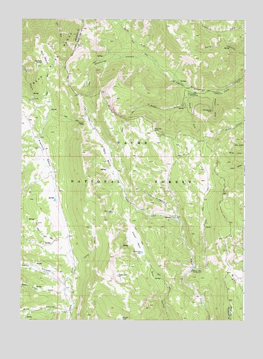
Egan Basin, ID USGS Topographic Map
Click on map above to begin viewing in our Map Viewer.

This topographic map contains these locations and features:
Feature Name Type Latitude Longitude GNIS ID View Map
Beaver Creek CampgroundLocaleN42.0208°W111.5291°377259View Map
Big Creek LakeLakeN42.0793°W111.5507°377491View Map
Blue LakeLakeN42.0448°W111.5740°377922View Map
Boss CanyonValleyN42.0041°W111.6010°378042View Map
Cloverleaf CampgroundLocaleN42.0944°W111.5316°379448View Map
Corral HollowValleyN42.0244°W111.5924°379806View Map
Cub BasinBasinN42.1094°W111.6130°380136View Map
Cub Basin SpringSpringN42.1072°W111.6137°380137View Map
Danish PassGapN42.0824°W111.5899°380240View Map
Egan BasinBasinN42.0677°W111.5780°381270View Map
Franklin BasinBasinN42.0708°W111.6116°382013View Map
Gibson BasinBasinN42.0324°W111.5602°382263View Map
Hidden LakeLakeN42.0184°W111.5708°383146View Map
Hodge Nibley CreekStreamN42.0116°W111.6002°383232View Map
Horse LakeLakeN42.0281°W111.5573°383390View Map
Middle Fork Saint Charles CreekStreamN42.0952°W111.5291°386839View Map
North Fork Saint Charles CreekStreamN42.0952°W111.5291°387769View Map
Pat HollowValleyN42.0458°W111.5397°388259View Map
Porcupine CampgroundLocaleN42.0952°W111.5183°388744View Map
Porcupine HollowValleyN42.0952°W111.5163°388761View Map
Red Pine SpringSpringN42.0373°W111.5005°389224View Map
Red SinksBasinN42.0177°W111.5052°389240View Map
Snowslide CanyonValleyN42.0949°W111.5291°390772View Map
South Fork Saint Charles CreekStreamN42.0952°W111.5288°391016View Map
White CanyonValleyN42.0144°W111.6008°393319View Map
Wiggler LakeLakeN42.0007°W111.5679°393411View Map

Note: Coordinates in the location and feature list above are referenced to NAD83 datum.


Copyright (C) 2008-2024 Ryan Niemi / Sunset Dynamics ... All Rights Reserved