TopoQuest Logo
Do you find TopoQuest useful?
Help keep TopoQuest running and adding new maps/features by donating!
Bitcoin:  19c7KJd3qBynnjoSw5npx9KScwjBe4ifkT
Litecoin:  LXs6TkuXGGXo1vDsWCkWVdjQX94eUKd6ui
Home View Maps Find Maps Find Places Resources & Links


Ardenvoir, Washington Topographic Map

USGS Map Title: Ardenvoir, WA
USGS Map MRC: 47120F3
DRG (GeoTIFF) Download: o47120f3.tif


Neighboring USGS Topographic Map Quads:


  Tyee Mountain, WA  
47120G4
 

  Baldy Mountain, WA  
47120G3
 

  Winesap, WA  
47120G2
 

  Chumstick Mountain, WA  
47120F4
 

  Ardenvoir, WA  
47120F3
 

  Entiat, WA  
47120F2
 

  Cashmere, WA  
47120E4
 

  Rocky Reach Dam, WA  
47120E3
 

  Orondo, WA  
47120E2


Map MRC Location:

N48°
W121°
N48°
W120°
H8 H7 H6 H5 H4 H3 H2 H1
G8 G7 G6 G5 G4 G3 G2 G1
F8 F7 F6 F5 F4 F3 F2 F1
E8 E7 E6 E5 E4 E3 E2 E1
D8 D7 D6 D5 D4 D3 D2 D1
C8 C7 C6 C5 C4 C3 C2 C1
B8 B7 B6 B5 B4 B3 B2 B1
A8 A7 A6 A5 A4 A3 A2 A1
N47°
W121°
N47°
W120°

Ardenvoir, WA USGS 1:24K Topographic Map Preview:
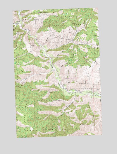
Ardenvoir, WA USGS Topographic Map
Click on map above to begin viewing in our Map Viewer.

This topographic map contains these locations and features:
Feature Name Type Latitude Longitude GNIS ID View Map
ArdenvoirPopulated PlaceN47.7373°W120.3690°1515943View Map
Ardenvoir Post OfficePost OfficeN47.7321°W120.3626°2769255View Map
Asher CanyonValleyN47.6676°W120.2567°1515968View Map
Bear GulchValleyN47.6862°W120.3484°1516266View Map
Byers CanyonValleyN47.7168°W120.2912°1517174View Map
Byers Canyon Spring Number 1SpringN47.7356°W120.2840°1533088View Map
Cherry SpringSpringN47.6855°W120.2685°1517663View Map
Crum CanyonValleyN47.7110°W120.3256°1518362View Map
Crum Canyon Spring Number 2SpringN47.7103°W120.2613°1533104View Map
Dick MesaSummitN47.6940°W120.2617°1518763View Map
Dinkelman CanyonValleyN47.6701°W120.3081°1518780View Map
Dinkelman RidgeRidgeN47.6596°W120.3520°1515698View Map
Dissmore CanyonValleyN47.6907°W120.3101°1518804View Map
Entiat CemeteryCemeteryN47.6756°W120.3047°1519356View Map
Entiat National Fish HatcheryParkN47.6994°W120.3225°1529668View Map
FarrisPopulated PlaceN47.6926°W120.3170°1530404View Map
Hanan CanyonValleyN47.6685°W120.2645°1520492View Map
Keystone CanyonValleyN47.6640°W120.2640°1521644View Map
Keystone PointSummitN47.6360°W120.2812°1521647View Map
Mad RiverStreamN47.7360°W120.3634°1522626View Map
Maple CanyonValleyN47.6779°W120.2981°1522685View Map
McArthur CanyonValleyN47.6690°W120.2723°1522845View Map
Mills CanyonValleyN47.6649°W120.2884°1523196View Map
Moe CanyonValleyN47.7296°W120.3579°1523302View Map
Moody CanyonValleyN47.6610°W120.2523°1523340View Map
Morical CanyonValleyN47.7246°W120.3423°1523366View Map
Mud CreekStreamN47.7493°W120.3656°1523467View Map
North Fork Crum CanyonValleyN47.7118°W120.3126°1523764View Map
Osburn CanyonValleyN47.7271°W120.2817°1524087View Map
Peters PointSummitN47.6582°W120.2823°1529394View Map
Ringstead CanyonValleyN47.7149°W120.3298°1525061View Map
Roaring CreekStreamN47.6907°W120.3179°1525085View Map
Saunders CanyonValleyN47.6751°W120.3012°1525454View Map
Stanley CanyonValleyN47.7018°W120.3151°1526493View Map
StelikoLocaleN47.7435°W120.3606°1529673View Map
Steliko CanyonValleyN47.7429°W120.3623°1526535View Map
Sunshine CanyonValleyN47.7140°W120.2820°1526782View Map
Sunshine Canyon SpringSpringN47.6996°W120.2724°1526783View Map
Tiny CanyonValleyN47.7151°W120.2870°1527252View Map

Note: Coordinates in the location and feature list above are referenced to NAD83 datum.


Copyright (C) 2008-2024 Ryan Niemi / Sunset Dynamics ... All Rights Reserved