TopoQuest Logo
Do you find TopoQuest useful?
Help keep TopoQuest running and adding new maps/features by donating!
Bitcoin:  19c7KJd3qBynnjoSw5npx9KScwjBe4ifkT
Litecoin:  LXs6TkuXGGXo1vDsWCkWVdjQX94eUKd6ui
Home View Maps Find Maps Find Places Resources & Links


Edinburgh, Indiana Topographic Map

USGS Map Title: Edinburgh, IN
USGS Map MRC: 39085C8
DRG (GeoTIFF) Download: o39085c8.tif


Neighboring USGS Topographic Map Quads:


  Franklin, IN  
39086D1
 

  Marietta, IN  
39085D8
 

  Lewis Creek, IN  
39085D7
 

  Nineveh, IN  
39086C1
 

  Edinburgh, IN  
39085C8
 

  Hope, IN  
39085C7
 

  New Bellsville, IN  
39086B1
 

  Columbus, IN  
39085B8
 

  Elizabethtown, IN  
39085B7


Map MRC Location:

N40°
W86°
N40°
W85°
H8 H7 H6 H5 H4 H3 H2 H1
G8 G7 G6 G5 G4 G3 G2 G1
F8 F7 F6 F5 F4 F3 F2 F1
E8 E7 E6 E5 E4 E3 E2 E1
D8 D7 D6 D5 D4 D3 D2 D1
C8 C7 C6 C5 C4 C3 C2 C1
B8 B7 B6 B5 B4 B3 B2 B1
A8 A7 A6 A5 A4 A3 A2 A1
N39°
W86°
N39°
W85°

Edinburgh, IN USGS 1:24K Topographic Map Preview:
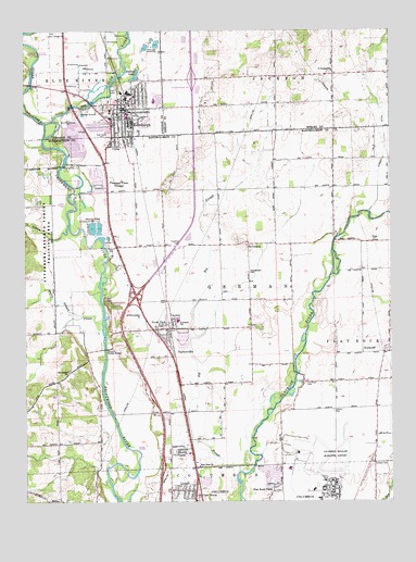
Edinburgh, IN USGS Topographic Map
Click on map above to begin viewing in our Map Viewer.

This topographic map contains these locations and features:
Feature Name Type Latitude Longitude GNIS ID View Map
Atterbury Army Air Field (historical)MilitaryN39.2622°W85.8956°2091536View Map
Big Blue RiverStreamN39.3467°W85.9928°431014View Map
Big SloughStreamN39.2598°W85.9225°431063View Map
Columbus Fire Department Station 2BuildingN39.2542°W85.8984°2626612View Map
Columbus Municipal AirportAirportN39.2555°W85.8965°449127View Map
CubaPopulated PlaceN39.3459°W85.9692°433234View Map
Dailey LakeLakeN39.3629°W85.9618°433283View Map
EdinburghPopulated PlaceN39.3542°W85.9667°434019View Map
Edinburgh Fire and Rescue Station 1BuildingN39.3531°W85.9661°2625827View Map
Edinburgh Fire and Rescue Station 2BuildingN39.3626°W85.9591°2626579View Map
Edinburgh Police DepartmentBuildingN39.3529°W85.9681°2758105View Map
Flat Rock ParkPopulated PlaceN39.2528°W85.9155°434568View Map
Flatrock Baptist CemeteryCemeteryN39.2809°W85.9046°434567View Map
German Township Fire DepartmentBuildingN39.2950°W85.9515°2625511View Map
Interchange 76CrossingN39.3042°W85.9625°446723View Map
Interchange 80CrossingN39.3623°W85.9008°446865View Map
Interchange 80CrossingN39.3620°W85.9422°446724View Map
Irwin ParkParkN39.3584°W85.9692°436840View Map
Lambert CemeteryCemeteryN39.2598°W85.8813°437578View Map
Liberty CemeteryCemeteryN39.2739°W85.8949°437818View Map
Lick CreekStreamN39.2976°W85.9739°437869View Map
LowellPopulated PlaceN39.2531°W85.9464°438357View Map
Muddy Branch CreekStreamN39.2995°W85.9806°439852View Map
New Hope ChurchChurchN39.2595°W85.9411°440067View Map
Nineveh CreekStreamN39.3226°W85.9853°440181View Map
North GatePopulated PlaceN39.2639°W85.9464°440261View Map
North ParkPopulated PlaceN39.2967°W85.9542°440284View Map
NorthcliffPopulated PlaceN39.2895°W85.8775°440317View Map
Old Bethel ChurchChurchN39.2845°W85.9853°440538View Map
Old Union ChurchChurchN39.3181°W85.9236°440618View Map
Pleasant View VillagePopulated PlaceN39.3337°W85.9736°441351View Map
Rest Haven CemeteryCemeteryN39.3473°W85.9743°441912View Map
Saint Georges ChurchChurchN39.3645°W85.8947°442541View Map
Steenbarger CemeteryCemeteryN39.3109°W85.9233°444112View Map
Sugar CreekStreamN39.3464°W85.9930°444321View Map
Tannehill CemeteryCemeteryN39.3023°W85.9709°444568View Map
Tannehill Covered BridgeBridgeN39.2906°W85.9731°444569View Map
TaylorsvillePopulated PlaceN39.2959°W85.9508°444607View Map
Taylorsville Census Designated PlaceCensusN39.2965°W85.9503°2393253View Map
Taylorsville Elementary SchoolSchoolN39.2978°W85.9478°446565View Map
Town of EdinburghCivilN39.3510°W85.9627°2396921View Map
Township of GermanCivilN39.3067°W85.9399°453325View Map
Treadway CemeteryCemeteryN39.3182°W85.9474°444862View Map

Note: Coordinates in the location and feature list above are referenced to NAD83 datum.


Copyright (C) 2008-2024 Ryan Niemi / Sunset Dynamics ... All Rights Reserved