TopoQuest Logo
Do you find TopoQuest useful?
Help keep TopoQuest running and adding new maps/features by donating!
Bitcoin:  19c7KJd3qBynnjoSw5npx9KScwjBe4ifkT
Litecoin:  LXs6TkuXGGXo1vDsWCkWVdjQX94eUKd6ui
Home View Maps Find Maps Find Places Resources & Links


Edgemont, South Dakota Topographic Map

USGS Map Title: Edgemont, SD
USGS Map MRC: 43103C7
DRG (GeoTIFF) Download: o43103c7.tif


Neighboring USGS Topographic Map Quads:


  Burdock, SD  
43103D8
 

  Edgemont NE, SD  
43103D7
 

  Minnekahta, SD  
43103D6
 

  Edgemont SW, SD  
43103C8
 

  Edgemont, SD  
43103C7
 

  Flint Hill, SD  
43103C6


  Rumford, SD  
43103B6


Map MRC Location:

N44°
W104°
N44°
W103°
H8 H7 H6 H5 H4 H3 H2 H1
G8 G7 G6 G5 G4 G3 G2 G1
F8 F7 F6 F5 F4 F3 F2 F1
E8 E7 E6 E5 E4 E3 E2 E1
D8 D7 D6 D5 D4 D3 D2 D1
C8 C7 C6 C5 C4 C3 C2 C1
B8 B7 B6 B5 B4 B3 B2 B1
A8 A7 A6 A5 A4 A3 A2 A1
N43°
W104°
N43°
W103°

Edgemont, SD USGS 1:24K Topographic Map Preview:
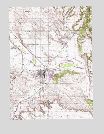
Edgemont, SD USGS Topographic Map
Click on map above to begin viewing in our Map Viewer.

This topographic map contains these locations and features:
Feature Name Type Latitude Longitude GNIS ID View Map
Bell RanchLocaleN43.3405°W103.7869°1265614View Map
Breakneck HillSummitN43.3708°W103.8531°1261345View Map
Cascade Post Office (historical)Post OfficeN43.3328°W103.7880°1267146View Map
City of EdgemontCivilN43.2983°W103.8271°1267376View Map
Coal CreekStreamN43.2539°W103.8702°1261458View Map
Cottonwood CreekStreamN43.3053°W103.8180°1261492View Map
DennisPopulated PlaceN43.2614°W103.8669°1266796View Map
Dry CreekStreamN43.3308°W103.8663°1266799View Map
DudleyPopulated PlaceN43.3114°W103.8183°1261594View Map
EdgemontPopulated PlaceN43.3011°W103.8255°1266810View Map
Edgemont Ambulance ServiceBuildingN43.3020°W103.8247°2658963View Map
Edgemont CemeteryCemeteryN43.3158°W103.8155°1261623View Map
Edgemont City HallBuildingN43.3003°W103.8254°2724712View Map
Edgemont City Police DepartmentBuildingN43.2996°W103.8252°2755545View Map
Edgemont Elementary SchoolSchoolN43.3013°W103.8341°2728681View Map
Edgemont Fire DepartmentBuildingN43.3034°W103.8399°2580910View Map
Edgemont High SchoolSchoolN43.3013°W103.8341°2728682View Map
Edgemont Municipal AirportAirportN43.2948°W103.8396°1266961View Map
Edgemont Post OfficePost OfficeN43.2991°W103.8248°2709843View Map
Edgemont Public LibraryBuildingN43.3003°W103.8254°2723467View Map
Red CanyonValleyN43.3452°W103.7844°1262269View Map
Red Canyon CreekStreamN43.3141°W103.7869°1262271View Map
Red Canyon Station (historical)LocaleN43.3430°W103.7852°1264606View Map
Sheep CanyonValleyN43.3080°W103.7623°1262392View Map
Stone Quarry CanyonValleyN43.3449°W103.7833°1262515View Map
Township of CottonwoodCivilN43.2536°W103.8677°1268764View Map
Trails Trains and Pioneers MuseumBuildingN43.2987°W103.8249°2729347View Map
White DrawValleyN43.3358°W103.7894°1262693View Map

Note: Coordinates in the location and feature list above are referenced to NAD83 datum.


Copyright (C) 2008-2024 Ryan Niemi / Sunset Dynamics ... All Rights Reserved