TopoQuest Logo
Do you find TopoQuest useful?
Help keep TopoQuest running and adding new maps/features by donating!
Bitcoin:  19c7KJd3qBynnjoSw5npx9KScwjBe4ifkT
Litecoin:  LXs6TkuXGGXo1vDsWCkWVdjQX94eUKd6ui
Home View Maps Find Maps Find Places Resources & Links


Ebenezer, Texas Topographic Map

USGS Map Title: Ebenezer, TX
USGS Map MRC: 31094A2
DRG (GeoTIFF) Download: o31094a2.tif


Neighboring USGS Topographic Map Quads:


  Cassells-Boykin Park, TX  
31094B3
 

  Veach, TX  
31094B2
 

  Buck Bay, TX  
31094B1
 

  Boykin Spring, TX  
31094A3
 

  Ebenezer, TX  
31094A2
 

  McGee Bend, TX  
31094A1
 

  Boggy Lake, TX  
30094H3
 

  Pace Hill, TX  
30094H2
 

  Jasper West, TX  
30094H1


Map MRC Location:

N32°
W95°
N32°
W94°
H8 H7 H6 H5 H4 H3 H2 H1
G8 G7 G6 G5 G4 G3 G2 G1
F8 F7 F6 F5 F4 F3 F2 F1
E8 E7 E6 E5 E4 E3 E2 E1
D8 D7 D6 D5 D4 D3 D2 D1
C8 C7 C6 C5 C4 C3 C2 C1
B8 B7 B6 B5 B4 B3 B2 B1
A8 A7 A6 A5 A4 A3 A2 A1
N31°
W95°
N31°
W94°

Ebenezer, TX USGS 1:24K Topographic Map Preview:
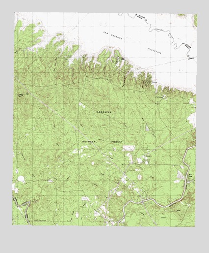
Ebenezer, TX USGS Topographic Map
Click on map above to begin viewing in our Map Viewer.

This topographic map contains these locations and features:
Feature Name Type Latitude Longitude GNIS ID View Map
Beech Grove BranchStreamN31.1152°W94.2085°1381387View Map
Black BranchStreamN31.0346°W94.1663°1381444View Map
Boggy CreekStreamN31.0127°W94.1732°1381477View Map
Buck BranchStreamN31.0463°W94.1666°1382455View Map
Clear CreekStreamN31.0313°W94.2388°1381657View Map
Cypress BranchStreamN31.0135°W94.1719°1381731View Map
Dudley BranchStreamN31.1066°W94.1888°1381805View Map
EbenezerPopulated PlaceN31.0380°W94.1610°1381830View Map
FergusonPopulated PlaceN31.0360°W94.1394°1381867View Map
Fuller BranchStreamN31.0863°W94.1607°1383653View Map
HarveytownPopulated PlaceN31.0769°W94.1474°1383651View Map
Hensarling CemeteryCemeteryN31.1196°W94.2308°1381993View Map
Hitt LakeReservoirN31.0267°W94.1296°1861987View Map
Hitt Lake DamDamN31.0269°W94.1319°1861986View Map
Jordan CemeteryCemeteryN31.0188°W94.2477°1382092View Map
Letney Recreation SiteLocaleN31.0769°W94.1466°1383650View Map
May BranchStreamN31.0255°W94.1324°1382243View Map
McGilberry BranchStreamN31.1052°W94.1630°1382264View Map
Norris CreekStreamN31.1227°W94.1616°1382401View Map
Parker CemeteryCemeteryN31.1063°W94.2038°1382456View Map
Parker CreekStreamN31.1119°W94.1885°1382459View Map
Parker PointPopulated PlaceN31.0982°W94.2160°1383656View Map
Plum RidgeRidgeN31.0946°W94.1808°1383652View Map
Plum Ridge ChurchChurchN31.1002°W94.1955°1382539View Map
River RidgeRidgeN31.0288°W94.1299°1383647View Map
Rocky BranchStreamN31.0219°W94.2299°1382640View Map
Salt Lick BranchStreamN31.1102°W94.1819°1382687View Map
Sam Rayburn ReservoirReservoirN31.1120°W94.1454°1384041View Map
Sandy CreekStreamN31.0160°W94.1682°1382709View Map
Sandy CreekStreamN31.1082°W94.1424°1382710View Map
Sandy Creek Recreation SiteLocaleN31.0974°W94.2030°1383746View Map
Shearwood CreekStreamN31.0146°W94.2383°1382750View Map
Speir BranchStreamN31.1096°W94.1777°1382788View Map
Speir CemeteryCemeteryN31.1024°W94.1813°1382789View Map
Sulphur Spring BranchStreamN31.1041°W94.1577°1382830View Map
Townsend CreekStreamN31.1085°W94.1338°1382876View Map
Trout CreekStreamN31.0166°W94.1557°1382881View Map
Ward BranchStreamN31.0413°W94.1334°1383231View Map
WestwoodPopulated PlaceN31.0855°W94.1582°1383649View Map
ZavalaLocaleN31.0091°W94.1382°1383009View Map

Note: Coordinates in the location and feature list above are referenced to NAD83 datum.


Copyright (C) 2008-2024 Ryan Niemi / Sunset Dynamics ... All Rights Reserved