TopoQuest Logo
Do you find TopoQuest useful?
Help keep TopoQuest running and adding new maps/features by donating!
Bitcoin:  19c7KJd3qBynnjoSw5npx9KScwjBe4ifkT
Litecoin:  LXs6TkuXGGXo1vDsWCkWVdjQX94eUKd6ui
Home View Maps Find Maps Find Places Resources & Links


Easton, Michigan Topographic Map

USGS Map Title: Easton, MI
USGS Map MRC: 43084A1
DRG (GeoTIFF) Download: o43084a1.tif


Neighboring USGS Topographic Map Quads:


  Chesaning West, MI  
43084B2
 

  Chesaning East, MI  
43084B1
 

  Montrose, MI  
43083B8
 

  Owosso North, MI  
43084A2
 

  Easton, MI  
43084A1
 

  New Lothrop, MI  
43083A8
 

  Owosso South, MI  
42084H2
 

  Corunna, MI  
42084H1
 

  Durand, MI  
42083H8


Map MRC Location:

N44°
W85°
N44°
W84°
H8 H7 H6 H5 H4 H3 H2 H1
G8 G7 G6 G5 G4 G3 G2 G1
F8 F7 F6 F5 F4 F3 F2 F1
E8 E7 E6 E5 E4 E3 E2 E1
D8 D7 D6 D5 D4 D3 D2 D1
C8 C7 C6 C5 C4 C3 C2 C1
B8 B7 B6 B5 B4 B3 B2 B1
A8 A7 A6 A5 A4 A3 A2 A1
N43°
W85°
N43°
W84°

Easton, MI USGS 1:24K Topographic Map Preview:
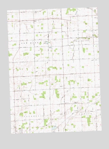
Easton, MI USGS Topographic Map
Click on map above to begin viewing in our Map Viewer.

This topographic map contains these locations and features:
Feature Name Type Latitude Longitude GNIS ID View Map
Charter Township of CaledoniaCivilN43.0006°W84.1053°1626021View Map
Christian Assembly HallChurchN43.0286°W84.0361°623243View Map
Coal Mine DrainCanalN43.0059°W84.0841°623511View Map
Coon DrainCanalN43.1017°W84.0022°623777View Map
EastonPopulated PlaceN43.1139°W84.0883°625296View Map
Easton CemeteryCemeteryN43.1142°W84.1000°2576140View Map
Easton Church of ChristChurchN43.1139°W84.0981°2575928View Map
Easton Post Office (historical)Post OfficeN43.1139°W84.0883°2576036View Map
Eveleth SchoolSchoolN43.0017°W84.1197°625682View Map
Galloway DrainCanalN43.0489°W84.0477°626613View Map
Kerby Road ParkParkN43.0019°W84.0661°2576217View Map
Kinsman DrainCanalN43.0856°W84.0644°629748View Map
Northwest Venice ChurchChurchN43.0286°W84.0497°633722View Map
Rogers DrainCanalN43.0378°W84.0483°636118View Map
Saxon DrainCanalN43.0186°W84.0008°637304View Map
Stewart DrainCanalN43.0417°W84.1116°638830View Map
Township of New HavenCivilN43.0867°W84.1088°1626802View Map
Vietz CemeteryCemeteryN43.1155°W84.0372°2576121View Map
Wilkinson CemeteryCemeteryN43.0217°W84.0314°1616483View Map

Note: Coordinates in the location and feature list above are referenced to NAD83 datum.


Copyright (C) 2008-2024 Ryan Niemi / Sunset Dynamics ... All Rights Reserved