TopoQuest Logo
Do you find TopoQuest useful?
Help keep TopoQuest running and adding new maps/features by donating!
Bitcoin:  19c7KJd3qBynnjoSw5npx9KScwjBe4ifkT
Litecoin:  LXs6TkuXGGXo1vDsWCkWVdjQX94eUKd6ui
Home View Maps Find Maps Find Places Resources & Links


Durand North, Wisconsin Topographic Map

USGS Map Title: Durand North, WI
USGS Map MRC: 44091F8
DRG (GeoTIFF) Download: o44091f8.tif


Neighboring USGS Topographic Map Quads:


  Weston, WI  
44092G1
 

  Menomonie South, WI  
44091G8
 

  Falls City, WI  
44091G7
 

  Arkansaw, WI  
44092F1
 

  Durand North, WI  
44091F8
 

  Meridean, WI  
44091F7
 

  Ella, WI  
44092E1
 

  Durand South, WI  
44091E8
 

  Tarrant, WI  
44091E7


Map MRC Location:

N45°
W92°
N45°
W91°
H8 H7 H6 H5 H4 H3 H2 H1
G8 G7 G6 G5 G4 G3 G2 G1
F8 F7 F6 F5 F4 F3 F2 F1
E8 E7 E6 E5 E4 E3 E2 E1
D8 D7 D6 D5 D4 D3 D2 D1
C8 C7 C6 C5 C4 C3 C2 C1
B8 B7 B6 B5 B4 B3 B2 B1
A8 A7 A6 A5 A4 A3 A2 A1
N44°
W92°
N44°
W91°

Durand North, WI USGS 1:24K Topographic Map Preview:
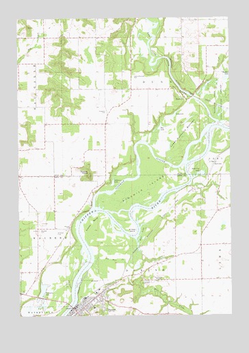
Durand North, WI USGS Topographic Map
Click on map above to begin viewing in our Map Viewer.

This topographic map contains these locations and features:
Feature Name Type Latitude Longitude GNIS ID View Map
Bear CreekStreamN44.6480°W91.9338°1561358View Map
Bear LakeBayN44.6586°W91.9296°1561377View Map
Big LakeLakeN44.7043°W91.9164°1561742View Map
Browning LakeBayN44.6847°W91.8924°1562268View Map
Burke School (historical)SchoolN44.6566°W91.9980°1578276View Map
Caddie Woodlawn ParkParkN44.7252°W91.9321°1562499View Map
City of DurandCivilN44.6272°W91.9614°1583108View Map
Cranes BendBendN44.6616°W91.9541°1563509View Map
Dry BrookStreamN44.6795°W91.8985°2761258View Map
DunnvillePopulated PlaceN44.7186°W91.9054°1564188View Map
DurandPopulated PlaceN44.6264°W91.9657°1564195View Map
Durand City Volunteer Fire DepartmentBuildingN44.6273°W91.9618°2698196View Map
Durand Middle / High SchoolSchoolN44.6296°W91.9576°1840879View Map
Durand Municipal Ambulance ServiceBuildingN44.6273°W91.9618°2698376View Map
Evergreen CemeteryCemeteryN44.7105°W91.9479°1564753View Map
Faith Lutheran ChurchChurchN44.6269°W91.9507°1840880View Map
Hay Creek School (historical)SchoolN44.7389°W91.9835°1578228View Map
Ingram School (historical)SchoolN44.6841°W91.9838°1578235View Map
Long LakeLakeN44.7096°W91.9077°1568544View Map
Lower Dunnville BottomsBendN44.7025°W91.9043°1568726View Map
Nine Mile Island State Natural AreaParkN44.6786°W91.9243°2061794View Map
Ninemile IslandIslandN44.6783°W91.9263°1570303View Map
Ninemile SloughStreamN44.6705°W91.9560°1570304View Map
Oak Grove School (historical)SchoolN44.6647°W91.9085°1578292View Map
Old Bear CreekStreamN44.6466°W91.9518°1570770View Map
Red CedarPopulated PlaceN44.6891°W91.8843°1577787View Map
Red Cedar RiverStreamN44.7058°W91.8824°1572133View Map
Saint Johns Lutheran ChurchChurchN44.6280°W91.9607°1840883View Map
Schlosser Field (historical)AirportN44.6608°W91.9777°1840885View Map
Schlosser LakeLakeN44.6807°W91.9445°1573784View Map
Snaggy BendBendN44.6619°W91.9343°1574330View Map
Thompson LakeLakeN44.6337°W91.9868°1575381View Map
Thompson Lake Christian SchoolSchoolN44.6337°W91.9900°2715707View Map
Town of DurandCivilN44.6310°W91.9314°1583109View Map
Town of WaubeekCivilN44.6618°W91.9773°1584369View Map
Wallace LakeLakeN44.7249°W91.8763°1576167View Map
Waubeek CemeteryCemeteryN44.6608°W91.9879°1576301View Map
Waubeek MoundSummitN44.6839°W91.9585°1576302View Map
Waubeek School (historical)SchoolN44.6980°W91.9485°1578269View Map
Woods Corner School (historical)SchoolN44.6252°W91.9127°1578300View Map
WRDN-AM (Durand)TowerN44.6411°W91.9229°1582547View Map
Yellow BankCliffN44.6700°W91.9577°1577082View Map

Note: Coordinates in the location and feature list above are referenced to NAD83 datum.


Copyright (C) 2008-2024 Ryan Niemi / Sunset Dynamics ... All Rights Reserved