TopoQuest Logo
Do you find TopoQuest useful?
Help keep TopoQuest running and adding new maps/features by donating!
Bitcoin:  19c7KJd3qBynnjoSw5npx9KScwjBe4ifkT
Litecoin:  LXs6TkuXGGXo1vDsWCkWVdjQX94eUKd6ui
Home View Maps Find Maps Find Places Resources & Links


Dunn Creek, Texas Topographic Map

USGS Map Title: Dunn Creek, TX
USGS Map MRC: 30096G4
DRG (GeoTIFF) Download: o30096g4.tif


Neighboring USGS Topographic Map Quads:


  Hearne North, TX  
30096H5
 

  Wheelock, TX  
30096H4
 

  Edge, TX  
30096H3
 

  Hearne South, TX  
30096G5
 

  Dunn Creek, TX  
30096G4
 

  Kurten, TX  
30096G3
 

  Mumford, TX  
30096F5
 

  Bryan West, TX  
30096F4
 

  Bryan East, TX  
30096F3


Map MRC Location:

N31°
W97°
N31°
W96°
H8 H7 H6 H5 H4 H3 H2 H1
G8 G7 G6 G5 G4 G3 G2 G1
F8 F7 F6 F5 F4 F3 F2 F1
E8 E7 E6 E5 E4 E3 E2 E1
D8 D7 D6 D5 D4 D3 D2 D1
C8 C7 C6 C5 C4 C3 C2 C1
B8 B7 B6 B5 B4 B3 B2 B1
A8 A7 A6 A5 A4 A3 A2 A1
N30°
W97°
N30°
W96°

Dunn Creek, TX USGS 1:24K Topographic Map Preview:
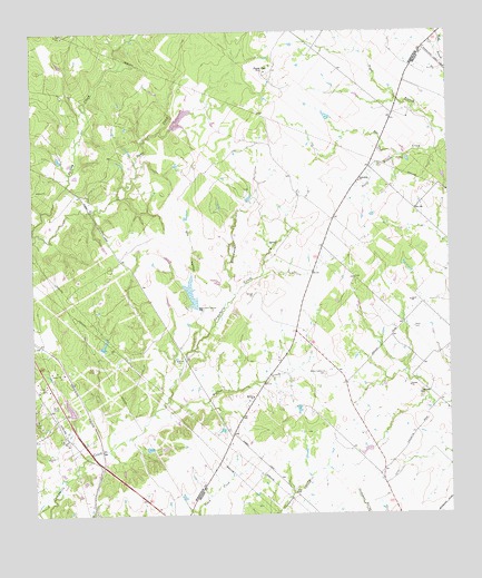
Dunn Creek, TX USGS Topographic Map
Click on map above to begin viewing in our Map Viewer.

This topographic map contains these locations and features:
Feature Name Type Latitude Longitude GNIS ID View Map
Alexander ChurchChurchN30.7810°W96.3839°1350974View Map
Dry HollowValleyN30.8095°W96.4532°1356352View Map
Dunns FortPopulated PlaceN30.8649°W96.4289°1379687View Map
Friendship ChurchChurchN30.8360°W96.4014°1357747View Map
Henry CemeteryCemeteryN30.7982°W96.3855°1359043View Map
Mount Zion ChurchChurchN30.7805°W96.4341°1363352View Map
P and M Bank Club LakeReservoirN30.8508°W96.4577°1862981View Map
P and M Bank Club Lake DamDamN30.8502°W96.4586°1862980View Map
Pecan BranchStreamN30.8430°W96.3875°1364952View Map
Persimmon CreekStreamN30.8071°W96.4389°1365091View Map
Peters LakeReservoirN30.7666°W96.4005°1857937View Map
Peters Lake DamDamN30.7669°W96.3986°1857936View Map
Pryor LakeReservoirN30.8530°W96.4114°1865311View Map
Pryor Lake DamDamN30.8535°W96.4119°1865310View Map
Savoy-Gant LakeReservoirN30.7755°W96.4891°1862985View Map
Savoy-Gant Lake DamDamN30.7752°W96.4886°1862984View Map
Seale LakeReservoirN30.8070°W96.4526°1858456View Map
Seale Lake DamDamN30.8035°W96.4519°1858455View Map
Walker CreekStreamN30.7766°W96.4641°1370755View Map
Walker Settlement CemeteryCemeteryN30.7860°W96.4125°1370763View Map

Note: Coordinates in the location and feature list above are referenced to NAD83 datum.


Copyright (C) 2008-2024 Ryan Niemi / Sunset Dynamics ... All Rights Reserved