TopoQuest Logo
Do you find TopoQuest useful?
Help keep TopoQuest running and adding new maps/features by donating!
Bitcoin:  19c7KJd3qBynnjoSw5npx9KScwjBe4ifkT
Litecoin:  LXs6TkuXGGXo1vDsWCkWVdjQX94eUKd6ui
Home View Maps Find Maps Find Places Resources & Links


Dundee, Florida Topographic Map

USGS Map Title: Dundee, FL
USGS Map MRC: 28081A5
DRG (GeoTIFF) Download: o28081a5.tif


Neighboring USGS Topographic Map Quads:


  Gum Lake, FL  
28081B6
 

  Davenport, FL  
28081B5
 

  Lake Tohopekaliga, FL  
28081B4
 

  Winter Haven, FL  
28081A6
 

  Dundee, FL  
28081A5
 

  Lake Hatchineha, FL  
28081A4
 

  Eloise, FL  
27081H6
 

  Lake Wales, FL  
27081H5
 

  Hesperides, FL  
27081H4


Map MRC Location:

N29°
W82°
N29°
W81°
H8 H7 H6 H5 H4 H3 H2 H1
G8 G7 G6 G5 G4 G3 G2 G1
F8 F7 F6 F5 F4 F3 F2 F1
E8 E7 E6 E5 E4 E3 E2 E1
D8 D7 D6 D5 D4 D3 D2 D1
C8 C7 C6 C5 C4 C3 C2 C1
B8 B7 B6 B5 B4 B3 B2 B1
A8 A7 A6 A5 A4 A3 A2 A1
N28°
W82°
N28°
W81°

Dundee, FL USGS 1:24K Topographic Map Preview:
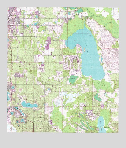
Dundee, FL USGS Topographic Map
Click on map above to begin viewing in our Map Viewer.

This topographic map contains these locations and features:
Feature Name Type Latitude Longitude GNIS ID View Map
8 Acre ParkParkN28.1242°W81.6244°2573512View Map
Alta Vista Elementary SchoolSchoolN28.0852°W81.6249°299277View Map
Bannon IslandIslandN28.0831°W81.5384°278087View Map
Bethune AcademySchoolN28.1221°W81.6243°299330View Map
Camp ReaganLocaleN28.0122°W81.6109°279931View Map
Chester Dees Mobile Home ParkPopulated PlaceN28.1054°W81.6064°2449288View Map
City of Haines CityCivilN28.1097°W81.6158°2403781View Map
Cook FieldParkN28.1192°W81.6242°2573514View Map
Cowpen BaySwampN28.0538°W81.5511°280956View Map
DundeePopulated PlaceN28.0225°W81.6192°281858View Map
Dundee Elementary SchoolSchoolN28.0268°W81.6181°299279View Map
Dundee Fire DepartmentBuildingN28.0230°W81.6202°2644363View Map
Dundee Post OfficePost OfficeN28.0215°W81.6234°2448776View Map
Dundee Public LibraryBuildingN28.0232°W81.6196°2448775View Map
E C Blomeyer Library - Palm Beach Atlantic CollegeBuildingN28.0245°W81.6184°299278View Map
East Park Softball ComplexParkN28.1178°W81.5975°2573517View Map
Forest Hill CemeteryCemeteryN28.0989°W81.6115°282658View Map
Gator Trace Golf and Country ClubLocaleN28.0666°W81.5536°2449277View Map
Glen Abbey Golf ClubLocaleN28.0154°W81.5314°2449279View Map
Grenelefe Census Designated PlaceCensusN28.0579°W81.5538°2583350View Map
Grenelefe Volunteer Fire DepartmentBuildingN28.0779°W81.5459°2131422View Map
Haines CityPopulated PlaceN28.1142°W81.6179°283589View Map
Haines City Fire and RescueBuildingN28.1100°W81.6229°2131476View Map
Haines City High SchoolSchoolN28.0985°W81.6082°299280View Map
Haines City Post OfficePost OfficeN28.0852°W81.6212°2768207View Map
Indian Head SwampSwampN28.0481°W81.5166°284503View Map
Jennings CampLocaleN28.0047°W81.5220°284754View Map
Lake AdaLakeN28.0107°W81.6132°277671View Map
Lake GordonLakeN28.0448°W81.6187°283223View Map
Lake Hamilton Police DepartmentBuildingN28.0426°W81.6215°2333640View Map
Lake Hamilton Post OfficePost OfficeN28.0445°W81.6228°2450174View Map
Lake JosephineLakeN28.0116°W81.6074°284943View Map
Lake MarieLakeN28.0198°W81.6082°286423View Map
Lake MarionLakeN28.0792°W81.5350°286432View Map
Lake MenzieLakeN28.0191°W81.6191°286716View Map
Lake MidgetLakeN28.0430°W81.5780°286821View Map
Lake RuthLakeN28.0245°W81.6144°290084View Map
Lake TraskLakeN28.0270°W81.5971°292404View Map
Larry Parrish Baseball ComplexParkN28.1128°W81.6106°2573516View Map
Oak Meadows Mobile Home ParkPopulated PlaceN28.1127°W81.5949°2449292View Map
Peak Haven Mobile Home ParkPopulated PlaceN28.1119°W81.5650°2449286View Map
Polk County Emergency Medical Services Fire Station 61BuildingN28.1034°W81.6236°2661686View Map
Polk County Emergency Medical Services Station 5 Sun AirBuildingN28.0125°W81.5300°2661680View Map
Polk County Fire Department Station 26 Sun AirBuildingN28.0125°W81.5300°2644649View Map
Polk County Fire Department Station 35 Lake HamiltonBuildingN28.0435°W81.6225°2644373View Map
Polk County Fire Department Station 640BuildingN28.1217°W81.6170°2644365View Map
Polk County Sheriff's Office - Community Policing Unit PoincianaBuildingN28.0663°W81.5109°2333766View Map
Polk County Sheriff's Office Dundee StationBuildingN28.0231°W81.6199°2333535View Map
Prine Railroad StationLocaleN28.0767°W81.6140°301385View Map
Shelley S Boone Middle SchoolSchoolN28.1009°W81.6127°299281View Map
Snell CreekStreamN28.1178°W81.5279°291302View Map
Snodgrass IslandIslandN28.0064°W81.5156°291309View Map
Southerly AirportAirportN28.0144°W81.5399°309379View Map
Town of DundeeCivilN28.0116°W81.5995°2406406View Map
Twin IslandsIslandN28.0997°W81.5448°292600View Map

Note: Coordinates in the location and feature list above are referenced to NAD83 datum.


Copyright (C) 2008-2024 Ryan Niemi / Sunset Dynamics ... All Rights Reserved