TopoQuest Logo
Do you find TopoQuest useful?
Help keep TopoQuest running and adding new maps/features by donating!
Bitcoin:  19c7KJd3qBynnjoSw5npx9KScwjBe4ifkT
Litecoin:  LXs6TkuXGGXo1vDsWCkWVdjQX94eUKd6ui
Home View Maps Find Maps Find Places Resources & Links


Dundee, Kentucky Topographic Map

USGS Map Title: Dundee, KY
USGS Map MRC: 37086E7
DRG (GeoTIFF) Download: o37086e7.tif


Neighboring USGS Topographic Map Quads:


  Philpot, KY  
37086F8
 

  Whitesville, KY  
37086F7
 

  Fordsville, KY  
37086F6
 

  Pleasant Ridge, KY  
37086E8
 

  Dundee, KY  
37086E7
 

  Olaton, KY  
37086E6
 

  Hartford, KY  
37086D8
 

  Horton, KY  
37086D7
 

  Rosine, KY  
37086D6


Map MRC Location:

N38°
W87°
N38°
W86°
H8 H7 H6 H5 H4 H3 H2 H1
G8 G7 G6 G5 G4 G3 G2 G1
F8 F7 F6 F5 F4 F3 F2 F1
E8 E7 E6 E5 E4 E3 E2 E1
D8 D7 D6 D5 D4 D3 D2 D1
C8 C7 C6 C5 C4 C3 C2 C1
B8 B7 B6 B5 B4 B3 B2 B1
A8 A7 A6 A5 A4 A3 A2 A1
N37°
W87°
N37°
W86°

Dundee, KY USGS 1:24K Topographic Map Preview:
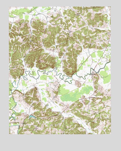
Dundee, KY USGS Topographic Map
Click on map above to begin viewing in our Map Viewer.

This topographic map contains these locations and features:
Feature Name Type Latitude Longitude GNIS ID View Map
AdaburgPopulated PlaceN37.5917°W86.8478°507372View Map
Adams ForkStreamN37.5601°W86.7922°485774View Map
Antioch ChurchChurchN37.5976°W86.8622°485987View Map
Bean HillSummitN37.5203°W86.7653°486513View Map
Beech Valley ChurchChurchN37.5789°W86.8061°486744View Map
Clear RunStreamN37.5245°W86.8708°489644View Map
Combs FordPopulated PlaceN37.5153°W86.8683°507736View Map
Concord ChurchChurchN37.5053°W86.8425°489932View Map
Dark HollowValleyN37.6103°W86.8709°490592View Map
DukehurstPopulated PlaceN37.5109°W86.8578°507884View Map
DundeePopulated PlaceN37.5589°W86.7728°491311View Map
Dundee Fire DepartmentBuildingN37.5609°W86.7733°2637058View Map
Halls CreekStreamN37.5442°W86.8667°493602View Map
Hedges RunStreamN37.5620°W86.8542°493998View Map
Humble Valley ChurchChurchN37.5056°W86.8061°494752View Map
Kelly CemeteryCemeteryN37.6242°W86.7828°495626View Map
Lick BranchStreamN37.5203°W86.8680°496418View Map
MaganPopulated PlaceN37.6003°W86.7994°508523View Map
Marvins ChapelChurchN37.5284°W86.8289°497634View Map
McCarty CemeteryCemeteryN37.6248°W86.7714°497777View Map
MGT Station 2105 HeliportAirportN37.5056°W86.8375°517394View Map
Midkiff CemeteryCemeteryN37.5198°W86.7689°498161View Map
Midkiff CemeteryCemeteryN37.5817°W86.8203°498162View Map
Mill CreekStreamN37.6034°W86.7528°498260View Map
Mount Vernon CemeteryCemeteryN37.5162°W86.7644°498883View Map
Patton CemeteryCemeteryN37.5967°W86.8633°500263View Map
Providence ChurchChurchN37.5981°W86.7503°501376View Map
RalphPopulated PlaceN37.6181°W86.8375°508897View Map
Ralph CemeteryCemeteryN37.6156°W86.8214°517040View Map
Ralph ChapelChurchN37.6151°W86.8280°501542View Map
Slovers CreekStreamN37.5437°W86.8717°503715View Map
Sugar Grove ChurchChurchN37.6173°W86.7889°504663View Map
Sugar Grove SchoolSchoolN37.5984°W86.7997°504669View Map
Sulphur RunStreamN37.5420°W86.7772°504747View Map
Sulphur SpringsPopulated PlaceN37.5356°W86.7767°504767View Map
SunnydalePopulated PlaceN37.5362°W86.8194°509163View Map
Taylor BranchStreamN37.6173°W86.8453°504989View Map
Wolf CreekStreamN37.5064°W86.7803°506999View Map
Wolfpen RunStreamN37.5642°W86.8158°507069View Map
Wright CemeteryCemeteryN37.5867°W86.7967°507164View Map

Note: Coordinates in the location and feature list above are referenced to NAD83 datum.


Copyright (C) 2008-2024 Ryan Niemi / Sunset Dynamics ... All Rights Reserved