TopoQuest Logo
Do you find TopoQuest useful?
Help keep TopoQuest running and adding new maps/features by donating!
Bitcoin:  19c7KJd3qBynnjoSw5npx9KScwjBe4ifkT
Litecoin:  LXs6TkuXGGXo1vDsWCkWVdjQX94eUKd6ui
Home View Maps Find Maps Find Places Resources & Links


Dundas, Illinois Topographic Map

USGS Map Title: Dundas, IL
USGS Map MRC: 38088G1
DRG (GeoTIFF) Download: o38088g1.tif


Neighboring USGS Topographic Map Quads:


  Newton, IL  
38088H2
 

  Sainte Marie, IL  
38088H1
 

  Oblong South, IL  
38087H8
 

  Wakefield, IL  
38088G2
 

  Dundas, IL  
38088G1
 

  Landes, IL  
38087G8
 

  Noble, IL  
38088F2
 

  Olney, IL  
38088F1
 

  Claremont, IL  
38087F8


Map MRC Location:

N39°
W89°
N39°
W88°
H8 H7 H6 H5 H4 H3 H2 H1
G8 G7 G6 G5 G4 G3 G2 G1
F8 F7 F6 F5 F4 F3 F2 F1
E8 E7 E6 E5 E4 E3 E2 E1
D8 D7 D6 D5 D4 D3 D2 D1
C8 C7 C6 C5 C4 C3 C2 C1
B8 B7 B6 B5 B4 B3 B2 B1
A8 A7 A6 A5 A4 A3 A2 A1
N38°
W89°
N38°
W88°

Dundas, IL USGS 1:24K Topographic Map Preview:
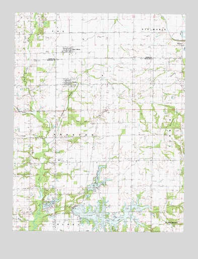
Dundas, IL USGS Topographic Map
Click on map above to begin viewing in our Map Viewer.

This topographic map contains these locations and features:
Feature Name Type Latitude Longitude GNIS ID View Map
Bethel CemeteryCemeteryN38.8620°W88.1092°404271View Map
Bird Haven CemeteryCemeteryN38.7575°W88.0734°1820888View Map
Camp BranchStreamN38.8034°W88.1017°405436View Map
Clover FarmsLocaleN38.7983°W88.0656°2628334View Map
Coon CreekStreamN38.8175°W88.1120°406523View Map
DundasPopulated PlaceN38.8350°W88.0850°407491View Map
Dundas CemeteryCemeteryN38.8328°W88.0817°1820892View Map
Dundas Post OfficePost OfficeN38.8347°W88.0837°1736796View Map
East Fork Fox RiverStreamN38.7581°W88.1067°407638View Map
East Fork LakeReservoirN38.7593°W88.0605°1736797View Map
East Fork LakeReservoirN38.7584°W88.0650°1691356View Map
East Fork Lake DamDamN38.7584°W88.0650°1691355View Map
Eyer School (historical)SchoolN38.7759°W88.0034°408148View Map
Fox Creek VineyardsBuildingN38.7706°W88.1119°2681049View Map
Hinman School (historical)SchoolN38.8423°W88.0375°410314View Map
Jack Oak CreekStreamN38.8153°W88.0895°410991View Map
Leaf School (historical)SchoolN38.7909°W88.0384°411891View Map
Linder School (historical)SchoolN38.8359°W88.0036°412233View Map
Long BranchStreamN38.7992°W88.1003°412550View Map
M D Borah LakeReservoirN38.7734°W88.0700°1691350View Map
M D Borah Lake DamDamN38.7734°W88.0700°1691349View Map
Macksburg School (historical)SchoolN38.7895°W88.0681°412806View Map
Mash CreekStreamN38.7553°W88.1095°413094View Map
McBurg CemeteryCemeteryN38.7770°W88.0673°1820900View Map
Oakdale School (historical)SchoolN38.8114°W88.0670°414873View Map
Olney LakeReservoirN38.7789°W88.0632°1736820View Map
Pilman's FarmsLocaleN38.8603°W88.1172°2724426View Map
RaeftownPopulated PlaceN38.8581°W88.0023°416348View Map
Richland Country ClubLocaleN38.7673°W88.0984°425376View Map
Saint Pauls Lutheran CemeteryCemeteryN38.8423°W88.0386°1820909View Map
Saron CemeteryCemeteryN38.8064°W88.0331°1820910View Map
Saron ChurchChurchN38.8062°W88.0328°418023View Map
Springtown CemeteryCemeteryN38.7981°W88.0048°419012View Map
Sylvan Iris School (historical)SchoolN38.7642°W88.0745°419505View Map
Township of PrestonCivilN38.8045°W88.0867°429604View Map
Vernor LakeReservoirN38.7652°W88.0991°420275View Map
Vernor Lake DamDamN38.7639°W88.1023°1691960View Map
Webber LakeReservoirN38.7704°W88.0704°1692205View Map
Webber Lake DamDamN38.7717°W88.0717°1692204View Map
West LibertyPopulated PlaceN38.8534°W88.0845°420868View Map
West Liberty Post OfficePost OfficeN38.8534°W88.0846°1725232View Map

Note: Coordinates in the location and feature list above are referenced to NAD83 datum.


Copyright (C) 2008-2024 Ryan Niemi / Sunset Dynamics ... All Rights Reserved