TopoQuest Logo
Do you find TopoQuest useful?
Help keep TopoQuest running and adding new maps/features by donating!
Bitcoin:  19c7KJd3qBynnjoSw5npx9KScwjBe4ifkT
Litecoin:  LXs6TkuXGGXo1vDsWCkWVdjQX94eUKd6ui
Home View Maps Find Maps Find Places Resources & Links


Dubach, Louisiana Topographic Map

USGS Map Title: Dubach, LA
USGS Map MRC: 32092F6
DRG (GeoTIFF) Download: o32092f6.tif


Neighboring USGS Topographic Map Quads:


  Lisbon, LA  
32092G7
 

  Bernice, LA  
32092G6
 

  Shiloh, LA  
32092G5
 

  Lake Foursome, LA  
32092F7
 

  Dubach, LA  
32092F6
 

  Cedarton, LA  
32092F5
 

  Simsboro, LA  
32092E7
 

  Ruston West, LA  
32092E6
 

  Ruston East, LA  
32092E5


Map MRC Location:

N33°
W93°
N33°
W92°
H8 H7 H6 H5 H4 H3 H2 H1
G8 G7 G6 G5 G4 G3 G2 G1
F8 F7 F6 F5 F4 F3 F2 F1
E8 E7 E6 E5 E4 E3 E2 E1
D8 D7 D6 D5 D4 D3 D2 D1
C8 C7 C6 C5 C4 C3 C2 C1
B8 B7 B6 B5 B4 B3 B2 B1
A8 A7 A6 A5 A4 A3 A2 A1
N32°
W93°
N32°
W92°

Dubach, LA USGS 1:24K Topographic Map Preview:
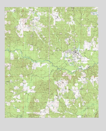
Dubach, LA USGS Topographic Map
Click on map above to begin viewing in our Map Viewer.

This topographic map contains these locations and features:
Feature Name Type Latitude Longitude GNIS ID View Map
Autrey CemeteryCemeteryN32.7013°W92.6754°546541View Map
Big CreekStreamN32.6799°W92.6749°533067View Map
Buck BranchStreamN32.6857°W92.6307°553820View Map
DubachPopulated PlaceN32.6990°W92.6568°554280View Map
Dubach High SchoolSchoolN32.6962°W92.6518°546564View Map
Dubach Police DepartmentBuildingN32.6967°W92.6563°2755232View Map
Dubach Post OfficePost OfficeN32.7006°W92.6561°1630621View Map
Dubach United Methodist ChurchChurchN32.6999°W92.6557°546565View Map
First Baptist ChurchChurchN32.6996°W92.6582°546575View Map
Grace Baptist ChurchChurchN32.7115°W92.6574°546581View Map
Greensboro (historical)Populated PlaceN32.6265°W92.7127°546585View Map
HenryPopulated PlaceN32.7374°W92.6813°546587View Map
Henry CemeteryCemeteryN32.7399°W92.6821°535630View Map
HicoPopulated PlaceN32.7449°W92.7138°535659View Map
Hico Baptist ChurchChurchN32.7438°W92.7118°546588View Map
Hico Elementary SchoolSchoolN32.7443°W92.7115°546589View Map
Hico Gas FieldOilfieldN32.7151°W92.6677°535660View Map
Hico SchoolSchoolN32.7263°W92.7127°535661View Map
HillyPopulated PlaceN32.6485°W92.6785°554716View Map
Hilly Lookout TowerTowerN32.6585°W92.6918°558782View Map
Hopewell CemeteryCemeteryN32.7048°W92.6366°535787View Map
Hopewell Church (historical)ChurchN32.7051°W92.6360°546591View Map
Knowles Oil and Gas FieldOilfieldN32.6757°W92.7313°554943View Map
KPCH-FM (Dubach)TowerN32.6532°W92.6774°1632441View Map
Lake Dubach DamDamN32.7001°W92.6501°557029View Map
Larance Ferry (historical)CrossingN32.6890°W92.7085°546595View Map
Macedonia SchoolSchoolN32.6313°W92.7018°536802View Map
Mays BridgeBridgeN32.7001°W92.7429°546607View Map
Middlefork Gas FieldOilfieldN32.7485°W92.6513°546610View Map
Mount ZionPopulated PlaceN32.6649°W92.7429°540800View Map
Mount Zion Number 2 Baptist ChurchChurchN32.6660°W92.7418°555424View Map
New Prospect Baptist ChurchChurchN32.6499°W92.6507°555485View Map
Parish Governing Authority District 4CivilN32.6920°W92.6630°1930020View Map
Pine Grove CemeteryCemeteryN32.6257°W92.6971°536793View Map
Providence CemeteryCemeteryN32.6724°W92.7423°538421View Map
Town of DubachCivilN32.7019°W92.6575°2406398View Map
Turkey CreekStreamN32.6940°W92.7196°540035View Map
UnionvillePopulated PlaceN32.6693°W92.6415°556304View Map
Vining Mills (historical)Populated PlaceN32.6996°W92.7424°546652View Map
Wafer CreekStreamN32.6290°W92.7249°556341View Map
Ward FourCivilN32.6735°W92.6979°545115View Map
Wise (historical)Populated PlaceN32.6960°W92.7307°546656View Map

Note: Coordinates in the location and feature list above are referenced to NAD83 datum.


Copyright (C) 2008-2024 Ryan Niemi / Sunset Dynamics ... All Rights Reserved