TopoQuest Logo
Do you find TopoQuest useful?
Help keep TopoQuest running and adding new maps/features by donating!
Bitcoin:  19c7KJd3qBynnjoSw5npx9KScwjBe4ifkT
Litecoin:  LXs6TkuXGGXo1vDsWCkWVdjQX94eUKd6ui
Home View Maps Find Maps Find Places Resources & Links


Driveway Peak, Montana Topographic Map

USGS Map Title: Driveway Peak, MT
USGS Map MRC: 47115E5
DRG (GeoTIFF) Download: o47115e5.tif


Neighboring USGS Topographic Map Quads:


  Black Peak, MT  
47115F6
 

  Helwick Peak, MT  
47115F5
 

  Belknap, MT  
47115F4
 

  Thompson Pass, MT  
47115E6
 

  Driveway Peak, MT  
47115E5
 

  Table Top Mountain, MT  
47115E4
 

  Lookout Pass, MT  
47115D6
 

  Saltese, MT  
47115D5
 

  Haugan, MT  
47115D4


Map MRC Location:

N48°
W116°
N48°
W115°
H8 H7 H6 H5 H4 H3 H2 H1
G8 G7 G6 G5 G4 G3 G2 G1
F8 F7 F6 F5 F4 F3 F2 F1
E8 E7 E6 E5 E4 E3 E2 E1
D8 D7 D6 D5 D4 D3 D2 D1
C8 C7 C6 C5 C4 C3 C2 C1
B8 B7 B6 B5 B4 B3 B2 B1
A8 A7 A6 A5 A4 A3 A2 A1
N47°
W116°
N47°
W115°

Driveway Peak, MT USGS 1:24K Topographic Map Preview:
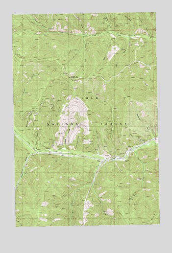
Driveway Peak, MT USGS Topographic Map
Click on map above to begin viewing in our Map Viewer.

This topographic map contains these locations and features:
Feature Name Type Latitude Longitude GNIS ID View Map
Antimony CreekStreamN47.5519°W115.6146°779083View Map
Antimony MineMineN47.5458°W115.5913°805139View Map
Burson GulchValleyN47.5447°W115.6046°801783View Map
Buster Brown GulchValleyN47.5447°W115.5715°780671View Map
Cooper GulchValleyN47.5427°W115.6096°781634View Map
Cox GulchValleyN47.5463°W115.5910°781804View Map
Crow CreekStreamN47.5394°W115.5471°781922View Map
Daisy CreekStreamN47.5441°W115.5218°782046View Map
Dirty GulchValleyN47.6122°W115.5427°782392View Map
Driveway PeakSummitN47.5874°W115.5768°782536View Map
East Fork Crow CreekStreamN47.5244°W115.5577°782830View Map
Everson GulchValleyN47.5460°W115.5818°783262View Map
Gilbert GulchValleyN47.5474°W115.5107°801791View Map
Helwick GulchValleyN47.6135°W115.5649°784757View Map
Iron Daisy MineMineN47.5272°W115.5157°793642View Map
Iron Daisy MineMineN47.5272°W115.5163°805135View Map
Looters GulchValleyN47.6099°W115.5243°786566View Map
Lower Schwark MineMineN47.5449°W115.5232°805136View Map
Lucky Boy GulchValleyN47.5419°W115.5529°786701View Map
Meadow Mountain/Tarbox MineMineN47.6194°W115.5024°804728View Map
Monroe GulchValleyN47.6149°W115.5407°787564View Map
Montana City (historical)LocaleN47.5541°W115.6232°1781010View Map
Montana MineMineN47.5369°W115.5299°787570View Map
Montana Standard MineMineN47.5374°W115.5302°805138View Map
Mountain House Historic SiteLocaleN47.5558°W115.6224°801799View Map
North Fork Clear CreekStreamN47.6144°W115.5938°788116View Map
Prospect Creek MineMineN47.5433°W115.5293°805141View Map
Quail GulchValleyN47.6113°W115.5065°789254View Map
Shamrock GulchValleyN47.5502°W115.5043°790277View Map
Stick GulchValleyN47.6108°W115.5629°791517View Map
Therriault GulchValleyN47.5408°W115.5360°792059View Map
United States Forest Service Fire StationLocaleN47.5435°W115.6063°792577View Map
Upper Fork Clear CreekStreamN47.6144°W115.5940°792634View Map
Upper Schwark MineMineN47.5522°W115.5107°805137View Map
West Fork Crow CreekStreamN47.5247°W115.5577°793009View Map
Wheatgrass GulchValleyN47.6122°W115.5210°793154View Map

Note: Coordinates in the location and feature list above are referenced to NAD83 datum.


Copyright (C) 2008-2024 Ryan Niemi / Sunset Dynamics ... All Rights Reserved