TopoQuest Logo
Do you find TopoQuest useful?
Help keep TopoQuest running and adding new maps/features by donating!
Bitcoin:  19c7KJd3qBynnjoSw5npx9KScwjBe4ifkT
Litecoin:  LXs6TkuXGGXo1vDsWCkWVdjQX94eUKd6ui
Home View Maps Find Maps Find Places Resources & Links


Dowden Creek, Louisiana Topographic Map

USGS Map Title: Dowden Creek, LA
USGS Map MRC: 31093C3
DRG (GeoTIFF) Download: o31093c3.tif


Neighboring USGS Topographic Map Quads:


  Florien, LA  
31093D4
 

  Peason, LA  
31093D3
 

  Kisatchie, LA  
31093D2
 

  Hornbeck, LA  
31093C4
 

  Dowden Creek, LA  
31093C3
 

  Kurthwood, LA  
31093C2
 

  Little Sandy Creek, LA  
31093B4
 

  Leesville, LA  
31093B3
 

  Slagle, LA  
31093B2


Map MRC Location:

N32°
W94°
N32°
W93°
H8 H7 H6 H5 H4 H3 H2 H1
G8 G7 G6 G5 G4 G3 G2 G1
F8 F7 F6 F5 F4 F3 F2 F1
E8 E7 E6 E5 E4 E3 E2 E1
D8 D7 D6 D5 D4 D3 D2 D1
C8 C7 C6 C5 C4 C3 C2 C1
B8 B7 B6 B5 B4 B3 B2 B1
A8 A7 A6 A5 A4 A3 A2 A1
N31°
W94°
N31°
W93°

Dowden Creek, LA USGS 1:24K Topographic Map Preview:
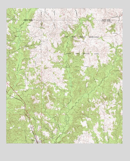
Dowden Creek, LA USGS Topographic Map
Click on map above to begin viewing in our Map Viewer.

This topographic map contains these locations and features:
Feature Name Type Latitude Longitude GNIS ID View Map
Ade BranchStreamN31.3171°W93.3624°532087View Map
AnacocoPopulated PlaceN31.2521°W93.3413°553300View Map
Anacoco Elementary SchoolSchoolN31.2522°W93.3376°549975View Map
Anacoco High SchoolSchoolN31.2525°W93.3385°549976View Map
Big BranchStreamN31.2618°W93.3138°533042View Map
Big BranchStreamN31.3260°W93.3607°533043View Map
Big BranchStreamN31.3430°W93.3613°533053View Map
Bonnie ChapelChurchN31.3030°W93.2882°553752View Map
Brushy CreekStreamN31.2916°W93.3741°533479View Map
Bull Bay BranchStreamN31.3266°W93.2577°547148View Map
Cold Springs Baptist ChurchChurchN31.2763°W93.2885°554040View Map
Coon BranchStreamN31.3568°W93.3596°534105View Map
Dowden CreekStreamN31.2816°W93.3074°534578View Map
Everett (historical)Populated PlaceN31.2988°W93.3668°549998View Map
Everette BranchStreamN31.2918°W93.3724°534859View Map
Log BranchStreamN31.3152°W93.3624°536657View Map
Martin CreekStreamN31.2813°W93.3071°536919View Map
McInnis CemeteryCemeteryN31.3018°W93.2888°550040View Map
Mitchell ChurchChurchN31.2555°W93.3268°537167View Map
Orange ChurchChurchN31.2521°W93.3399°537894View Map
Peason Ridge Oil FieldOilfieldN31.3232°W93.2946°550050View Map
Polly BranchStreamN31.2516°W93.3218°538325View Map
Pruitts ChapelChurchN31.3496°W93.3660°555739View Map
Swenley BranchStreamN31.3463°W93.3602°539769View Map
Union Grove CemeteryCemeteryN31.3399°W93.3566°550082View Map
Union Grove ChurchChurchN31.3402°W93.3557°540102View Map
Village of AnacocoCivilN31.2545°W93.3440°2407408View Map

Note: Coordinates in the location and feature list above are referenced to NAD83 datum.


Copyright (C) 2008-2024 Ryan Niemi / Sunset Dynamics ... All Rights Reserved