TopoQuest Logo
Do you find TopoQuest useful?
Help keep TopoQuest running and adding new maps/features by donating!
Bitcoin:  19c7KJd3qBynnjoSw5npx9KScwjBe4ifkT
Litecoin:  LXs6TkuXGGXo1vDsWCkWVdjQX94eUKd6ui
Home View Maps Find Maps Find Places Resources & Links


Dover, Georgia Topographic Map

USGS Map Title: Dover, GA
USGS Map MRC: 32081E6
DRG (GeoTIFF) Download: o32081e6.tif


Neighboring USGS Topographic Map Quads:


  Rocky Ford, GA  
32081F7
 

  Sylvania South, GA  
32081F6
 

  Hunters, GA  
32081F5
 

  Hopeulikit, GA  
32081E7
 

  Dover, GA  
32081E6
 

  Oliver, GA  
32081E5
 

  Statesboro, GA  
32081D7
 

  Brooklet, GA  
32081D6
 

  Leefield, GA  
32081D5


Map MRC Location:

N33°
W82°
N33°
W81°
H8 H7 H6 H5 H4 H3 H2 H1
G8 G7 G6 G5 G4 G3 G2 G1
F8 F7 F6 F5 F4 F3 F2 F1
E8 E7 E6 E5 E4 E3 E2 E1
D8 D7 D6 D5 D4 D3 D2 D1
C8 C7 C6 C5 C4 C3 C2 C1
B8 B7 B6 B5 B4 B3 B2 B1
A8 A7 A6 A5 A4 A3 A2 A1
N32°
W82°
N32°
W81°

Dover, GA USGS 1:24K Topographic Map Preview:
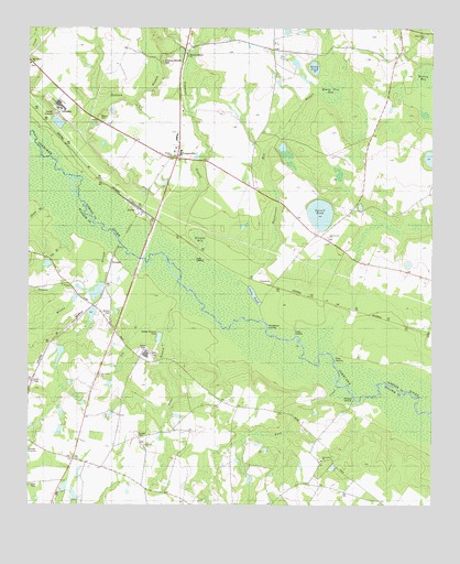
Dover, GA USGS Topographic Map
Click on map above to begin viewing in our Map Viewer.

This topographic map contains these locations and features:
Feature Name Type Latitude Longitude GNIS ID View Map
Big BranchStreamN32.5449°W81.7498°311317View Map
Branon CemeteryCemeteryN32.5502°W81.7259°311730View Map
Brook Instruments Company Pond DamDamN32.5585°W81.7282°341078View Map
Brooks Instruments Company PondReservoirN32.5560°W81.7290°341079View Map
Buck CreekStreamN32.5310°W81.6540°311955View Map
CameronPopulated PlaceN32.5580°W81.6737°354957View Map
Cameron CemeteryCemeteryN32.5582°W81.6629°350162View Map
Charlestown ChurchChurchN32.5705°W81.6573°312577View Map
Clito CemeteryCemeteryN32.5127°W81.7365°350314View Map
Clito ChurchChurchN32.5127°W81.7357°355195View Map
Clito School (historical)SchoolN32.5121°W81.7357°334805View Map
Clito Volunteer Fire DepartmentBuildingN32.5167°W81.7488°2604265View Map
CoopervillePopulated PlaceN32.5907°W81.7040°312952View Map
Cooperville Census Designated PlaceCensusN32.5879°W81.7111°2587030View Map
Cooperville School (historical)SchoolN32.5913°W81.7054°334890View Map
Ditch Pond ChurchChurchN32.6227°W81.6271°313490View Map
DonegalPopulated PlaceN32.5635°W81.7240°331569View Map
DoverPopulated PlaceN32.5771°W81.7151°355538View Map
Dows LandingLocaleN32.5382°W81.6551°331585View Map
Eagle Village Mobile Home ParkPopulated PlaceN32.5089°W81.7400°2502510View Map
EurekaPopulated PlaceN32.5177°W81.7154°334806View Map
Eureka CemeteryCemeteryN32.5179°W81.7159°313988View Map
Eureka ChurchChurchN32.5160°W81.7132°355725View Map
Evans LandingLocaleN32.5446°W81.6668°331674View Map
Freer BranchStreamN32.5532°W81.7004°314379View Map
Gin BranchStreamN32.5718°W81.7382°314605View Map
Glenns BranchStreamN32.5821°W81.7396°314641View Map
Henderson Mill BranchStreamN32.5574°W81.6818°315324View Map
Hendersons LandingLocaleN32.5471°W81.6754°331953View Map
Hendersons Mill BranchStreamN32.5496°W81.6837°325844View Map
Horse Pen BaySwampN32.6091°W81.6562°315698View Map
Inman CreekStreamN32.5563°W81.7318°315927View Map
Jackson BranchStreamN32.5904°W81.7409°315998View Map
Jarrell PondLakeN32.5764°W81.6595°316053View Map
Julie PondReservoirN32.5549°W81.6801°316301View Map
Landing Number OneLocaleN32.5460°W81.6873°334807View Map
Lily BranchStreamN32.5577°W81.7046°316863View Map
Macedonia CemeteryCemeteryN32.5121°W81.6593°350390View Map
Macedonia ChurchChurchN32.5118°W81.6587°317546View Map
Mobley BaySwampN32.6121°W81.6270°318361View Map
Morgan BaySwampN32.5697°W81.6965°318452View Map
Oak Grove CemeteryCemeteryN32.5349°W81.7276°350415View Map
Oak Grove CemeteryCemeteryN32.6157°W81.7490°350183View Map
Oak Grove ChurchChurchN32.5346°W81.7276°319791View Map
Oak Grove ChurchChurchN32.6154°W81.7490°319794View Map
Opies LandingLocaleN32.5643°W81.6987°332578View Map
Ricklighter PondReservoirN32.5500°W81.7301°341081View Map
Ricklighter Pond DamDamN32.5518°W81.7298°341080View Map
Robinson PondReservoirN32.6243°W81.6701°341278View Map
Screven County Fire Department Station 3BuildingN32.5889°W81.7055°2604634View Map
Simmons BranchStreamN32.5760°W81.7054°323001View Map
Simmons Branch CemeteryCemeteryN32.6160°W81.7082°323002View Map
Simmons Branch ChurchChurchN32.6174°W81.7004°323003View Map
Story PondLakeN32.6148°W81.6616°323658View Map
Wades CemeteryCemeteryN32.6016°W81.7279°324737View Map
Wades ChurchChurchN32.5916°W81.7059°324739View Map
Williams LandingLocaleN32.5280°W81.6490°333432View Map
Wilson BranchStreamN32.5688°W81.7240°325421View Map

Note: Coordinates in the location and feature list above are referenced to NAD83 datum.


Copyright (C) 2008-2024 Ryan Niemi / Sunset Dynamics ... All Rights Reserved