TopoQuest Logo
Do you find TopoQuest useful?
Help keep TopoQuest running and adding new maps/features by donating!
Bitcoin:  19c7KJd3qBynnjoSw5npx9KScwjBe4ifkT
Litecoin:  LXs6TkuXGGXo1vDsWCkWVdjQX94eUKd6ui
Home View Maps Find Maps Find Places Resources & Links


Double Spring, Nevada Topographic Map

USGS Map Title: Double Spring, NV
USGS Map MRC: 38119G5
DRG (GeoTIFF) Download: o38119g5.tif


Neighboring USGS Topographic Map Quads:


  Gardnerville, NV  
38119H6
 

  Mount Siegel, NV  
38119H5
 

  Pine Nut Valley, NV  
38119H4
 

  Carters Station, NV  
38119G6
 

  Double Spring, NV  
38119G5
 

  Oreana Peak, NV  
38119G4
 

  Heenan Lake, CA  
38119F6
 

  Topaz Lake, NV  
38119F5
 

  Long Dry Canyon, NV  
38119F4


Map MRC Location:

N39°
W120°
N39°
W119°
H8 H7 H6 H5 H4 H3 H2 H1
G8 G7 G6 G5 G4 G3 G2 G1
F8 F7 F6 F5 F4 F3 F2 F1
E8 E7 E6 E5 E4 E3 E2 E1
D8 D7 D6 D5 D4 D3 D2 D1
C8 C7 C6 C5 C4 C3 C2 C1
B8 B7 B6 B5 B4 B3 B2 B1
A8 A7 A6 A5 A4 A3 A2 A1
N38°
W120°
N38°
W119°

Double Spring, NV USGS 1:24K Topographic Map Preview:
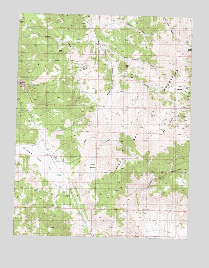
Double Spring, NV USGS Topographic Map
Click on map above to begin viewing in our Map Viewer.

This topographic map contains these locations and features:
Feature Name Type Latitude Longitude GNIS ID View Map
Alpine MillLocaleN38.8716°W119.5779°838426View Map
Alpine MineMineN38.8705°W119.5799°852498View Map
B and C Tungsten MineMineN38.8263°W119.6138°855543View Map
Bald MountainRidgeN38.8141°W119.5179°838573View Map
Bells Ranch (historical)LocaleN38.8474°W119.5593°848029View Map
Blossom CanyonValleyN38.8410°W119.5563°838914View Map
Boyd Ranch (historical)LocaleN38.8666°W119.5732°848028View Map
Brown MeadowsFlatN38.7902°W119.5699°839076View Map
Buffalo CanyonValleyN38.8691°W119.6191°839150View Map
Buffalo SpringSpringN38.8539°W119.5970°848514View Map
BullionvilleLocaleN38.8338°W119.5057°839186View Map
Carman HeightsPopulated PlaceN38.8374°W119.5091°855787View Map
Carson Valley Tungsten MineMineN38.8332°W119.6149°855544View Map
Carter CanyonBasinN38.8099°W119.6088°856627View Map
Danite MineMineN38.8241°W119.6135°839923View Map
Dead Horse FlatFlatN38.7763°W119.5882°839943View Map
Double SpringSpringN38.7941°W119.5988°848535View Map
Double Spring Census Designated PlaceCensusN38.7788°W119.6154°2583917View Map
Double Spring FlatFlatN38.7946°W119.6068°859545View Map
Double Springs (historical)Populated PlaceN38.7916°W119.5982°858394View Map
Duval MineMineN38.8499°W119.5871°855547View Map
Galena SummitGapN38.8574°W119.5035°840591View Map
Gold Bug MineMineN38.8196°W119.5282°840677View Map
Granite PeakSummitN38.8382°W119.5024°848046View Map
Knox and Nixon ShaftMineN38.8355°W119.5032°848023View Map
Little Comstock MineMineN38.7555°W119.5385°855542View Map
Longfellow MineMineN38.8346°W119.5029°841816View Map
Mammoth Ledge (historical)Populated PlaceN38.8191°W119.6179°858463View Map
Mammoth Ledge Post Office (historical)Post OfficeN38.8191°W119.6179°864813View Map
Mammoth MineMineN38.8241°W119.6154°848026View Map
Mill CanyonValleyN38.8416°W119.5549°848588View Map
Minnehaha CanyonValleyN38.7563°W119.5302°842161View Map
Monitor MineMineN38.7555°W119.5385°855541View Map
Mountain House Mining DistrictCivilN38.7555°W119.5385°848418View Map
Nevada Tungsten MineMineN38.8457°W119.5777°855545View Map
Orpheus MineMineN38.7555°W119.5385°853073View Map
Payday TunnelMineN38.8202°W119.5091°848022View Map
Pikes Peak MineMineN38.7849°W119.5221°850732View Map
Pine Nut Consolidated MineMineN38.8488°W119.5874°855546View Map
Pratts Quartz Mill (historical)LocaleN38.8349°W119.5338°848024View Map
Preachers MineMineN38.8707°W119.6238°854578View Map
Premier MineMineN38.8196°W119.5085°842973View Map
Rattlesnake HillSummitN38.8524°W119.5088°848008View Map
Red Canyon Mining DistrictCivilN38.8427°W119.5002°858446View Map
Red Cloud ShaftMineN38.8360°W119.5102°848025View Map
Ruby Hill MineMineN38.8463°W119.5774°843389View Map
Simee Dimeh SummitGapN38.8100°W119.6108°2099512View Map
Sprague Post Office (historical)Post OfficeN38.7916°W119.5982°864896View Map
Sugar LoafSummitN38.8460°W119.5493°848657View Map
Thompson CanyonValleyN38.8585°W119.5660°844287View Map
Tungsten MineMineN38.8721°W119.5760°855036View Map
Ventura MineMineN38.7555°W119.5385°858555View Map
Veta Grande MineMineN38.8357°W119.6216°844582View Map
Washoe Ranches Trust LandCivilN38.8733°W119.5666°2419516View Map
Water CanyonValleyN38.7946°W119.5799°850731View Map

Note: Coordinates in the location and feature list above are referenced to NAD83 datum.


Copyright (C) 2008-2024 Ryan Niemi / Sunset Dynamics ... All Rights Reserved